If you’re looking for sensational views on a relatively easy trail, then look no further than the hike to Butterbox Point, followed by Mount Hay summit. This was a trail that really surprised us, we weren’t expecting some of the best views we’ve seen in all the Blue Mountains along this pretty quiet and off the beaten track walk. They are truly jaw dropping.
The great thing about this walk is that you don’t need to be a hiker to do it and the best views on the trail are along the fairly flat Butterbox Point circuit. You can then choose whether to add on the summit of Mount Hay as well, which is a fun addition to the walk, but not a must.
So here’s why we love this trail and what to expect at Butterbox Point and Mount Hay, one of our favourite walks in the Blue Mountains.
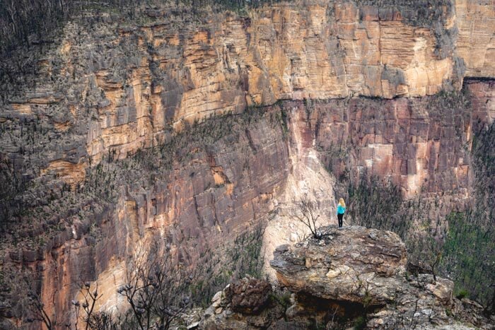
The viewpoint at Butterbox Point
Butterbox Point & Mount Hay Trail
The Stats
Distance: 6km (3km Butterbox, 3km Mount Hay)
Elevation: 291m (virtually all on the Mount Hay trail)
Difficulty: Easy to moderate
The Butterbox Point and Mount Hay trail can be split into two sections. The trail to Butterbox Point is a 3km loop that is almost entirely flat.
Most people will find this trail easy going, so long as you don’t suffer from vertigo (there’s one section where the trail becomes very narrow and close to the edge of a big drop). You can do the Butterbox Point circuit in an hour.
The trail to the summit of Mount Hay is a little harder and steeper. It’s 3km long in total, and isn’t too steep at first, but then gets more so towards the end.
It isn’t hard, but it is rough in sections, and certainly gets your heartbeat up! We recommend allowing another hour for this trail (2 - 2.5 hours for both trails combined).
If you’re a keen hiker, here are our recommends for other amazing walks in the Blue Mountains.
Starting the Butterbox Point Trail
The trail starts from the car park, heading downhill before you reach a sign post 200m along the track. Take the left path towards Butterbox Point.
The track immediately offers spectacular mountain views and you’ll also see the Butterbox Swamp.
The start of the trail
Butterbox Swamp
It’s not long until you reach another sign marking a turn to Butterbox Canyon but ignore it as this is for canyoners only!
Keep going along the path until you see a rocky knoll with a cave.

At this point you have a decision to make: the right path has a good viewpoint that is well worth visiting, but it has a narrow section of path which gets very close to the cliff edge. We don’t recommend going this way on a windy day!
The alternative is to take the left path to Butterbox Point, which doesn’t go near any big drops before reaching the main view.
The first viewpoint
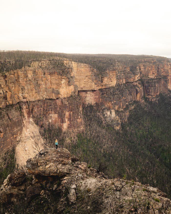
Taking the trail to the right of the cave, you’ll soon you’ll see a left turn to the top of the rocky outcrop. The views from here are jaw dropping and it’s the first of two great lookouts.
From here you can see across the Grose Valley, to Lockleys Pylon on the left, and Perry’s Lookdown and Mount Banks in the distance. These are the kind of viewpoints we love, no fencing or manicuring, just wild and expansive in all directions.


From the lookout, retrace your steps back down, but turn left when you rejoin the trail. This is where the path gets a bit sketchy, so be careful.
The path narrows and it’s very close to the edge of the cliff! It isn’t slippery in dry weather but I wouldn’t walk it if it’s been wet.
The view is incredible though and it adds a touch of adventure to the walk. We love it, but wouldn’t recommend it if you suffer from vertigo!

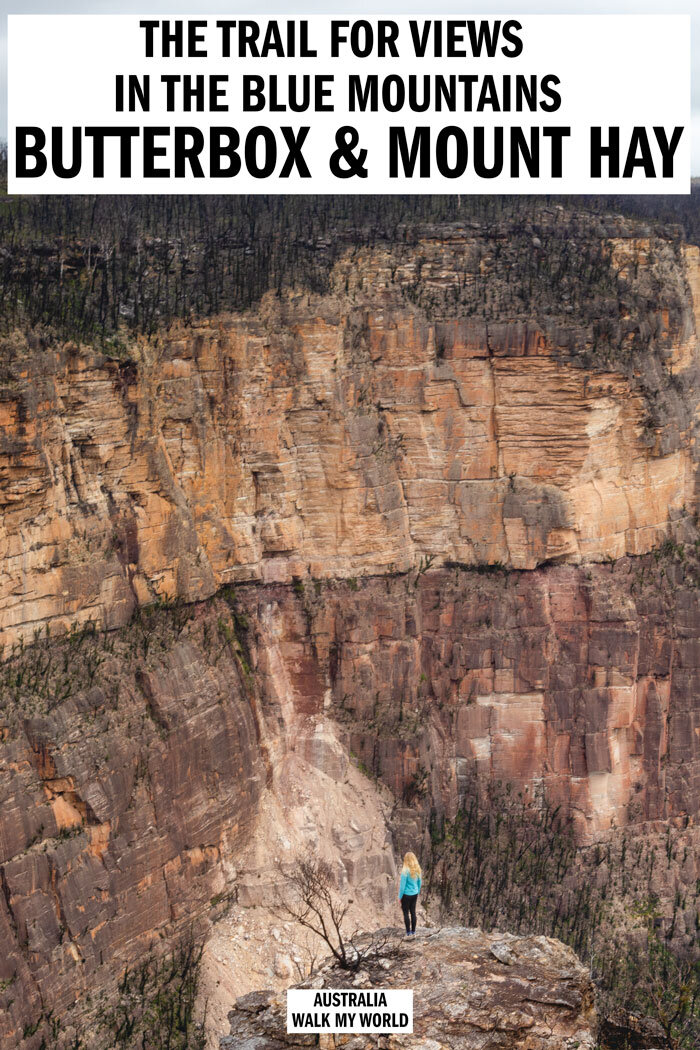
Butterbox Point
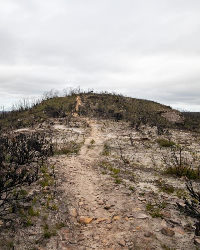
From here the trail heads down to Butterbox Point, an incredible ledge overlooking Butterbox Canyon and the Grose Valley.
This is a great photography spot as it’s one of the few places where you can get the sandstone walls of the Blue Mountains towering over whoever you’re taking a photo of.

The path to the spot in our photo requires climbing down a couple of rocks before making your way to the edge of the ledge. There are quite a few spiky plants down there, so watch out for them, wearing trousers to protect your legs could be a good idea too!
The walk to get to the edge is a little exposed, although it is never particularly narrow, but if you take your time it’s no problem. On a windy day, we wouldn’t have gone down there though!
However, if it’s calm and still, this view is incredible and well worth the extra few minutes walk to get to.

Back to the circuit
Heading back the way you came, take a right turn away from the cliff edge and around the main rocky outcrop. The landscape changes from pure scrub to green shoots and some vegetation.
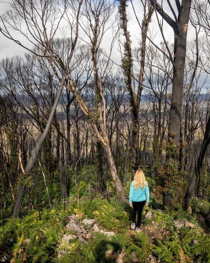
We visited after the 2020 bushfires, so the vegetation was a lot more sparse than it usually would be.


There’s a cool cave you can check out on your left, before the trail heads back towards the car park. If you want to make a loop, take the next left turn.
The trail has some amazing views of Mount Hay and a bit more of the valley.

After 2.8km you’ll get to a path where you can turn left to go up Mount Hay, or right to head back to the car park.
Hiking to the Mount Hay summit
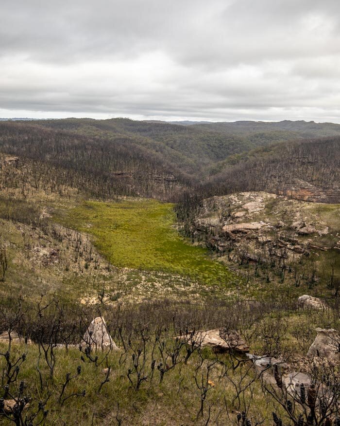
The trail to Mount Hay is a lot wilder and more overgrown. We were lucky that after the bushfires, the path was very clear and visible.
However, once the vegetation comes back, the path will return to being overgrown and not so easy to follow.

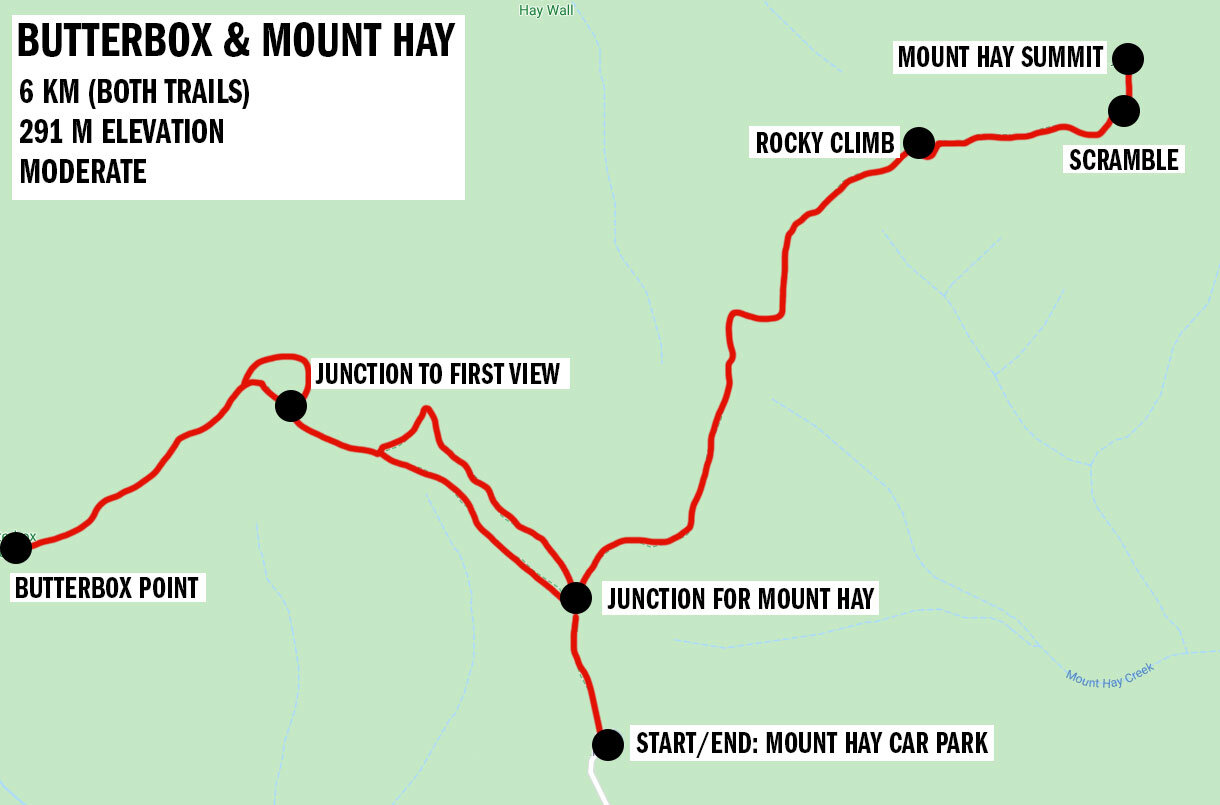
The trail heads up the first hump, and offers some more incredible views of the Grose Valley (seriously, this walk just keeps giving, with stunning view after stunning view).
In fact, this is where you’ll find the best views on the whole Mount Hay trail, so you don’t have to keep going to the top unless you want to complete the trail - something we’re always guilty of!
From here it winds uphill away from the edge and then becomes a little harder to follow.

After 1km, you’ll abruptly reach a rock. Whilst it may not be too obvious, the trail continues by scrambling up! It’s not hard, but you’ll be forgiven for thinking the track has mysteriously disappeared.
To the summit
From this point, the trail is obvious again for a while, but once you head into the bush it abruptly vanishes again.

Keep an eye out for a rocky pile, as this is where the official summit is. There’s no clear path, so just keep heading towards the top, climbing over the small rocks, and you’ll find the cairn which marks the top.

The views from the top of Mount Hay aren’t the best. As it’s in the middle of the bush, you can’t see the valley below or anywhere for that matter, even after the bushfires!
Heading back can be a little tricky, as finding the path isn’t obvious. Keep trying to retrace your steps and head south-west, and you’ll eventually find the trail again. It’s about 1.6km back to the car park.
It’s possible to go a few different ways as it’s not a very well defined trail. We saw people climbing up hundreds of metres from where we were, so it’s one of those tracks where you can choose the path that feels easiest to you.

Packing suggestions for Mount Hay & Butter Box
Having the right gear can make a huge difference. Here’s what we pack and have relied upon for years:
Sunscreen: Cancer Council Active. With a high SPF, but not the greasy feel of other sunscreens. Makes a big difference when you’re working up a sweat on a sunny day! Check it out on Amazon
Good Rain Jacket: North Face This is an essential item we always pack in our bag! This jacket from North Face is designed to keep you dry but also comfortably warm (many rain jackets will make you feel like you’re in a sauna). Check it out on Amazon
Bushman Spray: Good for keeping off the mozzies and any other bugs. Check it out on Amazon.
Day Pack: Osprey Talon 22 (we’ve owned this for years). Check on Amazon or direct with Osprey
Hiking Boots: Merrell Moab (for men and women). We’ve both used these for over three years and they just keep going. Check them out on Amazon
Trekking poles: We’ve used Black Diamond for years as they are light, solid and durable. Check them out on Amazon.
Reusable water bottle: To avoid single-use plastic. Check them out on Amazon
Essential information about Butterbox Point and Mount Hay
The Mount Hay Road
The most important logistical consideration for this hike is the condition of the Mount Hay Road. This is a 10km road that is unpaved and can get pretty rough if it hasn’t been graded recently. After rain, the road gets more churned up, making it accessible only with a high clearance vehicle.
However, this road does get regraded, making it accessible for normal cars too. If you get lucky, you may be able to go down it in a Toyota Camry like we did!
The trailhead
The trailhead for this walk is at the very end of Mount Hay Road and is marked on Google Maps. There is a small car park, which can fill quickly on a busy weekend, but the walk isn’t that well known, so you shouldn’t have a problem.
The views from the car park probably make it the most picturesque in the Blue Mountains!
Getting to the trail
The trailhead for Butterbox Point and Mount Hay is a 40 minute drive from Katoomba and about two hours from the centre of Sydney (with no traffic). Unfortunately you can’t get to this trail by public transport.
This post may contain affiliate links, meaning at no additional cost to you, that we will earn a small commission if you click through and decide to make a purchase. This helps towards the costs of running our website. Thanks for your support.
Like it? Pin it!
Follow us on social media
Are you planning on doing a walk in the Blue Mountains? Have you done the Butterbox Point & Mount Hay loop? Let us know in the comments below!