Sedona is a place that drew us in and never let us go. Since our first visit, not only did we detour our trip to go back, but we still think of the whole area. If you look hiking, there are fewer places better in the Southwest than Sedona.
After spending over a week there, we’ve put together some of the best Sedona hikes that will blow you away!
Sedona is one of the hiking capitals of the South-West, with so many trails to do! In the heart of Red Rock country, even a short stroll is stunningly beautiful and you’ll get neck ache from staring up at those incredible mountains.
It’s one of our favourite places in America and somewhere that we know we’ll be returning to. Make sure you put it on your Arizona itinerary.
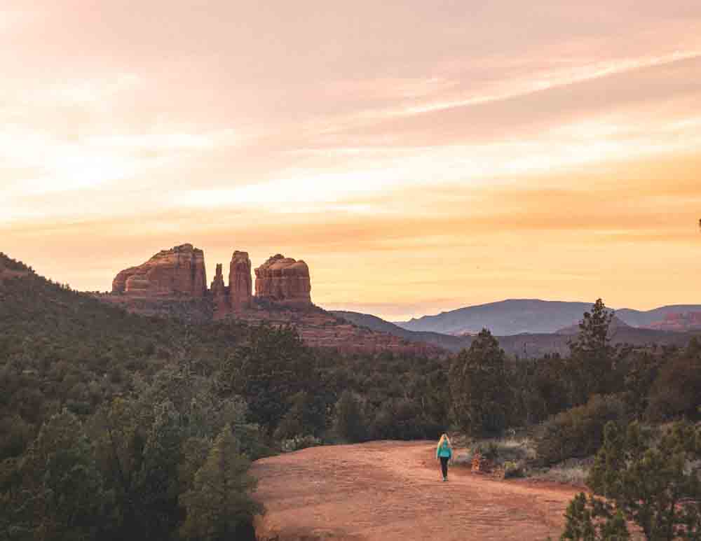
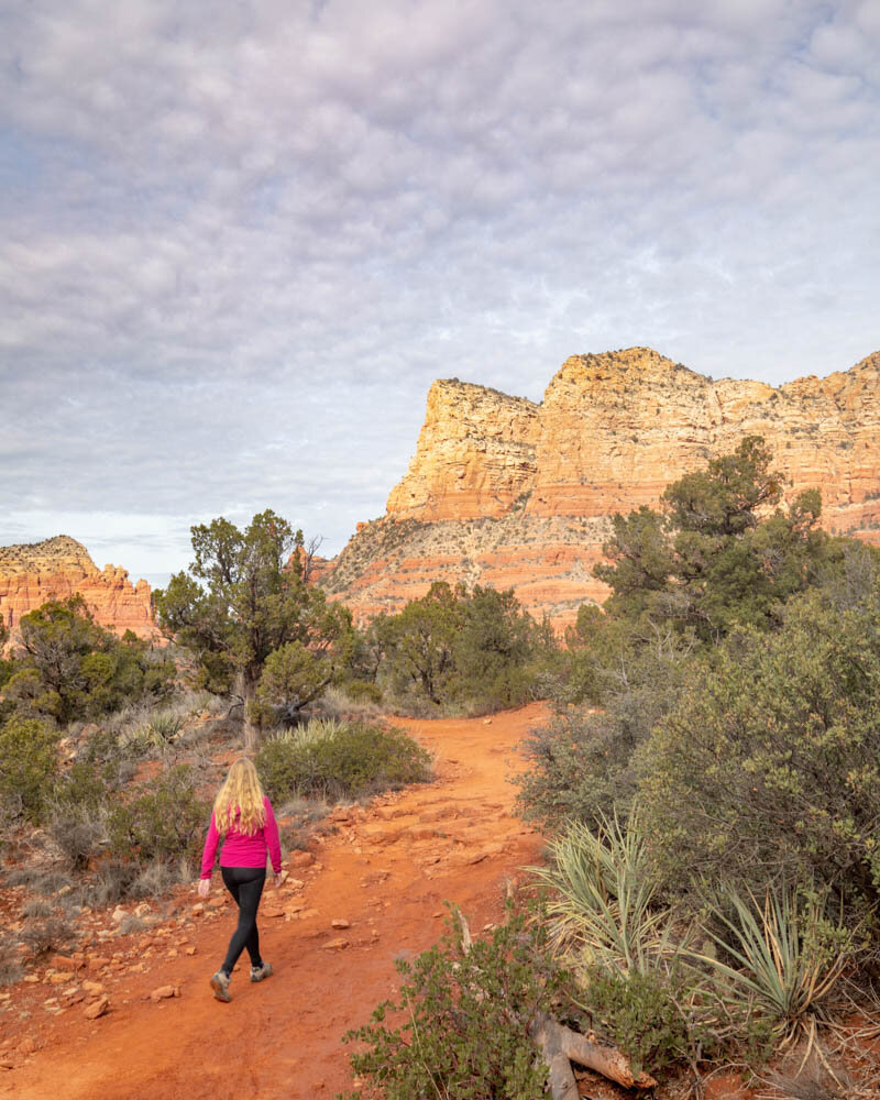
Sunset at Cathedral Rock
Best Sedona Hikes
Sedona is a hiking mecca and there’s a hike for everyone here - long & strenuous, flat & easy, ones with historic Indian ruins, beautifully scenic ones and some which become a rock climbing expedition.
These are a few of our favourites, we’ll also add a couple of suggestions for more trails that were on our list but that we didn’t make it on this time round.
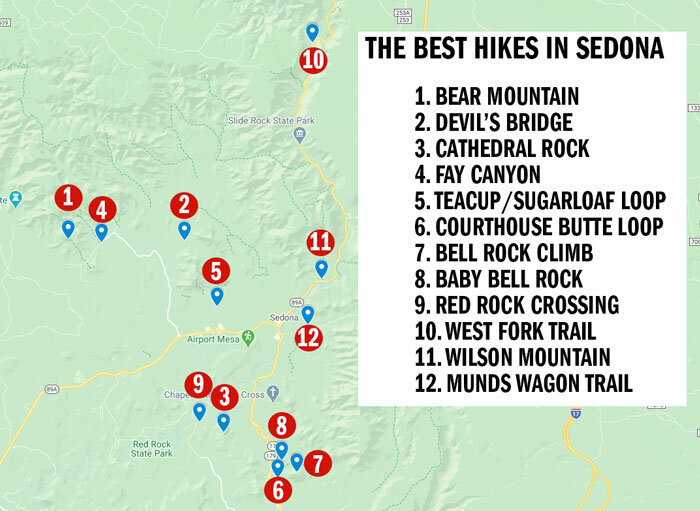
Sedona Hikes Map
Below you can see a map detailing the locations of all the hikes we’ve listed. You can click on this link to access a Google Maps version of this map.
Sedona Hiking Tips - what to know before you go
Here’s a few tips you’ll want to know before planning your trip:
The best time to visit is on weekdays outside of the school holidays. You will find a lot less people on the trails and less hassle for parking at trailheads.
Winter isn’t a bad time to visit Sedona. The days are warm on the whole, but you will probably want to bring warm clothes in case there’s a cold spell and a pair of Yak Tracks.
If possible avoid the summer. The day time temperatures are incredibly hot and oppressive, which is made worse by the fact that majority of trails in Sedona are exposed.
If you visit when it is hot, hike very early or later in the day. This will mean you miss the worst of the heat.
Bring lots of water. Sedona’s in the desert and the exposure here can make it very dehydrating.
The Devil’s Bridge is one of the most popular in Sedona and the parking lot fills up very quickly. You may have to be patient.
Speaking of which, try to avoid the late afternoon for the Devil’s Bridge. It will be in shadow, making those epic photos not so easy to get!
An annual National Parks Pass will cover your entry fee for a lot of the trails, but not all of them. Check at the parking lot before you hike.
Some of the hardest trails offer the best views. A lot of people avoid Bear Mountain because it’s a hard and steep hike. However, the effort is rewarded with some of the best views in Sedona.
Whilst Sedona may look like a small place, it can take longer than you think to get around. Add in the traffic from rush hour and the journeys can take up to 1 hour for what looks like quite a short distance.
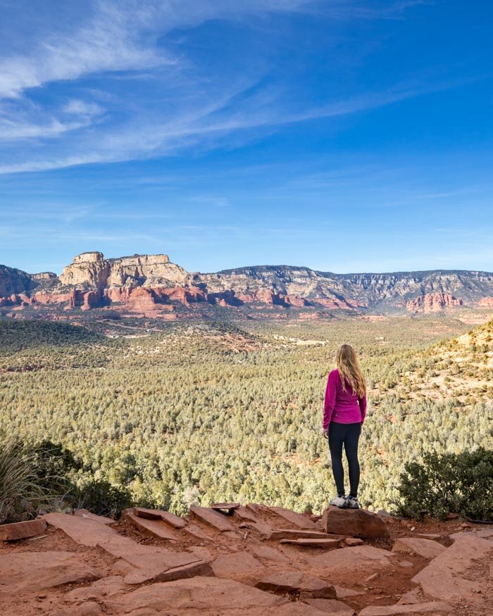
1. The local’s favourite - Bear Mountain
Distance - 6 miles each way
Elevation - 2,237 feet
Difficulty - Hard & very exposed (bring sunscreen and plenty of water)
Starting & End Point - Doe Mountain/Bear Mountain car park
Fees - Free with National Park Pass, otherwise $5 parking fee
The Bear Mountain trail is one of the harder walks in Sedona and is a local’s favourite. The trail has a pretty start beginning and continues uphill for most of the way.
We recommend allowing 5 hours to do the entire walk.
Why we love Bear Mountain
The photos of Bear Mountain don’t do justice to how good the views are on this trail. Once you’ve climbed over the first peak, you’ll have panoramic views of the whole area that are unparalleled.
On one side you’ll see down into Fay’s Canyon, a beautiful area with deep red walls and rock formations which look good from the ground, but even better from above.
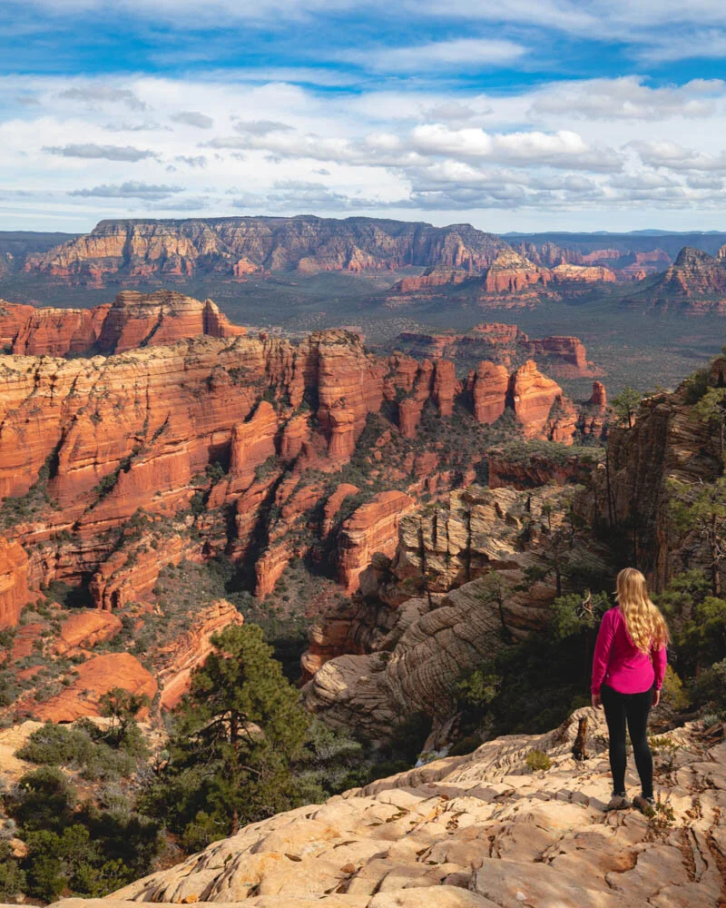
The views on the other side are also amazing (though not quite as good) and showcase the desert and out to the far away mountains in the distance.
This is a hike that is ever changing and keeps you always waiting the next epic view. We loved it.

It is also a good trail to do after rain as a lot of the path is rock and there are few areas which turn boggy (unlike a lot of the other Sedona hikes). We know because we hiked it the day after some pretty bad flash flooding. I’d been worried that the rock might be slippery but it wasn’t (or not any more so from having been wet anyway).
The hike to Bear Mountain is steep, long and strenuous. Before we started, we thought that it wouldn’t take too long to hike 4.5 miles, laughing at the sign that it takes 5 hours. We returned 4 hours 45 minutes later………
The mountain you’ll see from the top

The track takes you over three small peaks, all of which are false summits. The first at the top of a beautiful red cliff with a waterfall that marks the start of the very steep ascent.
After this you feel like you’re on a plateau on top of the mountain, but the truth is that you face quite a few uphill climbs before reaching the top.
The views all the way are spectacular and make for great motivation, but the trail is pretty smooth and steep, so you may want to take your time, especially on the way down.
The top is marked by an “end of trail sign” and a stunning view across to the gorgeous snow capped mountains (see the pic below). Most people chose to have lunch here and admire the panoramic views before heading back.
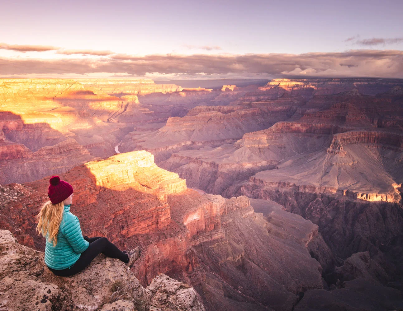
Read next: Stunning Grand Canyon hikes that will blow you away
Bear Mountain Parking
The car park for Bear Mountain is shared with another popular hike - Doe Mountain on Boynton Pass Road. There is a decent amount of space here, so you shouldn’t have to worry about arriving at the crack of dawn to get a car parking space!
2. For the best photo op in Sedona - Devil’s Bridge
Distance - 1.8 miles each way
Elevation - 341 feet
Difficulty - Easy to moderate (flat for the most part, with an uphill section at the end)
Starting & End Point - Devil’s Bridge Trail Head car park
Fee - None
The walk to Devils Bridge is an easy to moderate trail, with the majority being on a wide open dirt path, until an uphill climb at the end. We recommend allowing two hours to walk there and back, and add a little more for the photos on the bridge!
Why we love the Devils Bridge
It’s safe to say that the Devil’s Bridge is the most popular hikes for one reason - the epic view at the end. Once you lay eyes on it you’ll understand why so many people want to visit.

The bridge looks precarious side on: incredibly high, narrow and with a few cracks that make it look like it could collapse at any moment. However, it is regularly checked and is safe to visit - just make sure you take care when going on the bridge!
The walk to the Bridge is pleasant, but not as good as any other on this list. We loved this walk but it’s definitely all about that incredible destination.
Arguably the most popular view in Sedona
The views all around are beautiful though, it’s a Sedona hike after all, and you’ll see those unique red cliffs, but the majority of the path is along a 4x4 track and it can get really busy (with people not cars on our visit thank goodness).
If you’re short on time, the Devil’s Bridge should be high on your list. The views from the bridge make up for the mediocre trail and it’s pretty easy going (apart from the steep section at the end).

If you want more information about the famous Devil’s Bridge Sedona, then check out our detailed blog about the trail.
Insider tip: We recommend avoiding the late afternoon if you want to get that epic photo. Sadly the bridge is in the shadow, making it pretty hard to get the photo you want!
Devil’s Bridge Parking
The car park and trailhead for Devil’s Bridge is about seven miles away from the centre of Sedona and can be found along Vultee Arch Road. You won’t have a problem spotting it, it will be the place where cars are parked along the road leading up to it.
Parking can be a struggle here - especially in the middle of the day (it is one of the most popular Sedona hikes).
If you are parking in the 4x4 car park it was tiny but very few people seem to use it so it had space both times we passed by.
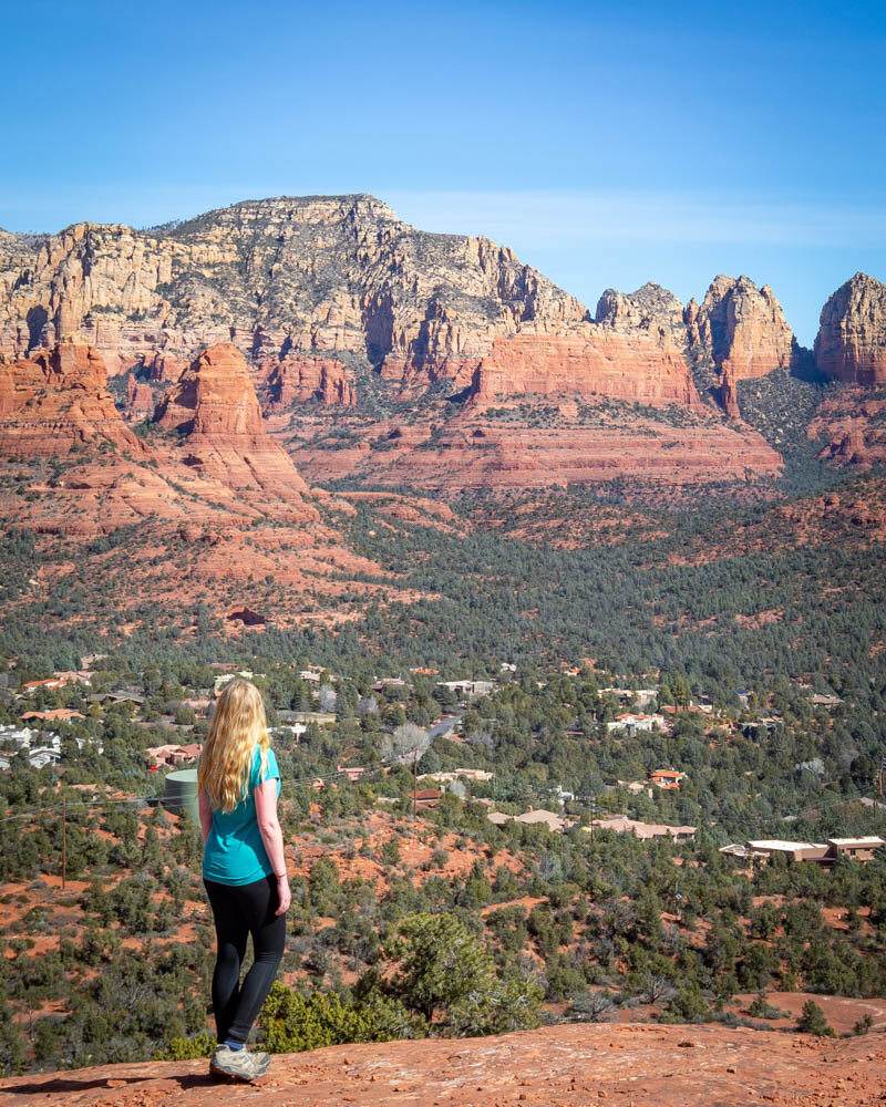
3. The Instagrammer’s favourite - Cathedral Rock
Distance - 1.5 miles each way
Elevation - 750 feet
Difficulty - Moderate. A lot of sections are fine, but some steep scrambles
Starting & End Point - Cathedral Rock Car Park
Fee - $5 if you don’t have a National Parks Annual Pass
The hike to Cathedral Rock is short, but is steep and slippery in several sections. This isn’t a trail to take on after rain or ice. If you’re up for the challenge, allow 1.5 hours for the entire trail.
Why we love the Cathedral Rock Trail
The Cathedral Rock Trail is one of the most popular hikes and also one of the shortest.
In truth, we wouldn’t really classify it as a hike as the majority of it is a scramble up smooth, steep rock and gullies. It’s a lot of fun and makes a nice change from an ordinary trail. If you time your hike right the view from the top offers the most stunning sunset views, an excellent reward for your efforts.
It is relatively steep, but there are plenty of places to stop and admire the views, aka catch your breath.
Sedona Hikes: The view from the Cathedral Rock Trail
The start of the trail crosses a wash before greeting you with the mission ahead - this steep path.
The hardest part of the whole trail is the upcoming gully. This is a really tricky part to navigate as essentially you are relying on jamming your feet into cracks and hoping they hold! It is about 100 metres long, so persevere as things get a bit easier after this.
The gully is also quite tricky on the way down as your momentum and gravity will be taking you down! Once you’ve conquered the gully there are a few more smooth and steep rock sections to climb, but they are easier than what you’ve climbed so far. It isn’t long before you get these beautiful sunset views, perfect for photography!
The views from Cathedral Rock
The views from the summit
Once you’re at the top, there’s a path that leads to another area which fewer people explore. Simply turn left at the top and you’ll find a path that winds up hill to a huge rock formation. Light-wise this is a better place to go to if you decide to climb Cathedral Rock in the morning. At sunrise it would no doubt be spectacular.
Insider tip: We don’t recommend attempting the Cathedral Rock Trail if it’s been raining! The rock will become very slippery, making it hard on the way up and pretty dangerous on the way down.
Cathedral Rock Parking
Cathedral Rock is close to Bell Rock and surprisingly as it is one of the most popular Sedona hikes the car par is really small! There are overflow car parks, but you may have to park on the road. This isn’t too big a problem in the off season as the road is pretty quiet but it could be trickier in high season.
Read next: 8 hikes in Zion ranked, Utah
4. The wow factor without having to get a sweat on - Fay Canyon
Distance - 1.5 miles each way
Elevation - 330 feet
Difficulty - Easy and entirely flat (if you don’t go off the track)
Starting & End Point - Fay Canyon Car Park
Fee - No fee
The Fay Canyon Trail is one of the easiest in Sedona, being short and flat, but doesn’t compromise on the views! The trail is in good condition, until the scramble. We recommend allowing 1-2 hours to see and enjoy Fay Canyon.
Why we loved Fay Canyon
Fay Canyon is a beautiful and primarily flat track that is a great introduction to the area. This was the first hike we did and it wowed us.
The marked path is almost entirely flat and winds through pretty forest, opening out at certain points to offer stunning views of the canyon. We hiked in winter so sun wasn’t a problem for us but this would be a good walk in hot weather as the trail is nicely shaded.
The path will continue until a dried up riverbed with a sign that says “End of Marked Trail”. You can simply turn around here, but we recommend that you don’t because you’ll miss the highlight of the trail - this view.
Sedona Hikes: The view into Fay Canyon
Cross the river bed and start hiking up the red rock. There are some steps cut out into the rock and whilst most people will be able to do it, the path becomes a lot narrower and not so well defined.
Once at the top of this rocky section you can continue along for quite a while into the canyon.
Or you can simply enjoy the many amazing views that aren’t far from the top of the path!
Another one of the beautiful views at Fay Canyon

The landscape at Fay Canyon
Fay Canyon Parking
Fay Canyon has its own car park that is 8 miles from the centre of Sedona and should take 18 minutes to drive to. The trail starts across the road from the car park.
Read next: Death Valley hikes that are unlike any we’ve ever done
5. Gorgeous panoramic views of the town - Teacup/Sugarloaf Loop Trail
Distance - 2 mile loop
Elevation - 380 feet
Difficulty - Easy
Starting & End Point - Sugarloaf Trailhead car park
Fee - Free
The Sugarloaf Mountain and Teacup Trail Loop is a nice and easy walk in Sedona, but also offers great views of the mesas that this area is so famous for.
Allow about an hour for the trail, but you may want to arrive early to snag a spot in the small parking lot.
Why we love this trail
The Sugarloaf and Tea Cup Trail starts from a car park in the middle of a housing estate, making you question whether you have come to the right place! A few metres later and you’re in the middle of red rock country again, with cliffs all round you and cacti by the dozen.

The aptly named Coffee Pot Mountain
The track is very flat apart from the short ascent to the summit of Sugar Loaf (making it one of the easier hikes on this list). The views from here are spectacular offering you a good look at how the town is entirely surrounded by mountains. You get above the powerlines and can see Coffee Pot Mountain and hundreds of other epic rock formations.
From here you can return to the Teacup Trail for some more pretty views. It isn’t much further on and is flat all the way. It’s a very easy trail and one that you can squeeze in if you only have an hour to spare.
Sugarloaf & Tea Cup Trail Parking
The trails for this hike start at the car park on Buena Vista Drive. This is only 3 miles away from Sedona and should take 5-10 minutes to drive to.
The drawback is that the car park is tiny and even in February it was full. It didn’t take long for someone to leave but in high season you would probably need to come early or late.
Read next: The best hikes in Joshua Tree National Park
6. A leisurely loop - Courthouse Butte Loop
Distance - 4 mile loop trail
Elevation - 800 feet
Difficulty - Easy to moderate (some uphill, but not much).
Starting & End Point - Courthouse Vista Car Park
Fees - $5 parking fee, otherwise free with Annual National Parks Pass
If you’re craving a longer hike without the monstrous incline of Bear Mountain, then head to Courthouse Vista and hike the Courthouse Butte Loop for a satisfying end.
This 5.2 mile trail will take you round Courthouse Butte and Bell Rock, two of the most famous rock formations in Sedona. You’ll also get glimpses of Cathedral Rock and some beautiful views of the rest of Sedona.
We recommend allowing 2 hours to do the trail at a leisurely pace and to enjoy the views.
Why we love this trail
Starting at Courthouse Vista car park, take the Bell Rock Pathway and then follow signs for the Courthouse Loop. It isn’t too hard to keep track of the path, but there are quite a few diversions along the way which could send you off course!
Sedona Hikes: The Courthouse Butte Loop
What we liked about this trail is that you got so many different angles of both rocks and very few people were here compared to many other Sedona hikes. The hike is predominantly flat so it’s a nice easy trail that still offers the kind of amazing views you would normally have to climb for.
If the Courthouse Loop wasn’t enough, then add in the Bell Rock climb for a fun scramble!

Courthouse Butte Loop
The best place to park for the Courthouse Butte Loop is at Courthouse Vista which is almost 6 miles outside of Sedona (it should take about 10 minutes to drive to). Parking is free is you have a National Parks Annual Pass, otherwise it is $5. It is the starting point for a few different Sedona hikes.
7. The one with an adrenaline rush - Bell Rock Climb
Distance - 1 mile (1.8 km) out & back
Elevation - 300 feet+
Difficulty - Moderate - Hard. You’ll be scrambling up slippery sections and narrow paths. Not for the faint hearted.
Starting & End Point - Courthouse Vista Car Park or Courthouse Loop
Fees - $5 Car Park fee or free with National Parks Annual Pass
We combined the Bell Rock Summit hike with the Courthouse Loop as the cherry on top of a fun hike! This isn’t so much of a hike though as a scramble. We recommend allowing about 45 minutes to 1 hour for this trail.
At first the path is pretty flat, but soon you’ll need to test your scrambling skills as you’ll be climbing up some steep slopes and over rocks.
You can get about three quarters of the way up before you’d need to start rock climbing! Very few people make it to the top and we didn’t even see anyone trying. The views are magnificent from very early on so however much of the trail you feel comfortable with will be worth it.
Sedona Hikes: The stunning view from Bell Rock
If you don’t fancy going too far or get put off by how steep it is, the above photo shows the view at around halfway up which we thought was spectacular.
If your shoes have good grip the rock itself is not really slippery (although we wouldn’t try it when it’s wet), the difficulty comes after around halfway up when the ledges become much more narrow and the drop feels very real!
I only got just over halfway up and Joe got quite a bit further before we turned back and we still thought it was a fantastic hike.
Read next: How bad are Upper Antelope Canyon tours for crowds?
8. The best sunset spot in Sedona - Baby Bell Rock
Distance - 1 mile each way
Elevation - 150 feet
Difficulty - Easy
Starting & End Point - Courthouse Vista Car Park
Fees - $5 Car Park fee, otherwise free with the Annual National Parks Pass
Sadly, we didn’t quite make it to Baby Bell Rock for sunset. We got within 100 metres of the rock, we couldn’t find the path to the top and the sky started going all kinds of beautiful colours, so we settled for just below it.
This isn’t such a bad consolation view.
Sedona Hikes: Well, we didn’t quite make it to Baby Bell Rock
However, we did return the next day to find the path to Baby Bell Rock and the view. This is what it looks like (just picture it being at the end of the day with the colour of above!).
The great thing about Baby Bell Rock is that is positioned perfectly in the middle of some of Sedona’s most famous sights. From the top you are surrounded by Bell Rock, Courthouse Butte and Cathedral Rock. There are few better Sedona hikes to do in the late afternoon.
We recommend going a little before sunset you don’t have a rush trying to find the not so obvious path to Baby Bell Rock! You will need to take Bell Rock Pathway and start heading left (east) towards Butte Rock.

Just before you get to Butte Rock you should see a small hill you can go up and a path that will lead you round the back of the rock and up to the top. If you don’t mind about being here for sunset then it’s directly off the Courthouse Butte Loop and is an easy, short addition to that trail.
Parking for Baby Bell Rock
The best place to park for Baby Bell Rock is at Courthouse Vista which is almost 6 miles outside of Sedona (it should take about 10 minutes to drive to). Parking is free if you have a National Parks Annual Pass, otherwise it is $5.
9. The second most photographed view in Arizona - Red Rock Crossing (Track closed, but view open)
Due to recent floods and storms, the Red Rock Crossing Track from the usual start point at Crescent Moon has closed and when we spoke to Parks staff they didn’t know if it would reopen (it used to be one of the most popular Sedona hikes). This is due to the natural rocks which created stepping stones across the river being washed away.
In the summer or warmer weather, you may still be able to cross the river - just check to see that it isn’t flowing too fast.
However, you can still get to one of the most famous views in Sedona. The one below.
Sedona Hikes: The iconic view in Sedona
Granted, we don’t think this is worth the $10 entry fee the park charges (and they didn’t tell us the path wasn’t accessible when we were paying - tut tut).
If you’re desperate to see that famous view then go for it but go in the knowledge that you will only really get a photograph for your money. Having said that if you are interested in Vortexes there is one on this site which is around a ten minute walk from the car park. We went to this spot by accident when looking for the trail we later found out to be closed.
Insider tip: If you want to get to Red Rock Crossing without paying for the entry fee, try starting from the Baldwin Trail. It’s a little further, but it won’t sting you with the $10 fee.
Red Rock Crossing Parking
The car park for the famous viewpoint is at Crescent Moon Ranch which charges $10 per car (even if you have a National Parks pass). It is 7 miles from Sedona and should take 15 minutes.
If you want to walk the Red Rock Crossing we think you can still get there from the other side of the river by heading to Verde Valley School Road. It is a lot further away from the centre of Sedona (12 miles) and should take about 20 minutes to drive to. You can find it on the map below.
Other hikes that are still on our list
We had some flash flooding during our visit, so we missed a few hikes that we’d been planning on doing and one that isn’t really suitable for a winter visit.
10. West Fork Trail
This is supposed to be one of the best Sedona hikes but is not great in winter (when we visited) due to the number of times you have to cross the creek and the high water flow and ice. In the warmer months all those creek crossings would no doubt be heavenly!
11. Wilson Mountain
This was recommended to us by a local we met on Bear Mountain. It is a fairly hefty climb but one of the quieter hikes without compromising on epic views.
12. Munds Wagon Trail
This was also recommended to us on the Bear Mountain trail by frequent Sedona visitors. It’s another fairly long trail but less well known than many others so again it will be quieter than most Sedona hikes.
It has some pretty fantastic views including Carousel Rock which looks like it makes for a great photo op. They warned us though that after rain this trail gets seriously muddy so save it for a dry spell.
Packing suggestions for Sedona
Having the right gear can make a huge difference, whether it’s hiking during the hot summers, or the potential snow in the winter. Here’s what we pack and have relied upon for years:
Sunscreen: A lot of the trails in Sedona have very little shade and the sun is brutal most of the year! Check for sunscreen on Amazon or REI
Day Pack: Osprey Talon 22 (we’ve owned this for years). Check on Amazon, REI or direct with Osprey
Hiking Boots: Merrell Moab (for men and women). We’ve both used these for over three years and they just keep going. Check them out on REI or Amazon
Trekking poles: We’ve used Black Diamond for years as they are light, solid and durable. Check out REI or Amazon.
Reusable water bottle: To avoid single-use plastic. Check then out on REI or Amazon
For winter
Where to stay in Sedona
Sedona Summit Diamond Resorts
We’re not sure why but every time we came to Sedona the Diamond Resorts were offering the best deals! There are a few Diamond Resorts to choose from in Sedona (we also stayed in The Ridge on Sedona Golf Resort which was good but not quite as good as the Summit), all of which offer large rooms, a brilliant kitchenette (with cooking tops, fully stocked pots & pans etc and amenities like a coffee maker).
However, our favourite was the Sedona Summit due to its location (its pretty close to the main town) and the stunning hot tub views it offers. After a long day’s hiking, it was heaven.
Mesa Views at Sedona Summit
The rooms were really good value and spacious which made them perfect to retreat to. We’ve visited Sedona three times and always booked a Diamond Resort. One bugbear though is that the properties are time share and therefore expect to receive a sales pitch!
Check the latest prices on:
This post may contain affiliate links, meaning at no additional cost to you, that we will earn a small commission if you click through and decide to make a purchase. This helps towards the costs of running our website. :-)
Like it? Pin it!


Follow us on Social Media
Are you planning a trip to Sedona? Where is your favourite Sedona hike? Let us know in the comments below!