We’ve been on a mission to visit all of the waterfalls in Royal National Park and after a good bout of recent rain we decided to check out the little known Engadine Falls. We’ll be honest that we weren’t expecting too much, but what we found was a gorgeous waterfall in a secluded setting. We had it to ourselves on a sunny Saturday afternoon when the national park was absolutely jam packed!
If you visit after high rainfall you’ll be in for a treat, at any other time Engadine Falls is just a trickle and not really worth the effort. The waterfall is not signposted and does require a scramble to access, but we’ll cover all of that in the post.
Here’s everything you need to know about finding Engadine Falls.

The walk to Engadine Falls
The stats
Distance: 1.9km each way
Elevation gained: 115m
Difficulty: Moderate
The walk to the creek that flows into Engadine Falls (which doesn’t offer a view) is easy, but to reach the base requires a scramble. It’s not overly difficult, but it is rocky and has some loose soil. It’s also a touch slippery in places after rain and you need the rain in order to make the trip worthwhile.
The path is shared with cyclists, but we only saw one bike and there is plenty of room to keep your distance. It took us 45 minutes to get to the falls, but we probably spent 15 minutes on the scramble to ensure we didn’t slip! Once we knew the route, the scramble took only 5 minutes on the way back - but it’s easier going uphill too as there’s less slip risk!
Starting the trail: finding the top of the falls
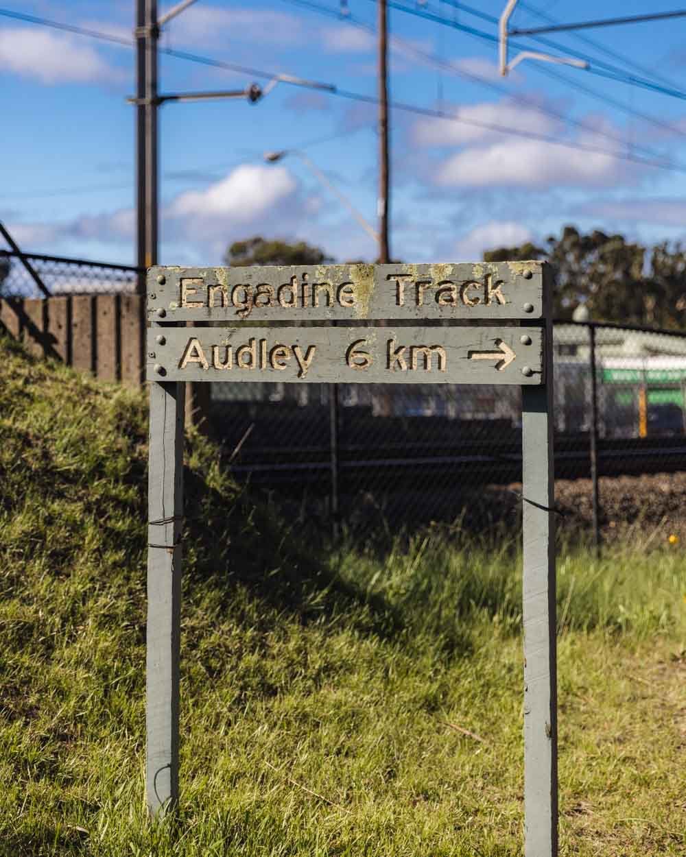
The walk begins at Engadine train station, but if you prefer to drive there is plenty of free parking right by the station.
Take the bridge over the train tracks and follow the sign for Royal National Park. The bridge crosses the platforms and drops you down at a dirt track, head left, you’ll soon see a sign for the Engadine Track.
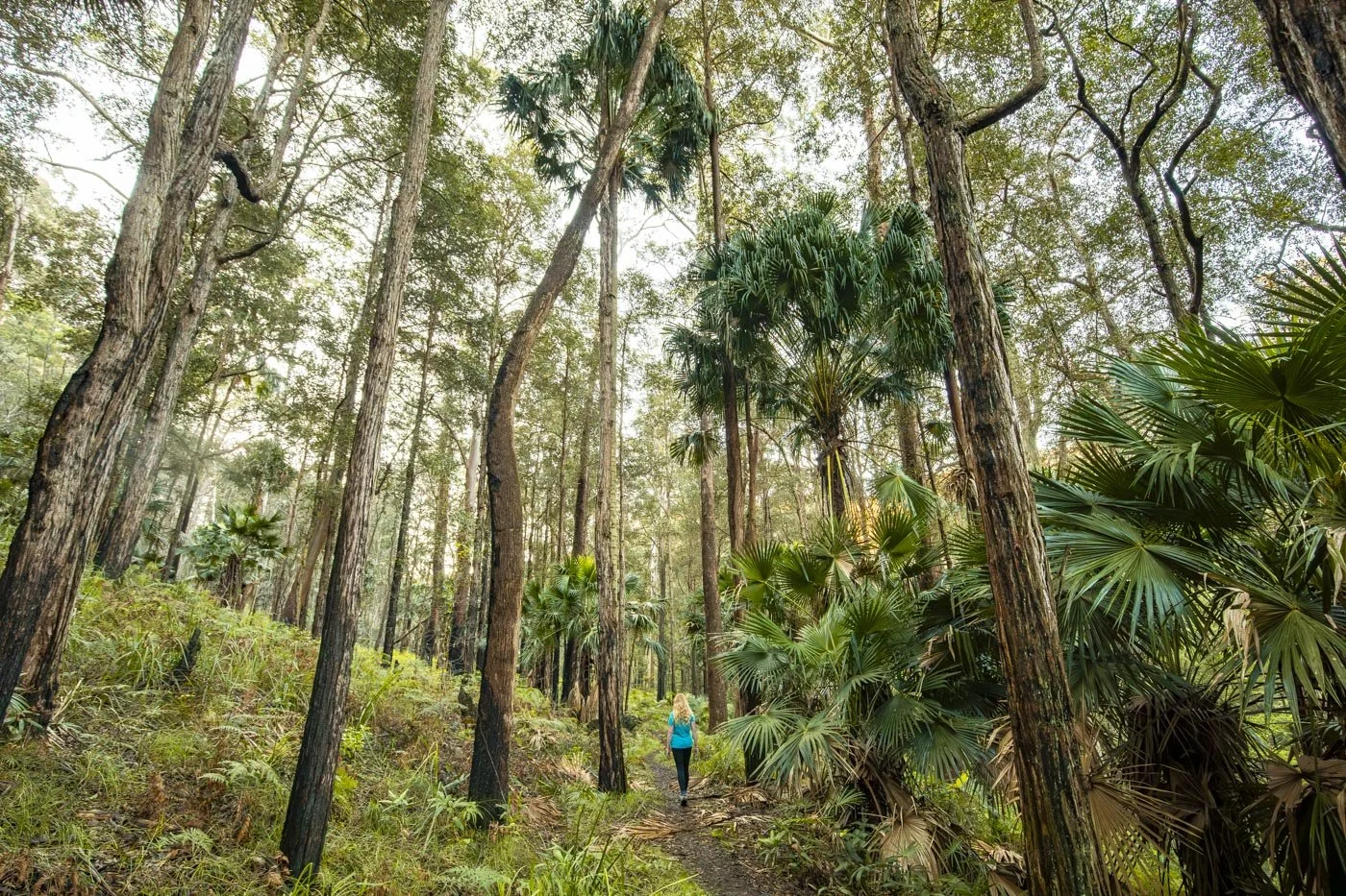
The trail will head into the bush on a narrow sandy path.

There are quite a few side trails along this track but we’ll note each turning. The sandy trail you start on will reach the first T-junction about 100m into the bush track. At this junction, turn left (as everyone’s stride is different our measurements may be slightly different to yours, but it should be close enough that you make all the right turnings). The path will then quickly fork right and there’s a beautiful tree fern and gymea lily.
The next is 880m into the walk and you keep straight (there are some tempting side trails, but ignore them). This part of the trail is all pretty much flat and very leisurely. The bush provides good shade from the sun too.

Once you’ve been walking for just over 1km the path (now a gravel fire trail) starts to get a little rocky and begins descending. Keep going straight to continue on the track to the waterfall at this point.
The fire trail will soon curve left and a couple of hundred metres later it will flatten.


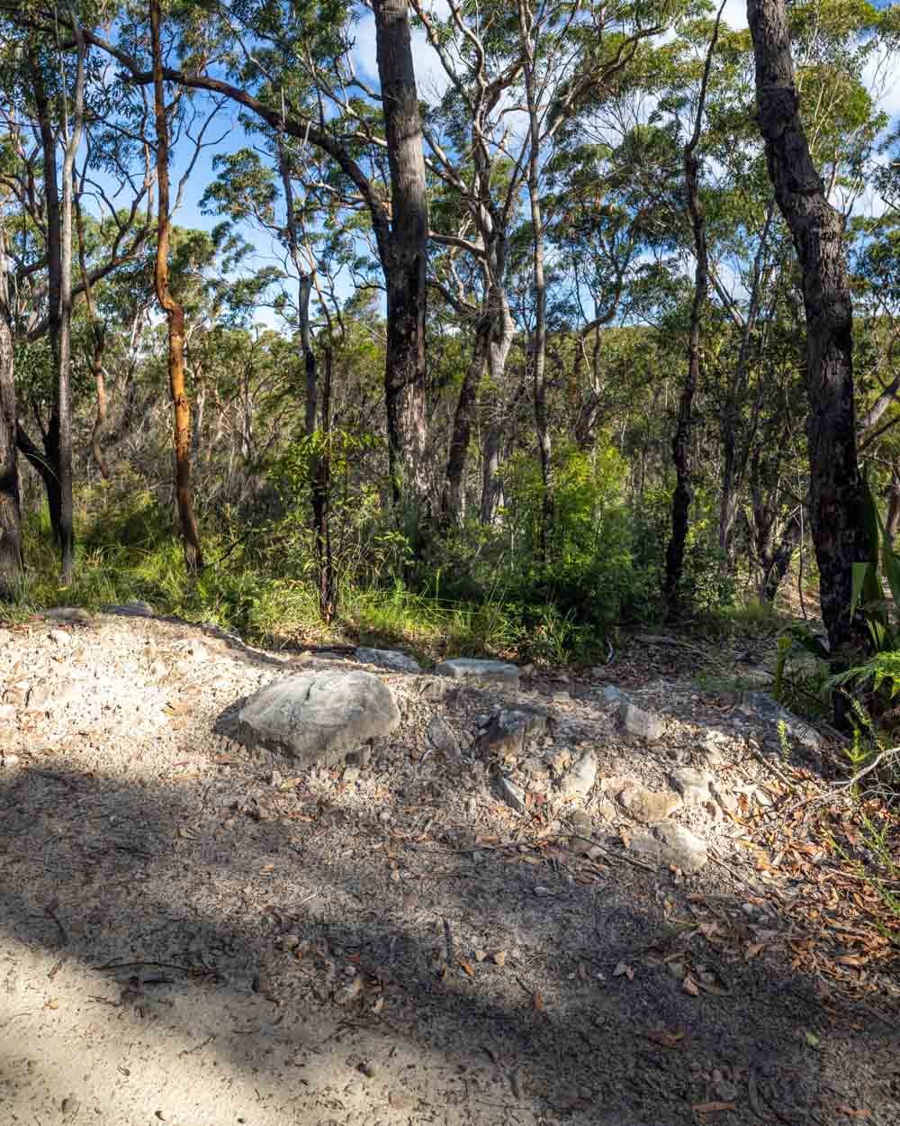
Roughly 350m further on you will see an obvious side trail on the right. You can see it in the photo below, the coordinates for the turn are -34.0618245, 151.0285066.
This is the start of the bush track to the falls and the trail heads downhill with a few loose stones, though it flattens 50m later.
Scrambling to the base of the falls
Co-ordinates for the waterfall: -34.0624404, 151.0292272
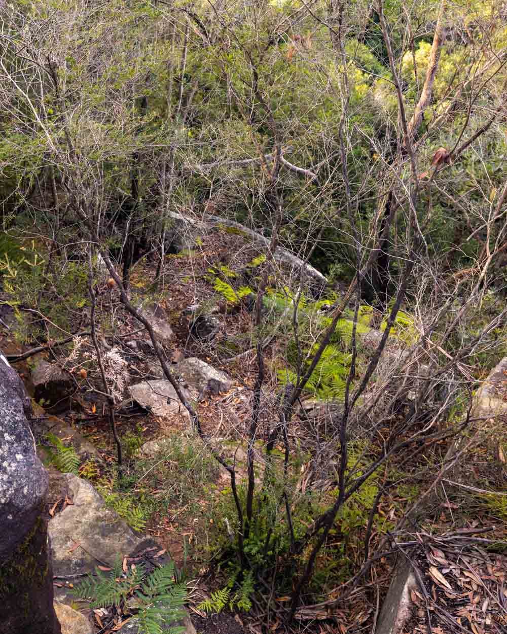
The bush track will take you to the creek which leads to the top of the falls within just a minute. You cross the creek (the creek flows under the rock, so no wet feet) and follow the obvious path directly ahead of you. There was a little debris here on our most recent visit, but nothing challenging to step over.
The trail gets a bit more scrubby but is still fairly obvious and soon takes you between the two rocks you can see in the photo.

Keep following the path for another 30m and then head left, down the worn path which is covered in leaf litter.
When you make this left turn you are just 140m from the bottom of Engadine Falls.
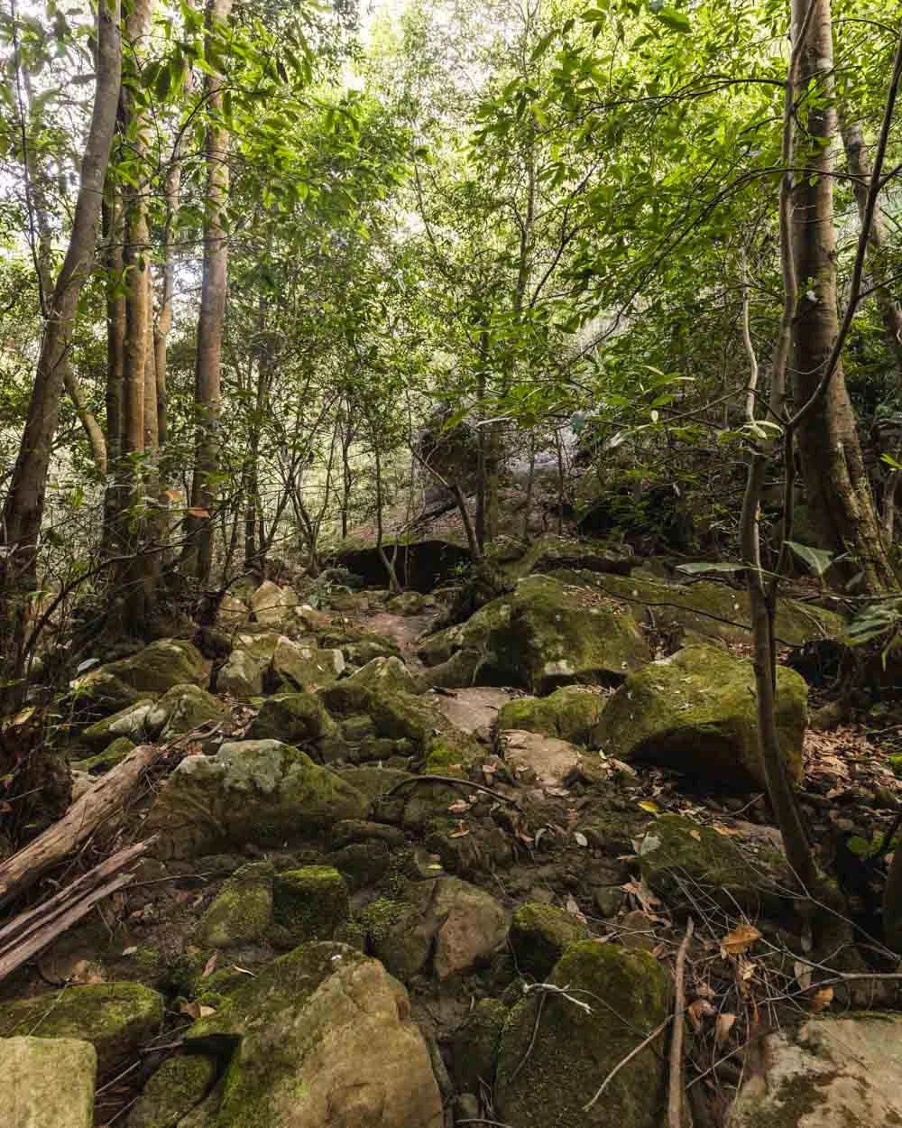
To get to the falls, you’ll head down some large rocky ledges and then down a little dirt path before you can turn left to an overhang, which is just by the top of the falls (50m from the turnoff which you took along the leaf litter path).


You can see the water through the trees. There is a way to descend to the falls here, but it’s harder than the one to the right (before you take the turn off to the overhang).

The easier path follows a dirt trail covered in leaf litter (there are lots of trees to hold onto for stability although it’s not overly steep), it’s 90m to the base of the falls from here.
You then have a couple of big rocks to scramble down and then you’ll see the bottom of the falls. There are just a few more rocks to walk across and then you can relax!
The final rocks to walk over to the base of the falls
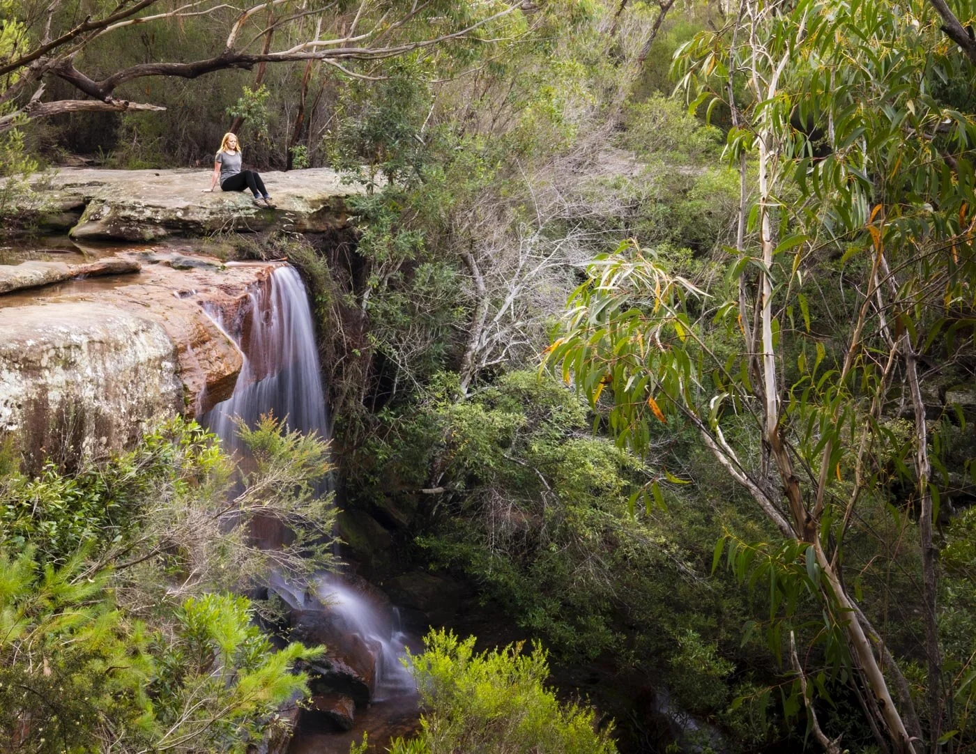
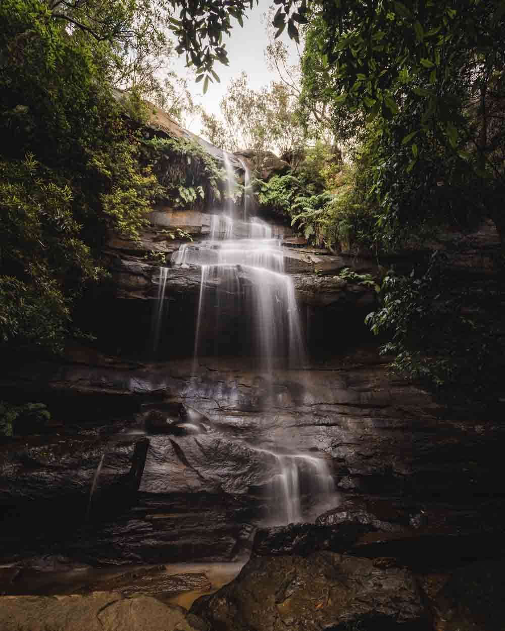
Engadine Falls
The waterfall is surrounded by giant boulders and dense bush, which gives it a really secluded feel. The falls are gorgeous after rain and tumble over large rocks at the base.
There is no pool for swimming, but you could definitely have a waterfall shower!

It’s more the kind of place to just sit and relax though and there are plenty of boulders to rest on. It’s a wonderful peaceful spot and must be one of the least visited waterfalls in the park.


Once you’re ready, the scramble back up to the main trail is much easier as you feel more stable. Just watch out when you’re back on the main track that you keep an eye on all the turnings you need to make as it’s easy to stray onto the wrong trail.
Continuing downstream of Engadine Falls
On our more recent visit to the falls we decided to look a little downstream of the main waterfall. Unfortunately there are no tracks and the further we went the more overgrown and difficult it became. However, there is a pretty waterfall, or large cascade depending on how you view it, around 360m downstream from the base of Engadine Falls. It’s not too difficult to reach either, it’s past this waterfall that the bush becomes very thick and challenging.
You want to keep on the right side of the creek (keeping the water on your left) and make your way along the rocks and rock platforms. It is all uneven terrain and there’s a bit of light scrambling. You’ll pass a very small waterfall 190m from Engadine Falls and then you are just 170m from the pretty one. There is a small pool with lovely clear water, but it was quiet shallow and full of leaf litter on our visit, so it isn’t really a swimming spot. We have unfortunately lost the photos, so we included a video of the falls instead!
It is a lovely place to sit and relax for a while though and I can’t imagine you’d ever bump into anyone else! As mentioned, we continued quite a bit further but it does get considerably rougher and more challenging.
Getting to Engadine Falls
As the walk begins at Engadine train station it’s an easy one to do by public transport. You can take a direct train from Sydney central station which takes 45 minutes.
It’s takes a similar amount of time to drive from the CBD, due to traffic.
This post may contain affiliate links, meaning at no additional cost to you, that we will earn a small commission if you click through and decide to make a purchase. This helps towards the costs of running our website. Thanks for your support.