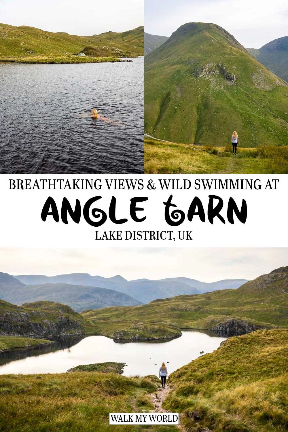
We had high hopes for Angle Tarn after reading that Wainwright described it as one of the best tarns in Lakeland. And it definitely lived up to this accolade, however, what we hadn’t been expecting was just how spectacular the whole walk would be.
The views in this little visited corner of the Lake District are jaw-dropping, especially if you complete the full circuit track rather than just walking to the tarn and back. The views, the chance to swim in the tarn and the lack of crowds make this a truly unmissable walk.
Here’s what to expect on the trail.
The Angle Tarn Circular
The stats
Distance: 6.3 mile (10.1 km) circuit
Elevation gain: 485m
Difficulty: Moderate
Trailhead: Patterdale Hotel Car Park or the layby in Patterdale
Summary: The majority of the walk up to Angle Tarn is uphill, but the paths are in good condition and it’s predominantly gravel, so you don’t need to worry about mud or bog. There’s a little bit of marshy ground around the tarn, but it was all avoidable on our August visit.
Continuing on the circular route involves a little bit of rougher terrain in places, however, only one short section was slippery.
This is on the descent through a small patch of woodland and it was very rubbly underfoot. Otherwise the descent is somewhat steep in places but the paths are good when dry.
Starting the trail: the climb from Patterdale
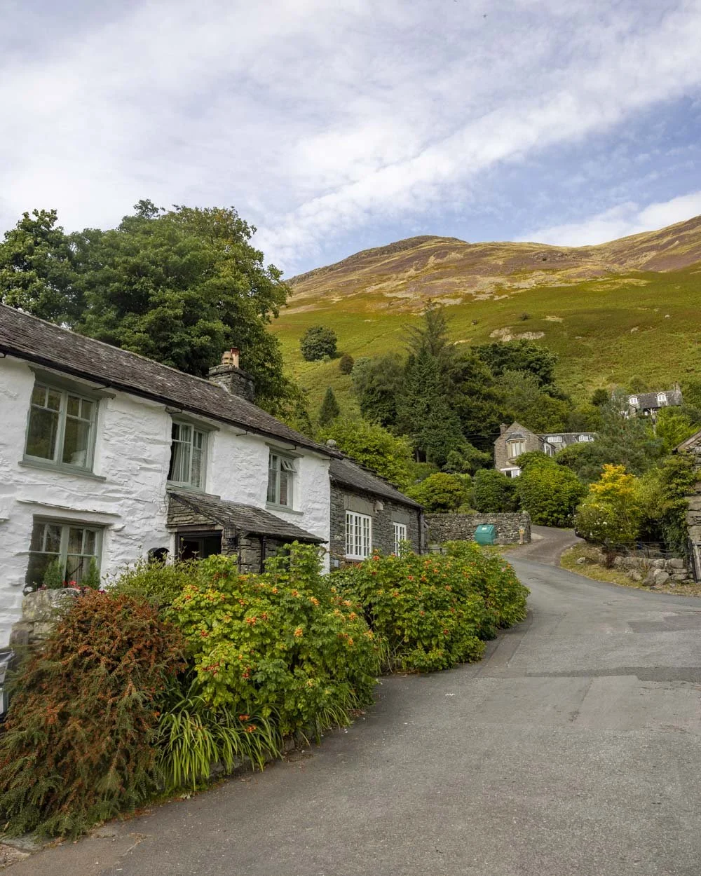
The walk begins in Patterdale and there are a couple of free parking spots you can snag if you’re lucky (more details on parking at the end of the post) but most people will probably begin from the Patterdale Hotel car park.
From here you head left through the hamlet and will come to a signpost for Angle Tarn after 130m. You’ll keep heading southeast along the pavement on the A592 before turning left at the bridge at the 220m mark.
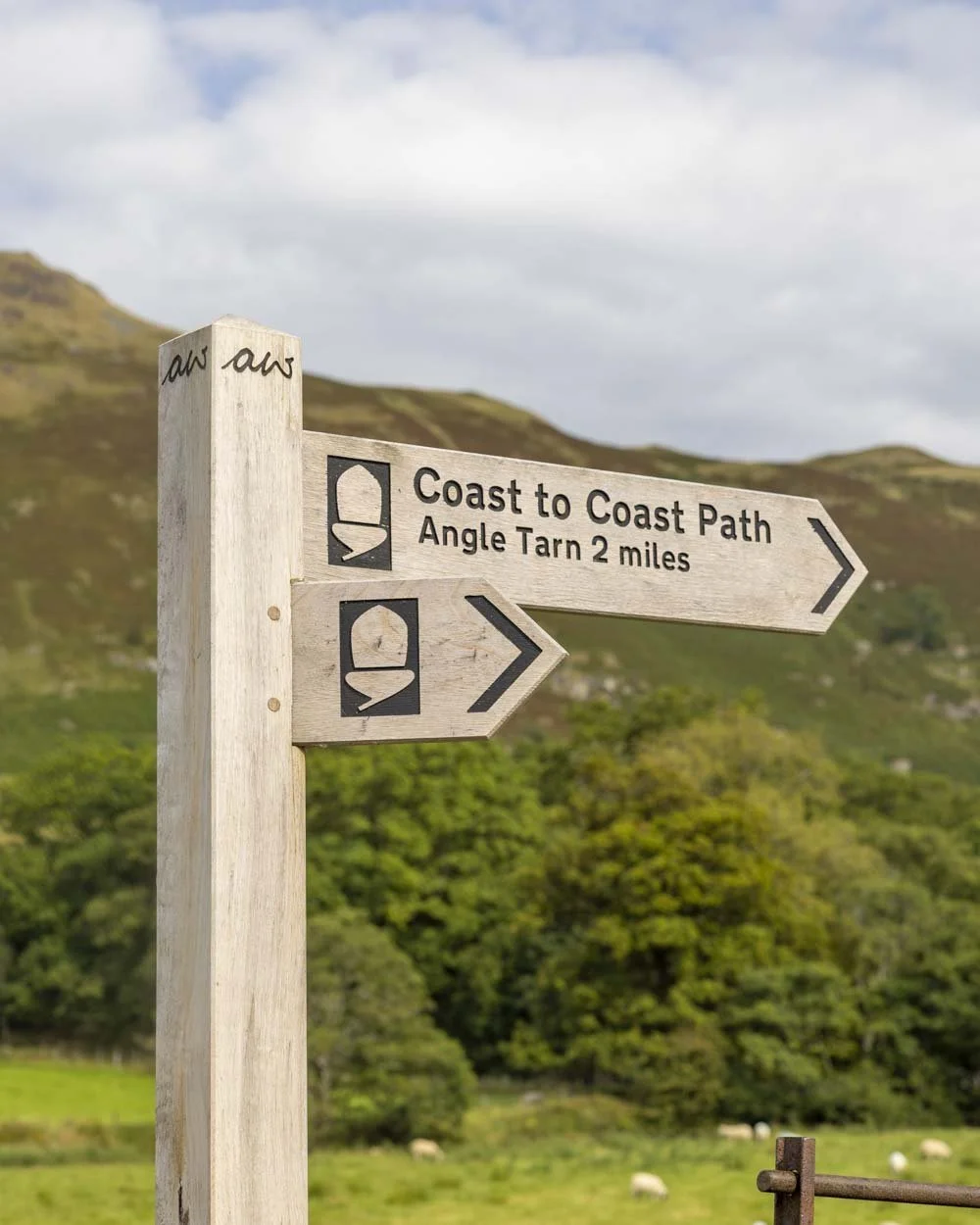
The flat walk continues for another 330m into the hamlet of Rooking, before you start heading gently uphill, following the sign for Angle Tarn.
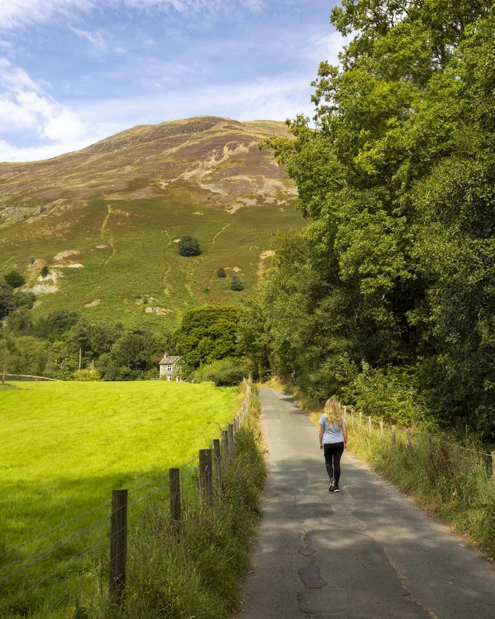
Just under 100m later you’ll pass through a gate and leave the paved road behind.
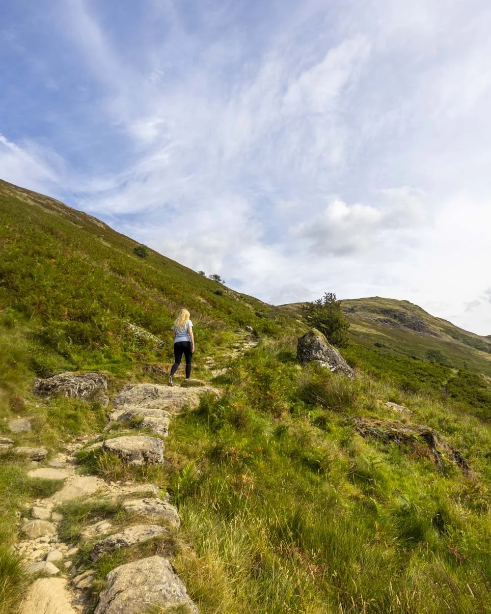
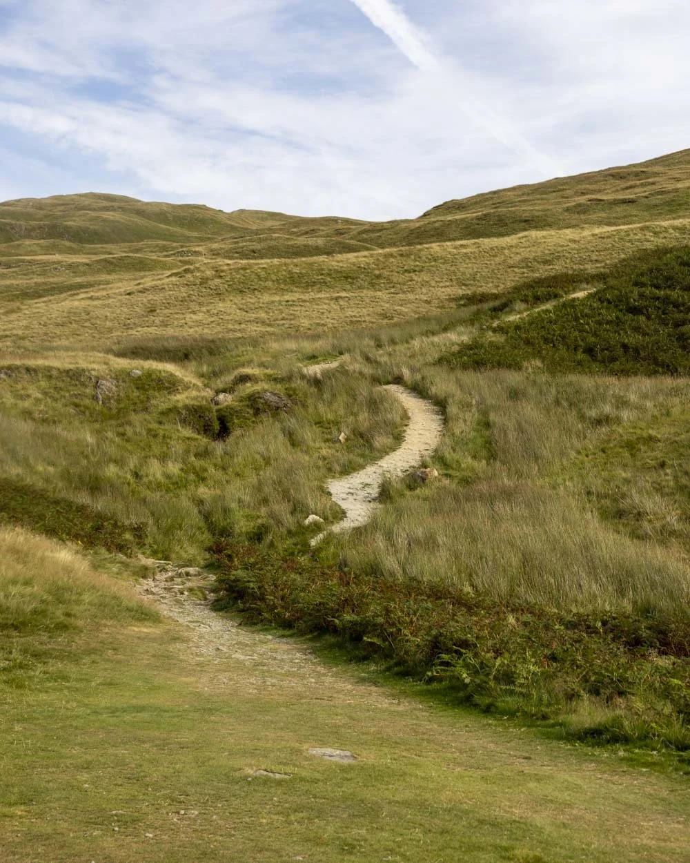
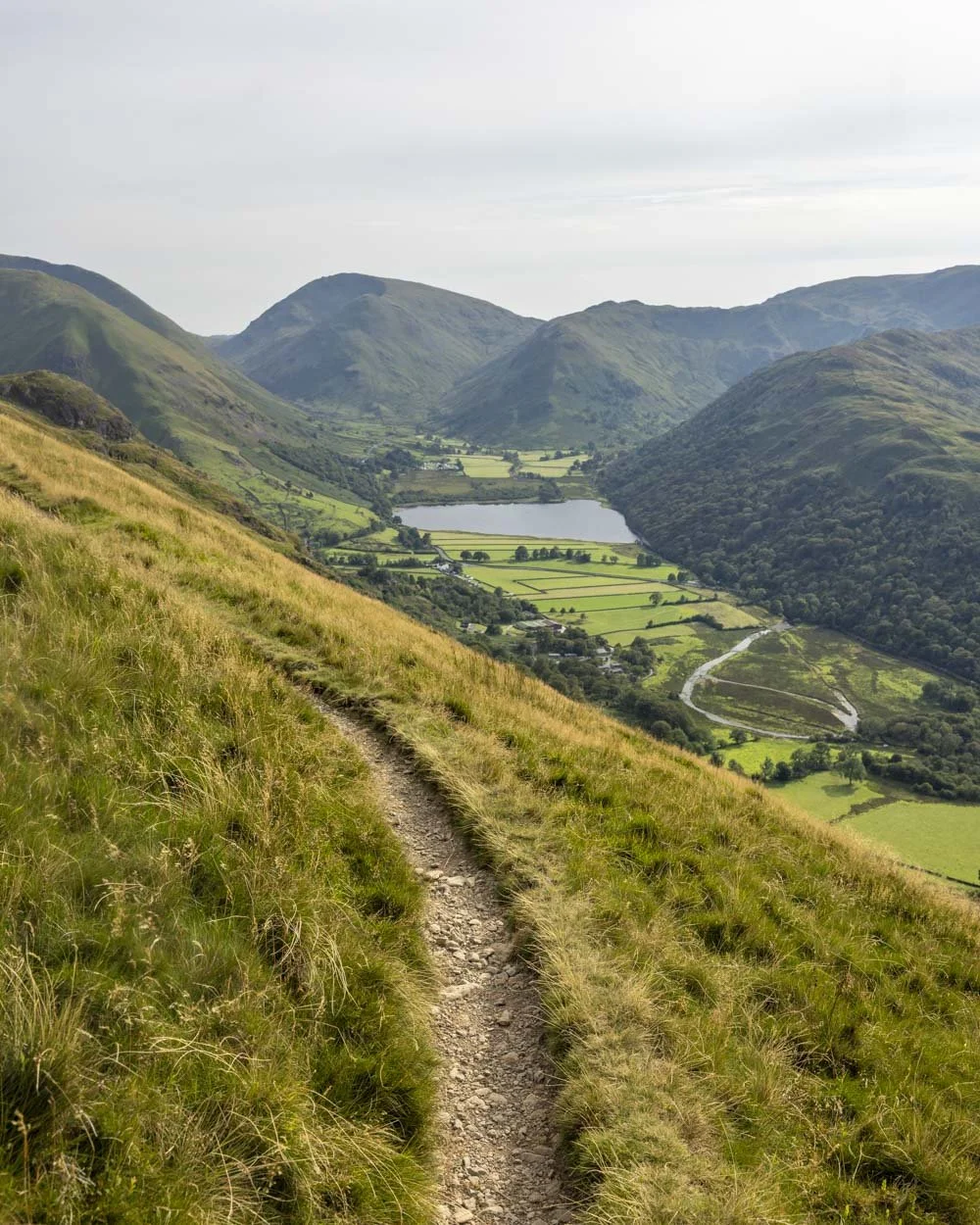
From now on you will climb up towards the tarn on a mix of gravel track and stone stairs. At the 710m mark you turn right and the gradient will slacken briefly before steepening again.
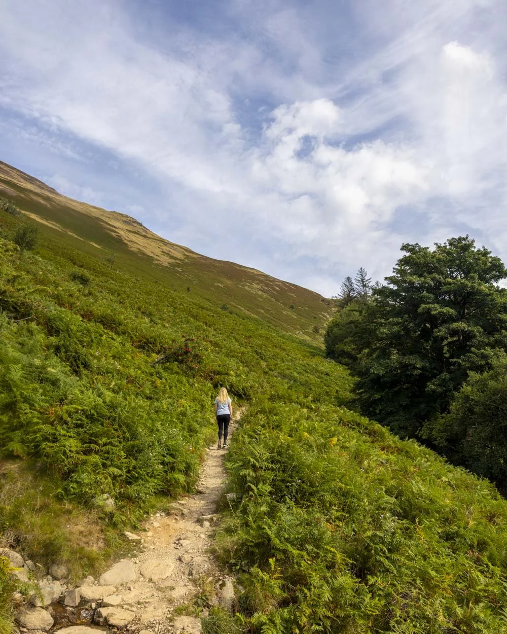
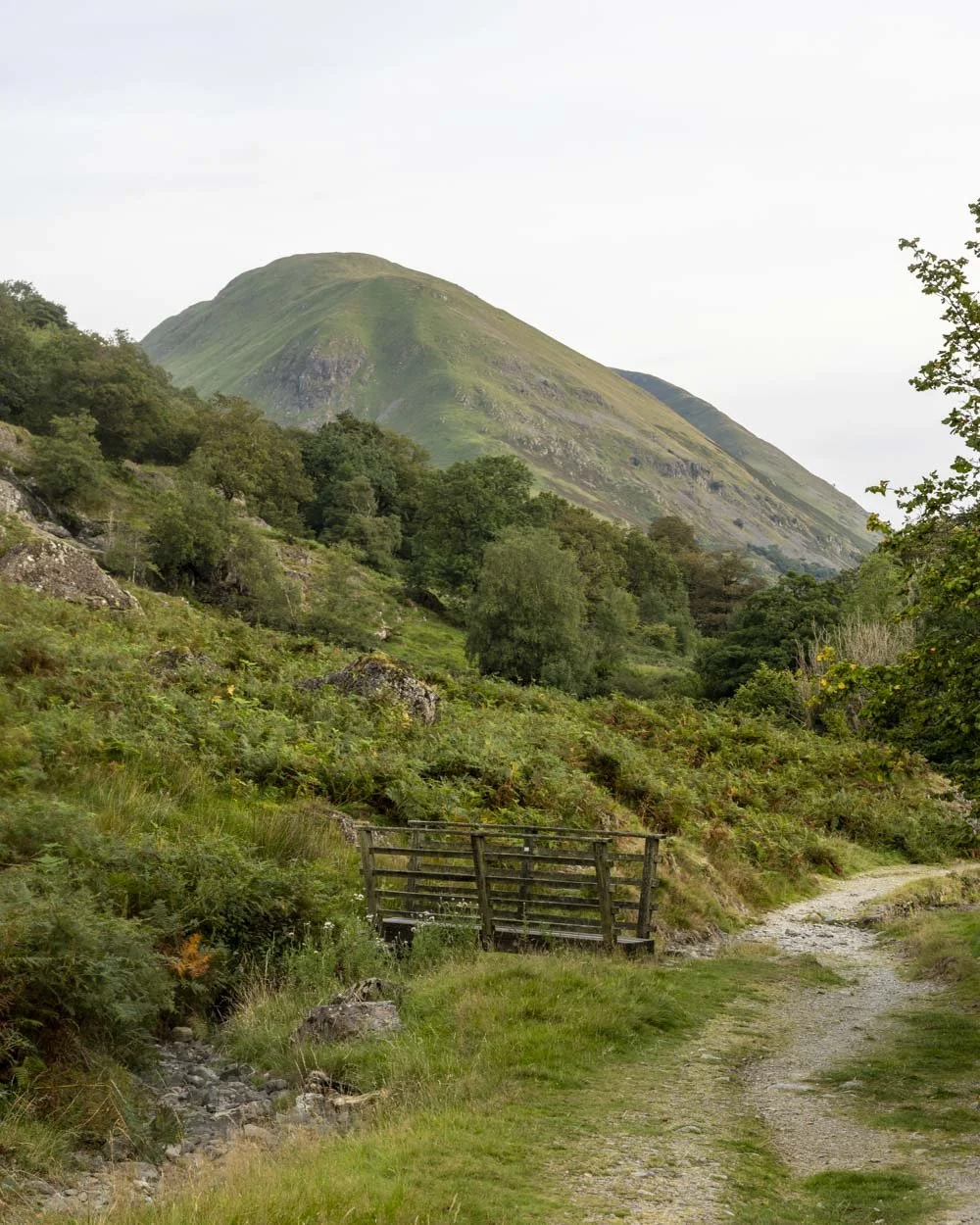
Though the track is pretty relentless in heading uphill, you will be easily distracted by the stunning fell views.
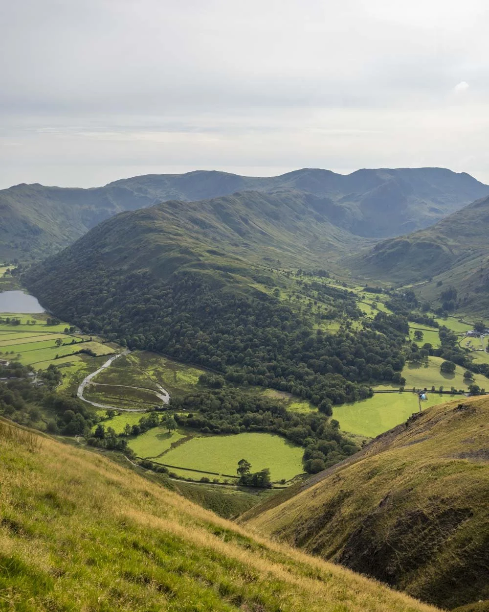
As you climb, Brothers Water and Ullswater will also come into view.
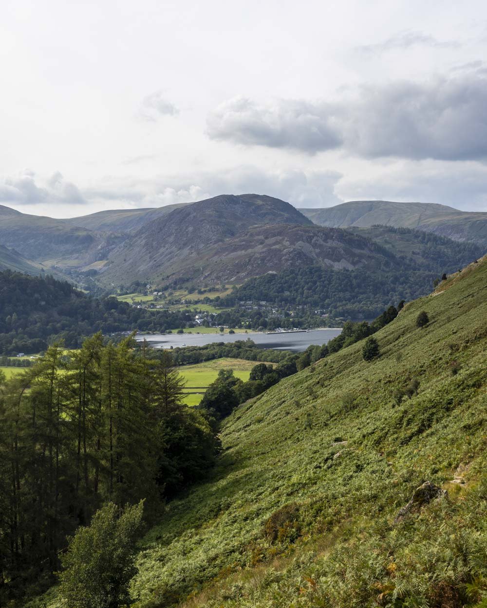
Ullswater
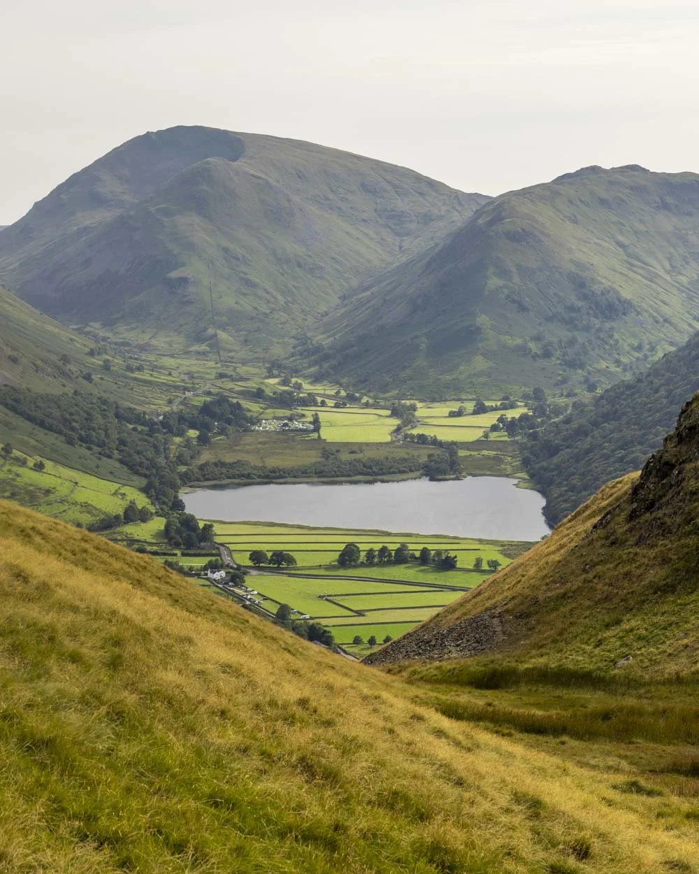
Brothers Water
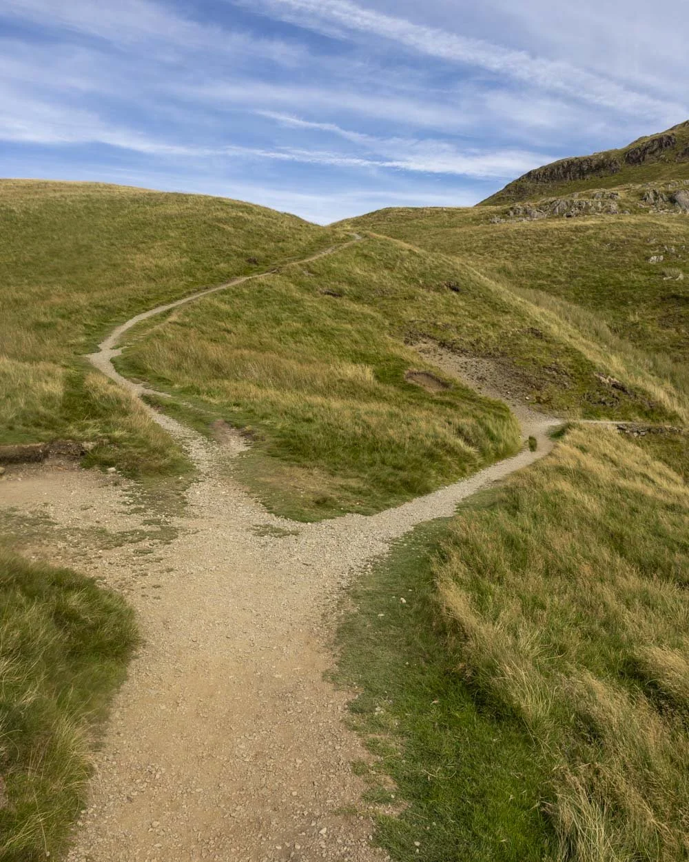
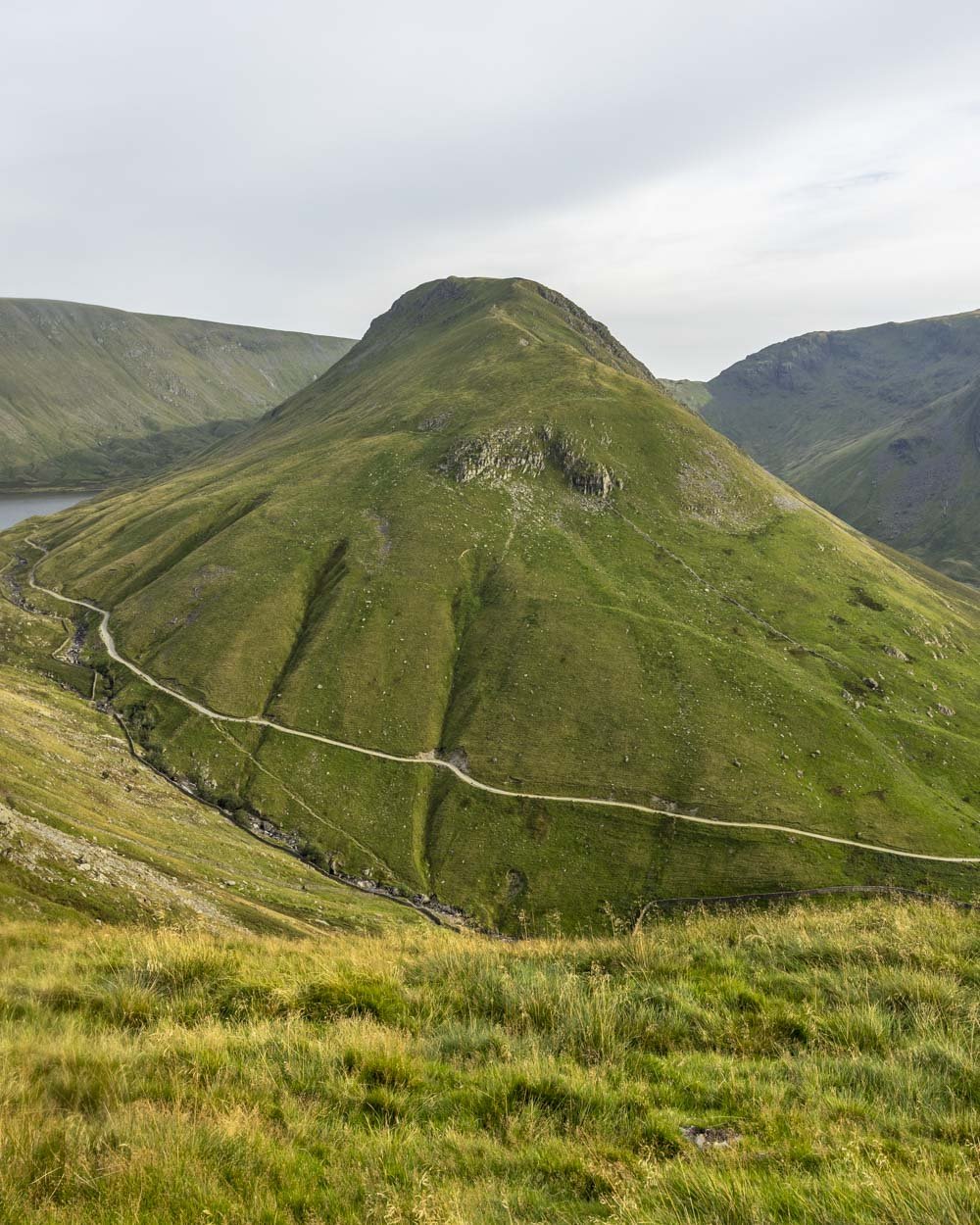
Roughly 870m into the track the path will fork, keeping left on the stone steps is a slightly steeper, but shorter route up, though both trails will soon converge.
There’s a short reprieve after 500m, but it’s only for 100m and then you’ll continue the climb.
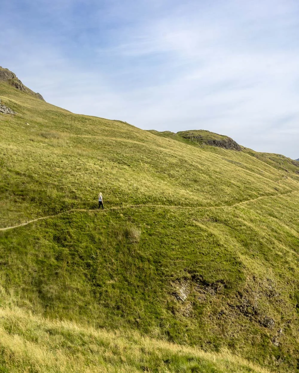
At the 1.6km mark the views change as you move further into the fells and you’re completely surrounded by rolling peaks as far as the eye can see.
All signs of civilisation melt away and you feel a lot more out in the wilds. It’s breathtaking.
Reaching the tarn
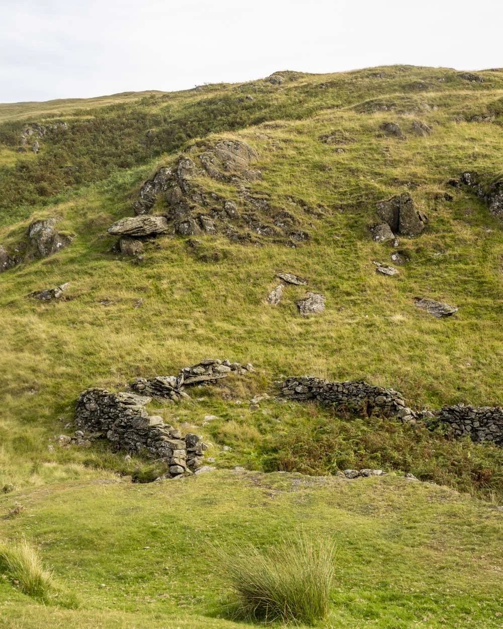
Just 150m after the path heads deeper into the fells, you will see a small sets of ruins and from here you take the path on the right.
You’ll continue climbing but the track is less steep. The path is still a good gravel track, with just one very minor rocky section at the 2.1km mark.
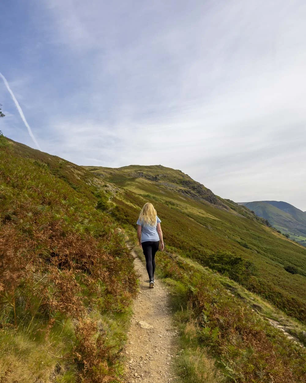
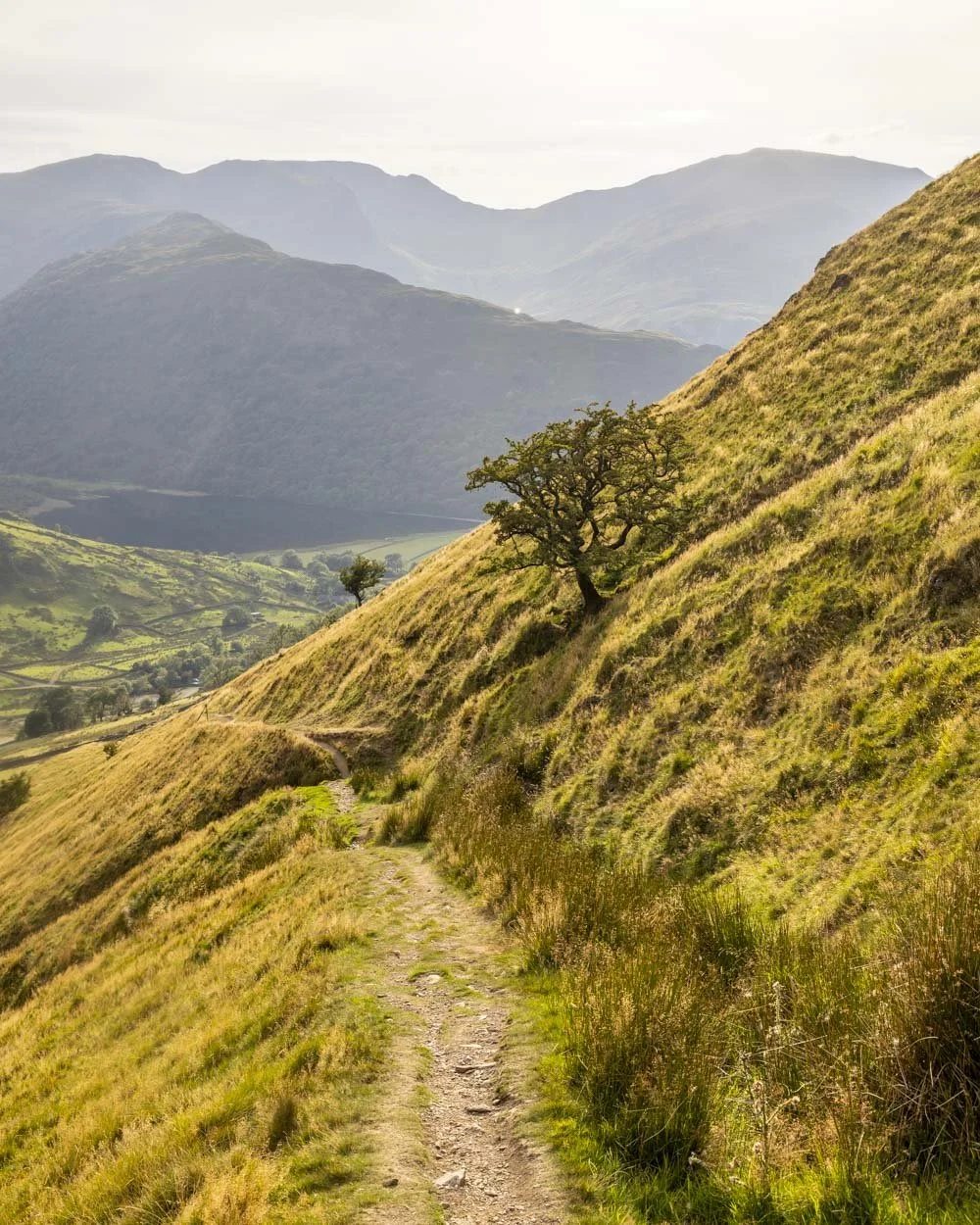
You’ll reach a large cairn 150m later and you have just 250m to go before you fork right onto one of my favourite sections of the whole track.
The path now mercifully flattens and becomes very narrow, clinging to the cliff side with sensational views that feel more exciting due to the slender nature of the track.
It’s not so narrow as to feel precarious, unless the winds are exceptionally high, or you suffer from vertigo.
It only lasts for 400m but it’s a very memorable part of the walk.
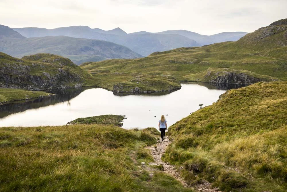
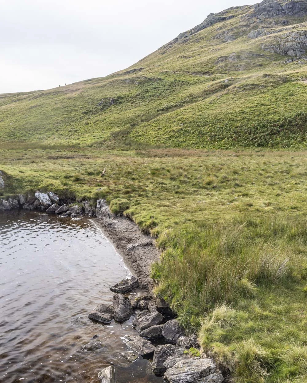
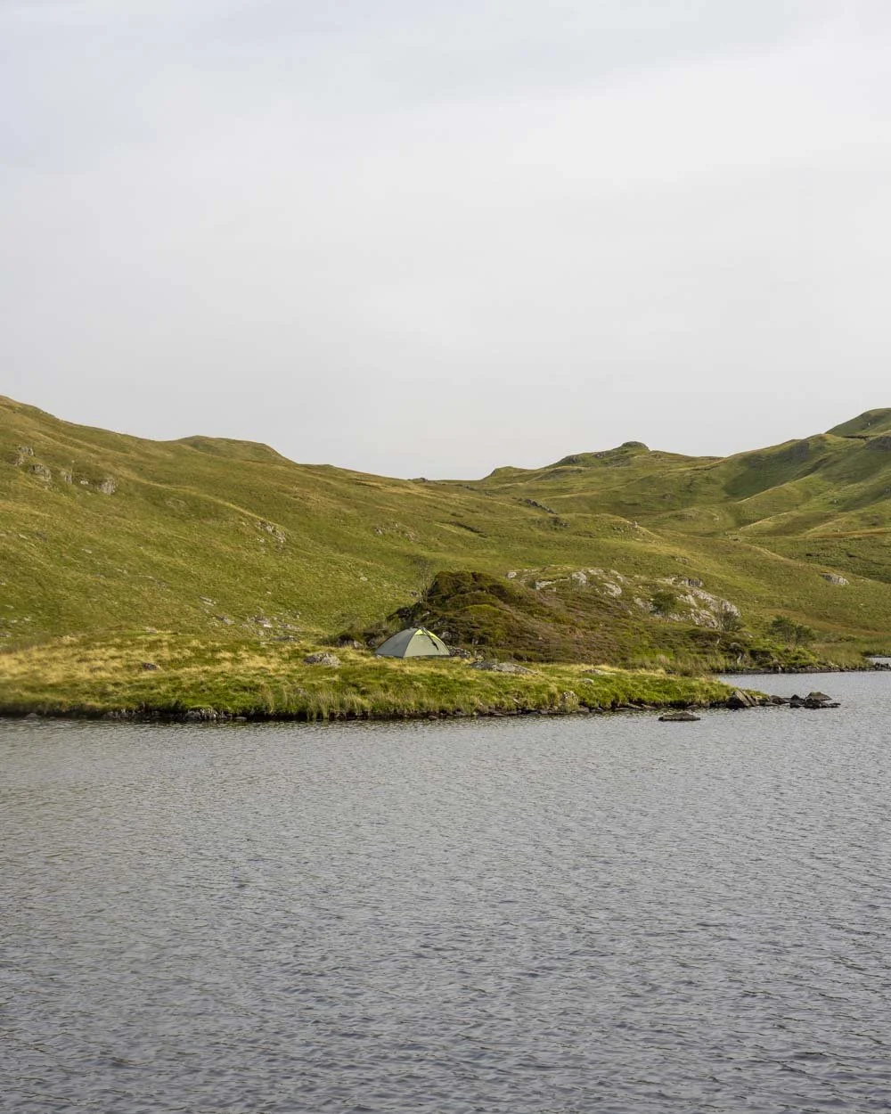
A brief 50m climb on rocky track follows before you round the corner to get your first glimpse of the tarn. It has a beautiful shape and several little islands which have become popular spots for wild camping.
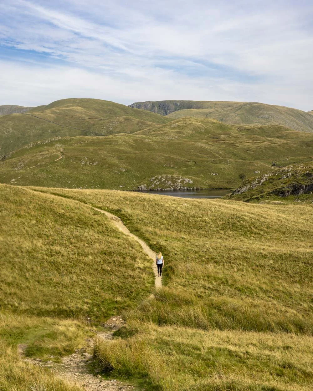
You’re now just 250m of relatively flat track away from the shores of the tarn and there are multiple entry points to the water.
Swimming in Angle Tarn
The tarn is pretty big and there are many possible places to enter the water, we personally opted for the left side of the lake (as viewed from the trail in) which was 600m from the point you round the corner to see the tarn, or 3.6km into the walk.
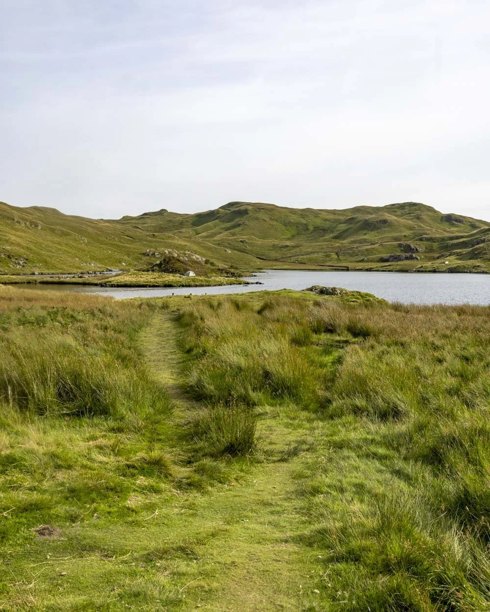
There is a small stony beach here which looks like the most pleasant place to get in, however, it’s very rocky and shallow at the entry point, making it an awkward shuffle for some distance.
If you enter a little to the right, off the tiny muddy bank, you have barely any rocks (none if the light is in your favour and you can see clearly down to the bottom) and you can simply walk in before the water gets deep enough to swim off. The entry doesn’t look as nice as it’s via mud, but it’s so much easier.
The tarn then becomes deep enough for a proper swim and your surroundings are sublime. The water is pretty warm by Lake District standards and you can swim far and wide, making it easy to keep warm.

We did lose the sun behind a very thick mass of clouds, so our photos don’t do justice to what really is a stunning wild swimming spot.
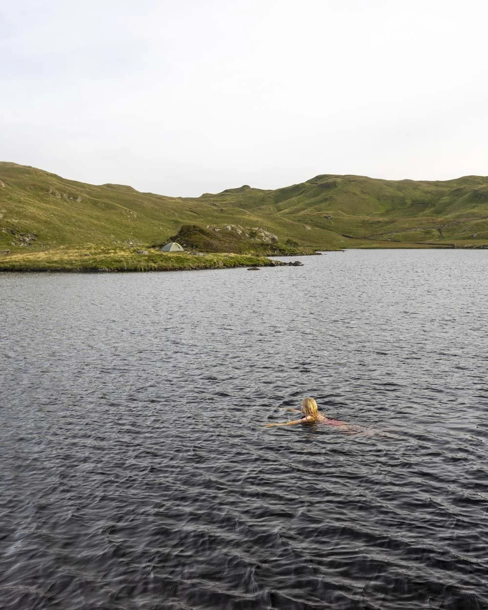
We visited on the August bank holiday weekend and it was still fairly quiet, so I imagine it would be almost empty on any other weekend.
To the best views of the whole trail
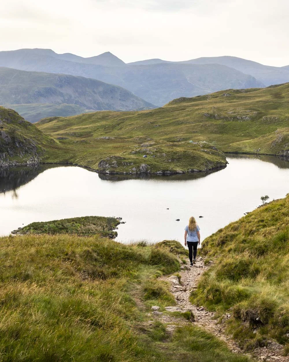
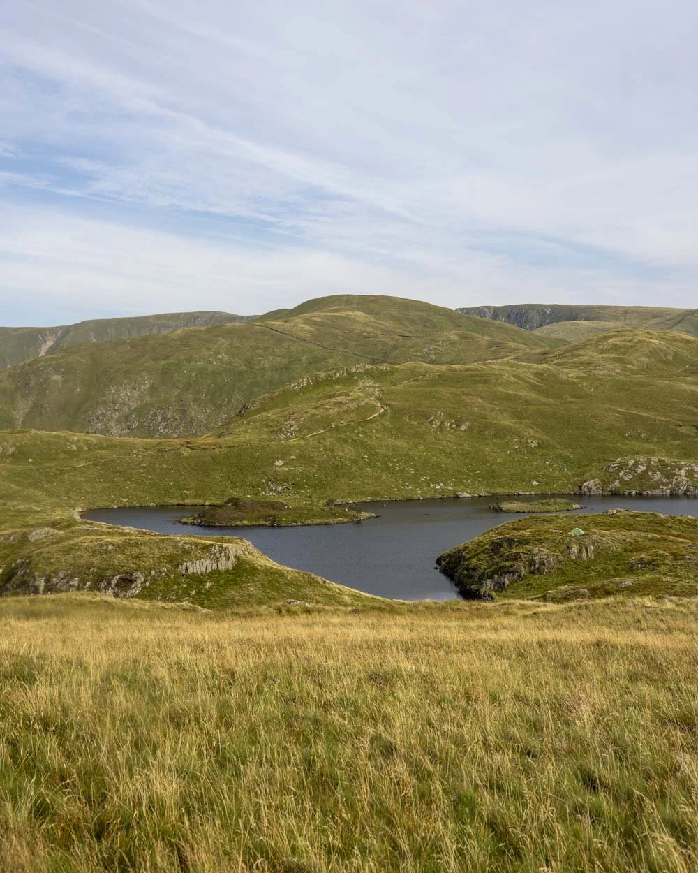
Even if you don’t want to do the full circuit track we’d recommend continuing along the path for a few hundred metres to see the tarn from another angle.
It’s my favourite vantage point, with it’s three islands clearly visible and backed by the rugged ridgelines surrounding Helvellyn.
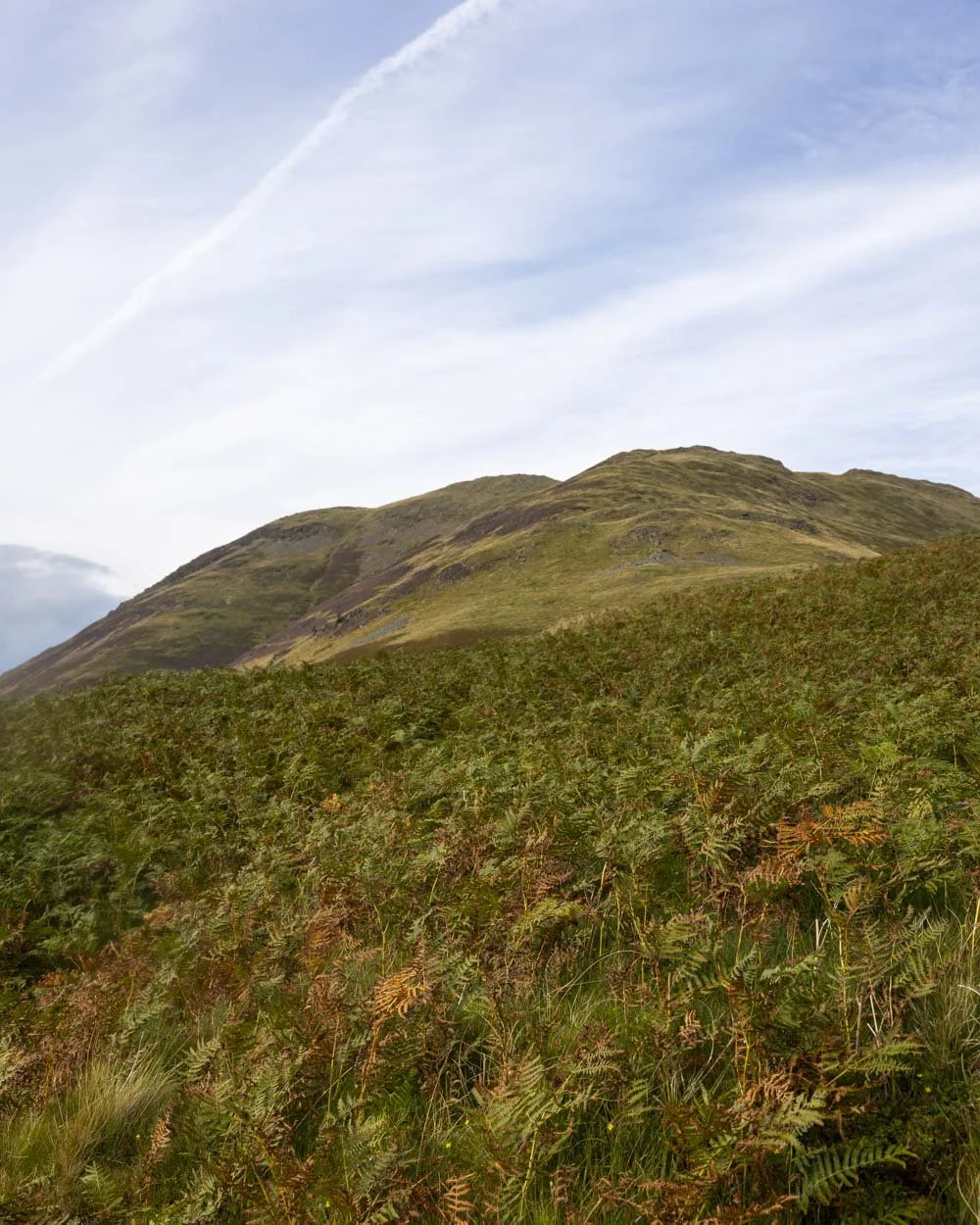
And if you’re a collector of Wainwright’s, you may want to head up to Angletarn Pikes before continuing on.


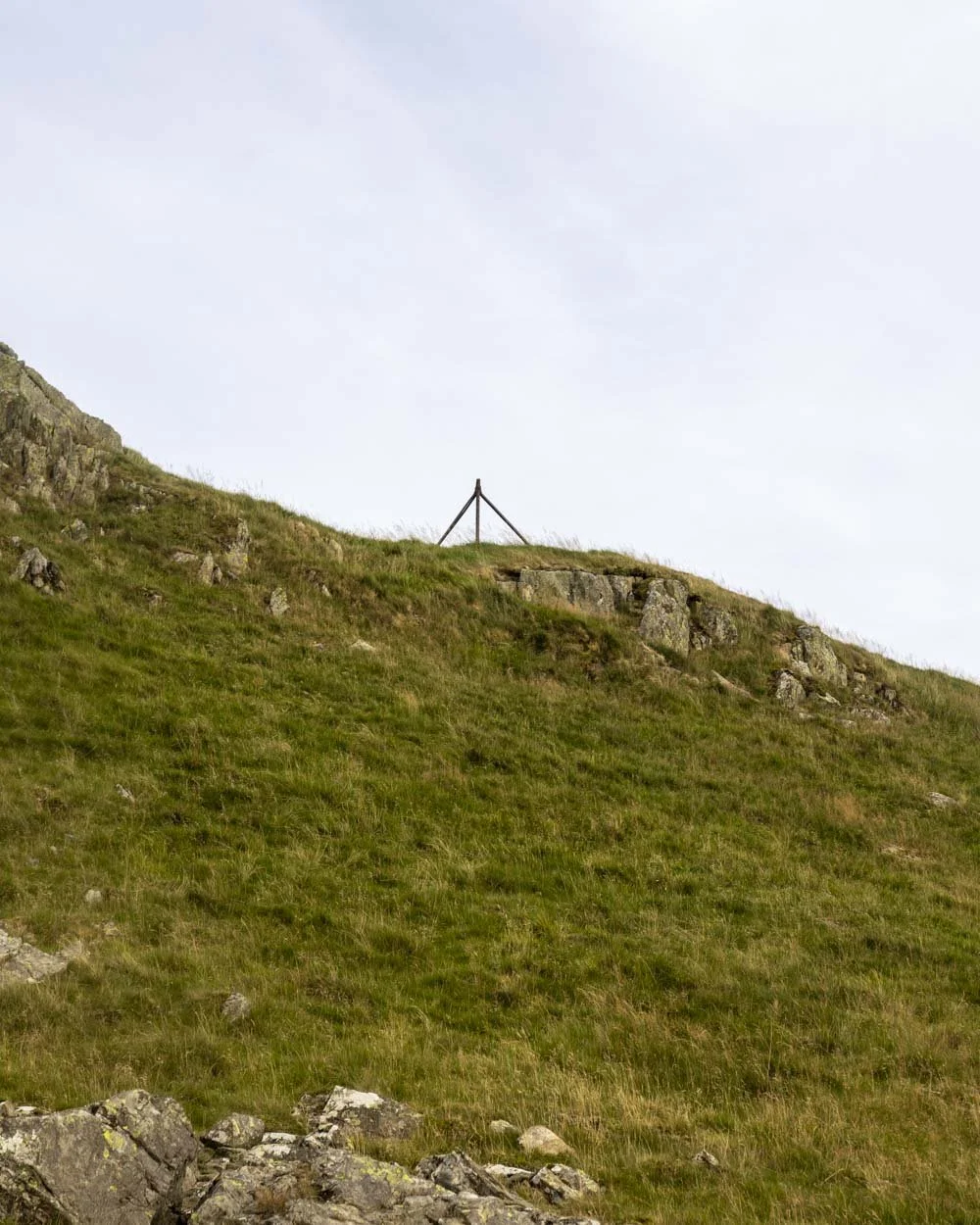
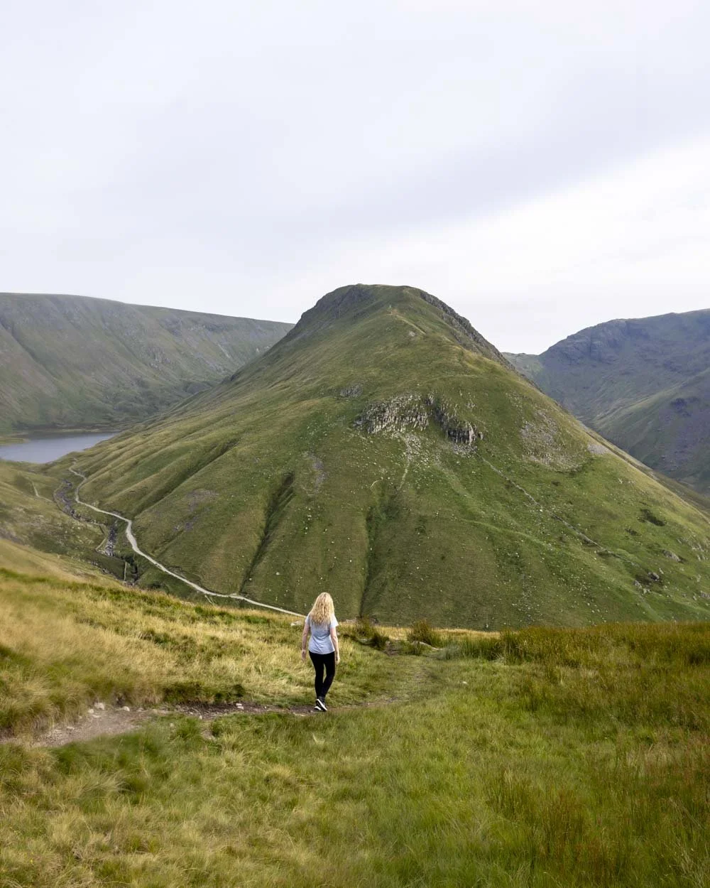
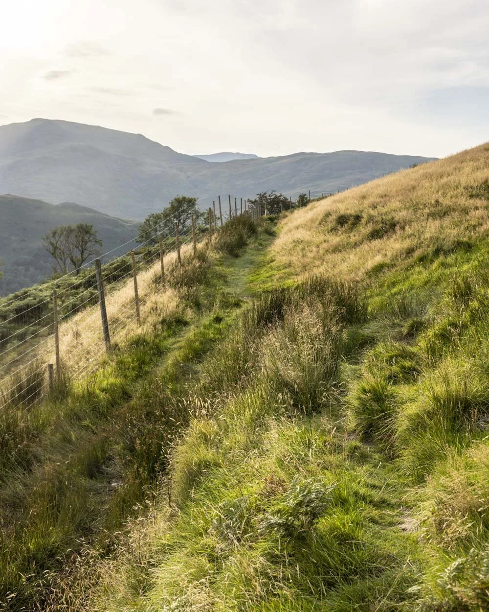
At the 4km mark you’ll have a little bit more climbing to go, passing Buck Crag trig 150m later (it’s a very minor detour if you’re a trig bagger).
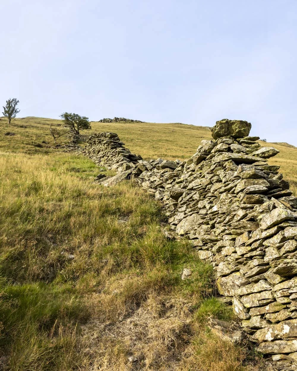
After another 350m you head right onto a flat grassy path before turning left 200m later, through the gap in the dry stone wall.
Grey Crag will come into view and as you begin descending it looms larger and larger. You can see the beautiful blue lake of Hayeswater underneath the shadow of Grey Crag and it looks almost glacial, like it could be a famous scene in Iceland, yet it’s right here in the Lake District and not at all well known!
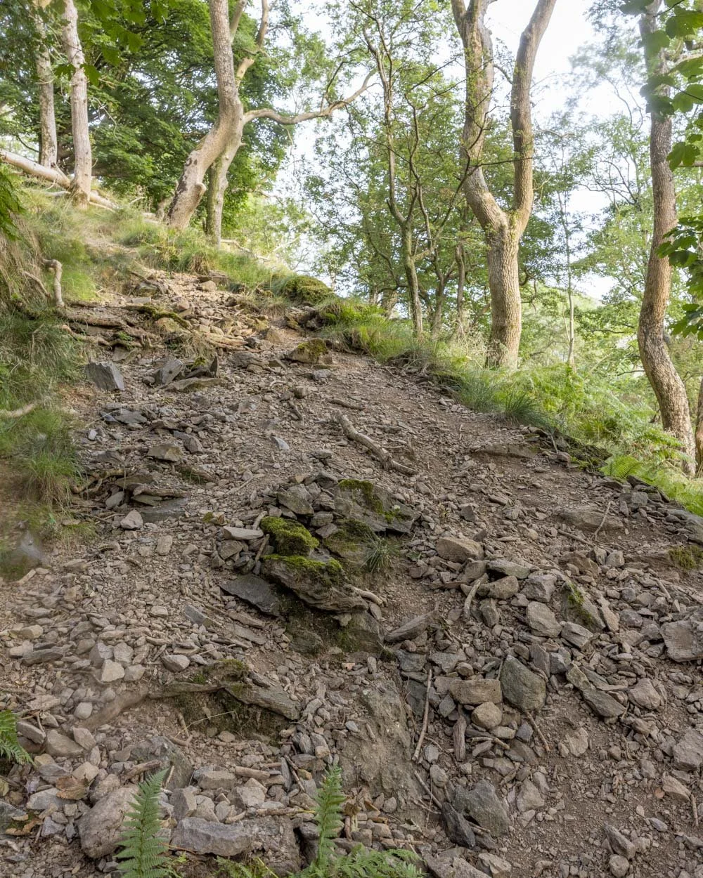
Happily you will enjoy this view for almost a kilometre as you descend. The path is mainly gravel, though it can be rocky in places.
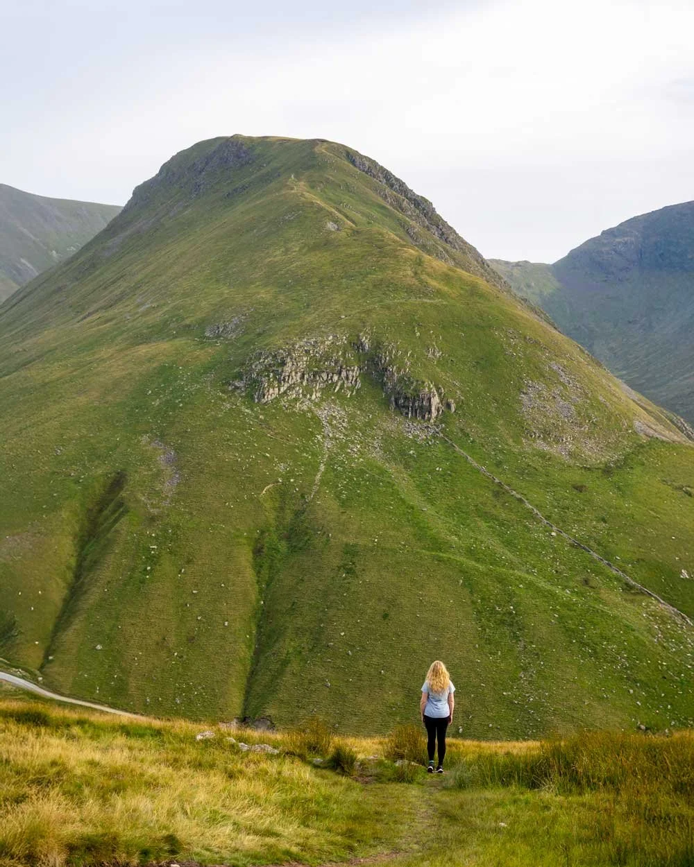
It is relatively steep but footing was good, however, we walked when it was dry and it’s possible the path could become slippery when wet which would make it much more challenging.
Occasionally it might be preferable to walk in the rocky gully to the right, rather than the on the actual path on the left if it’s become slippery as there is a huge drop on the left side.
When dry, it’s a pretty easy descent allowing you to really soak up those incredible views.
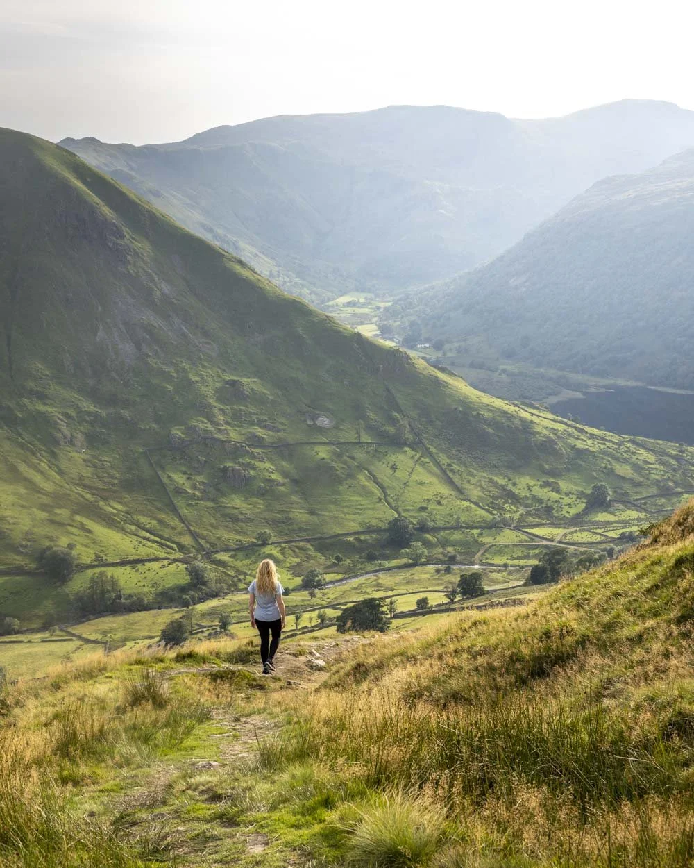
The final descent and completing the circuit
At the 5.9km mark, or just over 1.1km into the descent, you will reach a wooden gate and just before it, turn right.
There’s a very minor boggy patch and a brief bit of uphill before the trail flattens and then begins descending again.
You’ll walk between dense bracken on a more rustic track, with some stones and small muddy patches. It’s uneven but not challenging until you reach a little woodland copse, 6.6km into the trail. This was the only part of the descent I didn’t like.
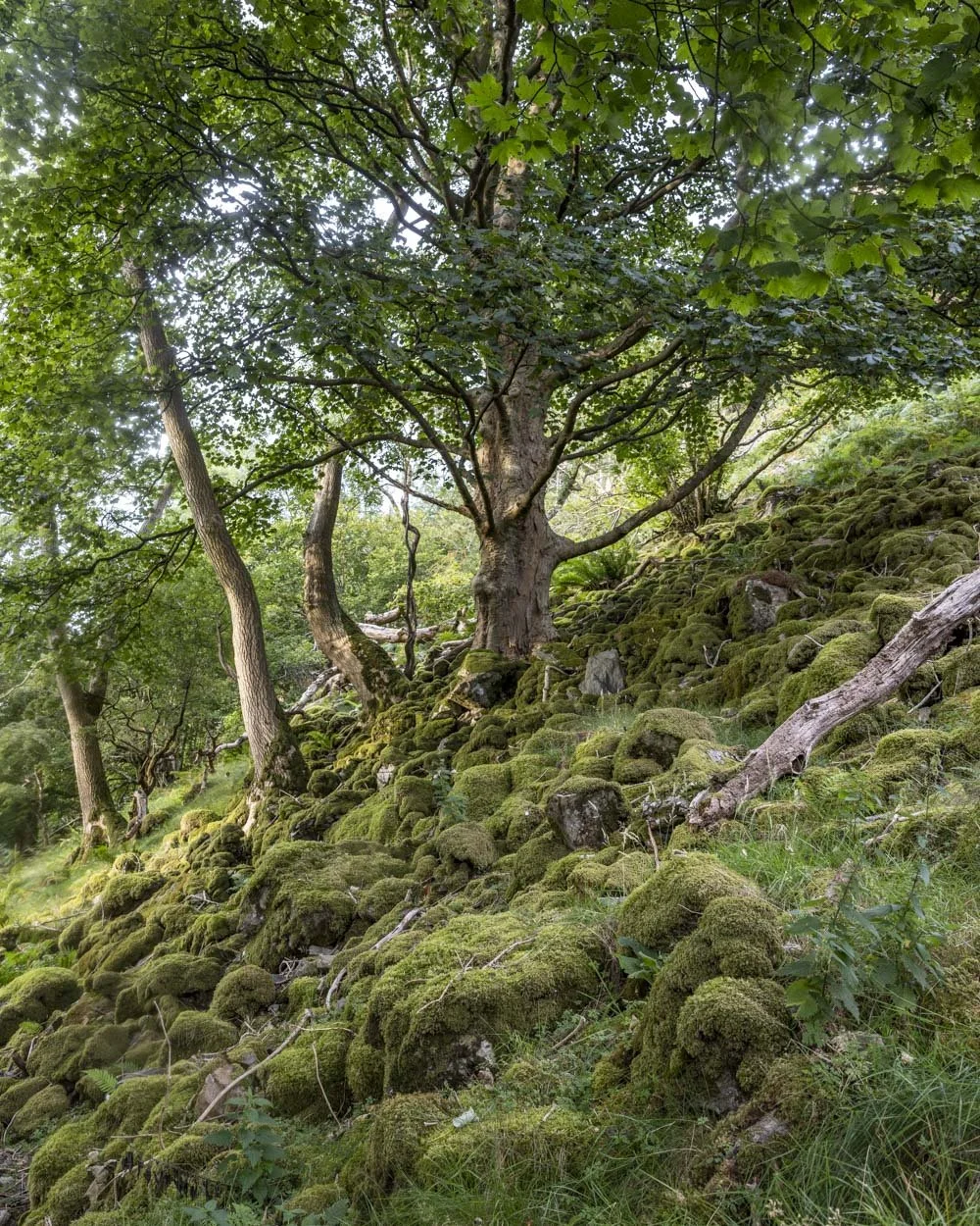
The path is quite steep and very rubbly. I am prone to skidding so it’s my least favourite kind of terrain. The steep section lasts about 250m and though the scenery is pretty, with mossy boulders and beautiful old oak trees, I was glad when it ended.
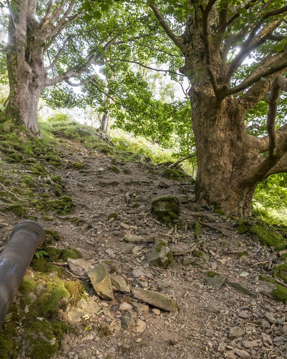
The path then gets much better and all but flattens for the remainder of the walk back to Patterdale (3.1km away).
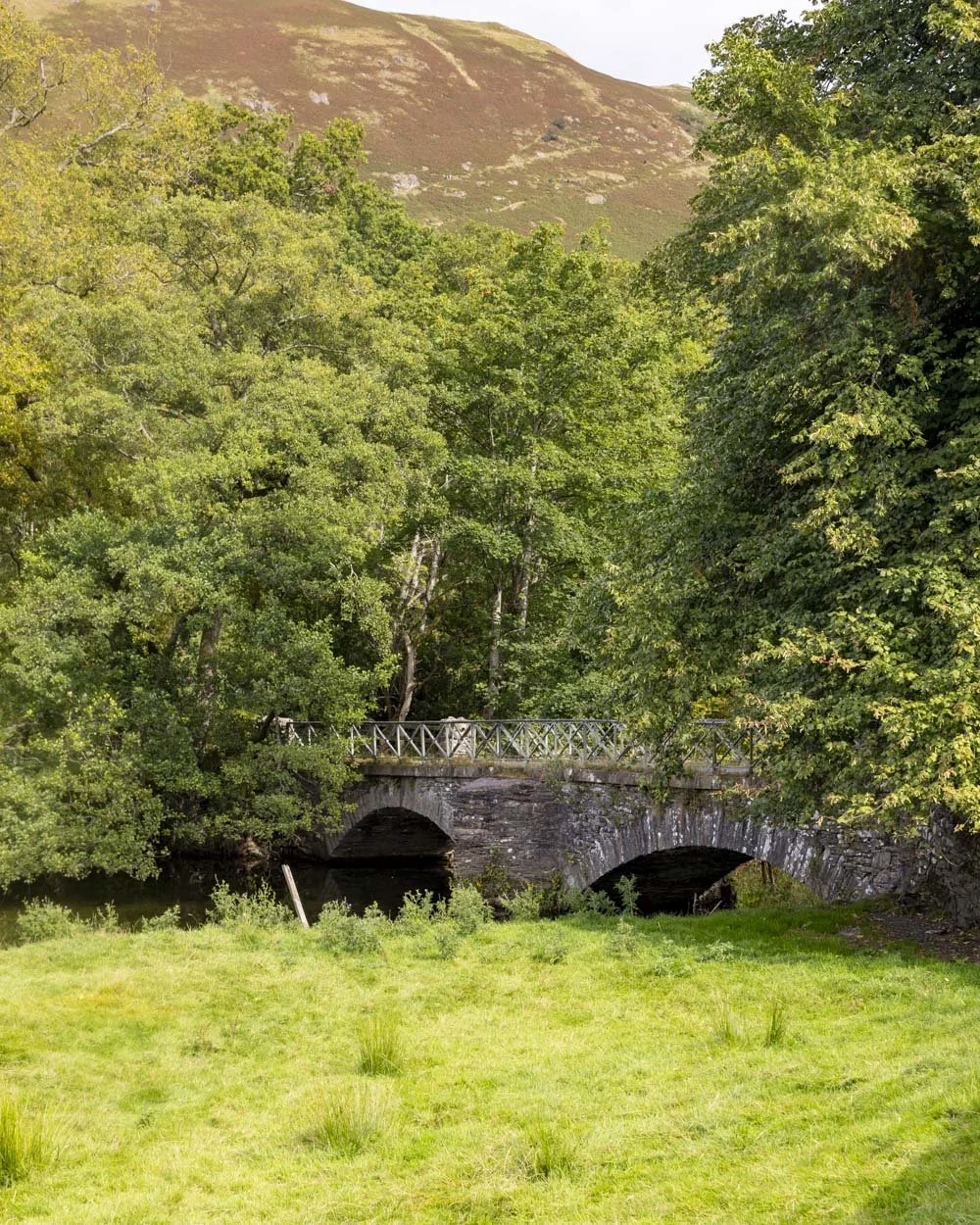
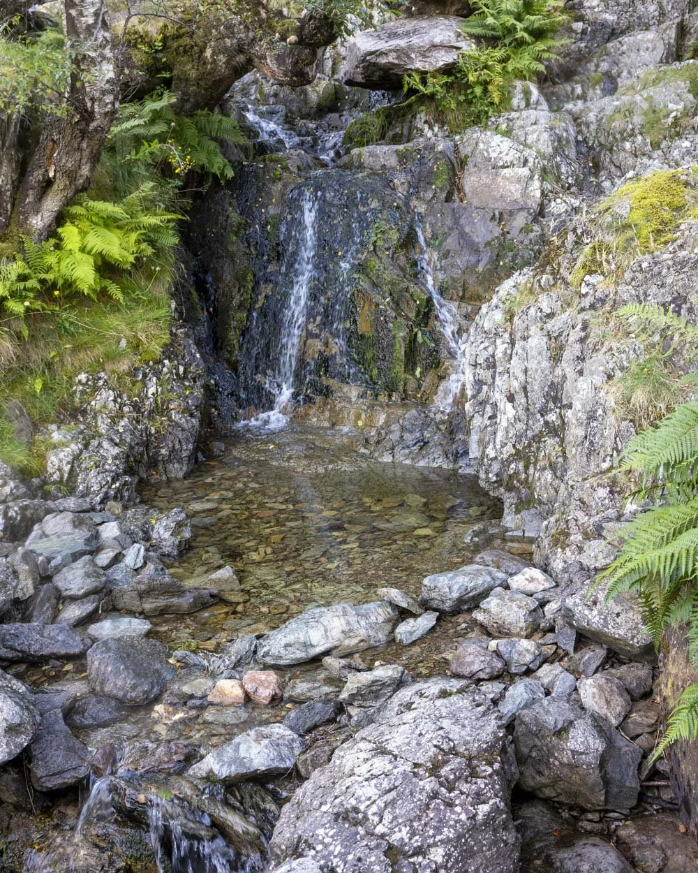
You’ll pass a small waterfall beside a bridge and walk alongside fields of Herdwicks with lovely fell views. It’s not as spectacular as the rest of the walk, but it’s still very pretty.
Around 850m after the waterfall you will pass through a gate and another 850m further on, pass through some houses before arriving back at the village and car park 1km later.
Parking for the Angle Tarn walk
There is room for a couple of cars to park at these coordinates 54.534135, -2.933221 near the White Lion pub in Patterdale.
If you can’t get one of these spaces you can park at the Patterdale Hotel which costs £5 a day at time of writing.
Note that if visiting at peak times in the school summer holidays, all the spaces may fill up, so you might want to start your walk early or late in the day. We had no trouble getting a spot at 3.30pm on the August bank holiday weekend.
Patterdale is located a couple of minutes from Glenridding and 30 minutes from both Ambleside and Keswick.
This post may contain affiliate links, meaning at no additional cost to you, that we will earn a small commission if you click through and decide to make a purchase. This helps towards the costs of running our website. Thanks for your support.