Gloucester Falls is one of the most popular attractions in Barrington Tops National Park. The walk to the falls forms part of the stunning Gloucester Tops Circuit, which is one of the best walks in all of NSW. However, the trail itself doesn’t offer a great view of the falls, nor access to the swimming holes; for that you need to venture just a few metres off track down an un-signposted path.
From here you can access the falls and cascades where you’ll find a series of gorgeous, if a little chilly, swimming holes. Take a dip here and you’ll feel invigorated for the rest of the day!
Here’s what to expect on the Gloucester Falls walking track.

The Gloucester Falls Track
The stats
Distance: 2km loop
Elevation gain: 80m
Difficulty: Easy, but not flat
Summary: The Gloucester Falls Track is easy, but it does have a couple of uphill sections. The terrain is generally good, though you will encounter a bit of uneven track, including rocks and tree roots.
Accessing the biggest waterfall pool involves climbing down some rock shelves. The rock is grippy when dry and not overly slippery when wet, though care must be taken.
Starting the trail
From the Gloucester Falls picnic area, the walking track leaves the eastern side of the car park and is signposted. It starts off as a wide gravel path, heading gently downhill.

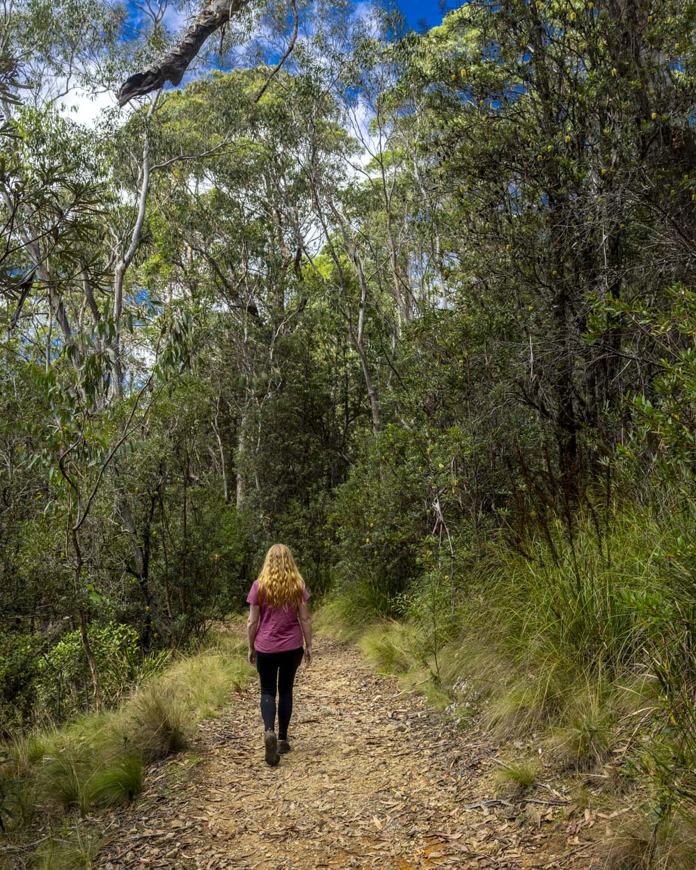
After 250m you’ll reach a junction with the Andrew Laurie Lookout and though you could walk the circuit in either direction, we turned right here, following the sign for Gloucester Falls.
The trail heads downhill a little further before the path flattens and you’ll enter a beautiful ferny area. The sound of the creek is very relaxing.
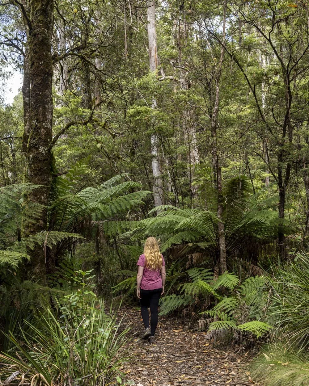
The trees start to get a little mossy, though not on the scale of the nearby Antarctic Beech Forest walk, which is utterly spectacular and a must when in the area (you’ll cover this track if you’re walking the full Gloucester Tops Circuit).

Through the forest
At the 400m mark you’ll reach another signpost for Gloucester Falls and continue along a narrow dirt path above the river.

After 200m (600m into the trail) you’ll see the first path leading off the main track and down to the river (a 50m detour each way).
This offers access to a small gorge pool, which is ok for a plunge, but not for a swim. There’s a larger river swimming hole just up from here, but we personally opted to swim at the waterfalls a little further along the main trail.


The side trail to Gloucester Falls is found 200m further along the main track on the right (800m into the walk). After a 30m uneven trail downhill you’ll reach a rock platform.
This cut down is a touch steep, but not slippery when dry. You’ll come out at the middle level of the falls, with cascades upstream and the main waterfall downstream.


Swimming at Gloucester Falls
From the middle level you can head upstream to the cascades, which involves walking around the side of the rock wall.
It’s narrow but easy enough and grippy when dry. If you slipped you wouldn’t really go anywhere, so it’s not a scary traverse.

It takes less than a minute to reach the rock platform beside the cascades. The pool here is very shallow, so this is a dip spot, but not suitable for proper swimming.
The rocks in the water are a bit muddy and as such pretty slippery. It’s nice to see the cascades up close, but this was my least favourite spot to get into the water.


The middle pool is easy to access, only requiring you to carefully walk down two little tiered rocks and into the pool. Assume that the rocks in the water are slippery just to be cautious, though it actually wasn’t too bad.
You can have a plunge here and it’s deeper than the cascades, though not deep enough to swim due to the rocks in the water.

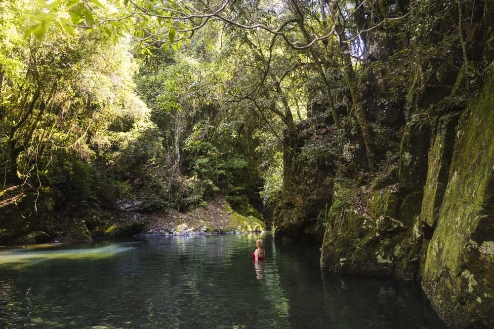
The best spot by far is the main waterfall downstream of the middle rock platform. This is the trickiest to access as you have to climb down a tiered rocky slope. All the dry rock was grippy.
The wet rock wasn’t too bad, but I treated it all like it would be very slippery just incase.


With care it’s not hard to climb down the tiers and enter the water at a shallow point (heading straight down the rocks towards the middle/left side, not close to the waterfall on the right side of the platform).

Accessing the water here is easy. There are a couple of slippery rocks inside the water to be mindful of, but then it quickly becomes deep enough to swim off. I didn’t encounter further rocks inside the water so it was great for an unobstructed swim.
The water is cold, colder than most places in Australia due to the elevation, but on a sunny day it wasn’t actually that bad - probably because you could swim to warm up.

The falls look amazing from inside the water, much more impressive than from above. Sadly we couldn’t photograph them from this angle, so it’s something you have to see for yourself!
The waterfall is powerful, but I found plenty of room to swim outside the current. If there has been especially heavy rain I wouldn’t recommend swimming here as the current would be very strong and it wouldn’t be safe.
Finishing the circuit
Once back on the main trail you continue along the narrow track for 150m to reach the Gloucester Falls viewpoint. It’s flat and then slightly uphill as you near the lookout.
The view over the falls isn’t bad, but it’s from quite a distance and it’s more like a forest view with small cascades than it is a waterfall viewpoint. If you haven’t seen them from the side track, I definitely think you’d feel a bit short changed.

Just back from the lookout you’ll see a path leading uphill to the right. This is the route to continue the circuit. The first 150m are uphill and steepish before it flattens.
You’ll then walk through shady forest before arriving at the Andrew Laurie Lookout, 350m after leaving the Gloucester Falls Lookout. It offers a stunning view over the mountains on a clear day.

From here the trail takes you gently downhill for 220m before you reach the junction with the Antarctic Beech Forest Track, which we highly recommend if you have time. If not you would continue straight on to reach the Gloucester Falls car park.
The track is flat for 230m before it reaches the junction with the trail you walked in on. From here it’s a gentle climb back to the car park, which is 205m away and well signposted.

Keep them wild
Please remember to take all rubbish with you and keep these places wild and pristine - as with anywhere in the outdoors. It’s important to leave them exactly as you found them so they will remain beautiful for generations to come.
Litter tends to breed litter, so if you do spot any and are able to pick it up and dispose of it outside the national park, it will go a long way to keeping the area clean.
Parking for the Gloucester Falls Walk
Parking is at the Gloucester Falls Picnic Area (you can find the exact location here on Google Maps). There are picnic benches and a long drop toilet here.
The last 29km of the road to the car park is unsealed. There are 6 fords to cross, which in times of normal water flow are suitable for any car.
The road is generally in good condition, but does have a few uneven patches.
The picnic area is around 56km and a one hour 20 minute drive from the nearest town of Gloucester.
The weather at Gloucester Tops
The weather can change quickly in this area and it’s generally colder than you’ll find at the nearest town (Gloucester), sometimes by as much as 10C. In winter you may even get a dusting of snow.
This post may contain affiliate links, meaning at no additional cost to you, that we will earn a small commission if you click through and decide to make a purchase. This helps towards the costs of running our website. Thanks for your support.