

High Force Waterfall is often referred to as the tallest waterfall in England and whilst that’s a myth, it’s still very impressive. High Force is incredibly powerful, gushing through a cleft in the rock wall and down into the swirling mass of white water below. When we visited after heavy rain it was totally wild and unlike any other waterfall we’ve seen in England so far.
If you want to take the quickest route to the falls you’ll need to pay an entry fee. If you don’t mind a longer walk - along a very pretty trail - you’ll be able to see the falls for free.
Here’s everything you need to know about the free High Force Waterfall circular walk.

The free High Force Waterfall Walk
The stats
Distance: 4.2 miles (6.8km) return, or 5 mile (8km) circuit
Elevation gain: 130m
Difficulty: Easy - moderate
Summary: The free walking route to High Force Waterfall (as opposed to the shorter option which has an entry fee) is predominantly flat. There are a few short steep staircases, but overall there’s very little in the way of elevation gain.
The terrain is generally very good, with level gravel or grassy paths and the odd rocky section here and there. There was almost no mud, which was a surprise given we were visiting after prolonged heavy rainfall.
The track is pretty well signposted on the way out, although the return leg is not signposted at all. We’ve included step by step directions in the trail notes below.
Starting the trail: to Low Force
We begun our walk at the Bowlees Visitor Centre car park (a donation based car park) but you could also start at a nearby lay-by if you want a totally free option - more details on that at the end of the post.
From the visitor centre car park, you walk to the visitor centre, which is a few minutes away and then down the lane that runs along side it. You’ll reach the main road and cross over it to head through the gate marked as ‘Low Force’.


From here it’s a flat easy stroll inbetween fields, passing through a couple more gates, before you reach a little patch of woodland (450m from the car park).

Low Force
You can either choose to go down the steps, or the slope and then you’ll reach Low Force 150m later. You’ll come first to a suspension bridge over the river, but you’ll want to head right to check out the falls up close before crossing the bridge.
You can walk along the rocky gorge and get some fantastic unobstructed views. If you’re a fan of Netflix series ‘The Witcher’ you’ll recognise it from series two!


Low Force is a set of two small but powerful cascades that flow through a dolerite rock gorge, formed millions of years ago.
The amount of water that flows through the gorge is quite something, especially after heavy rainfall.

There always seems to be a lot of water coming through the gorge from what I’ve seen in photos, so it probably doesn’t make for a great swimming spot - although people do swim here.
There are warning signs about strong currents, so if you are looking for a swim spot, there are safer - if not quite as scenic - spots further along the trail and away from any white water.

The other thing to note about visiting Low Force (and High Force) after significant rain is that the water can discolour. As far as we could tell the water has tannins in it, so it will always have a brown tint, but after heavy rain it gets a lot browner.
Continuing along the river
To continue towards High Force you’ll now cross the little suspension bridge - Wynch Bridge - which is Grade II listed. You can only cross one person at a time, but it’s pretty sturdy, you don’t get the sway that you often find on similar swing bridges.

The view from the middle of the bridge is gorgeous and you get to appreciate a lot more of the gorge from this angle.


After crossing the bridge there’s another viewpoint for Low Force on the right before you’ll head up the staircase and begin following the river.
The flat gravel path has fields and the odd farmhouse to your left and the river to your right. When we walked in August both sides of the trail were covered in thistles, which added beautiful pops of colour to the walk.
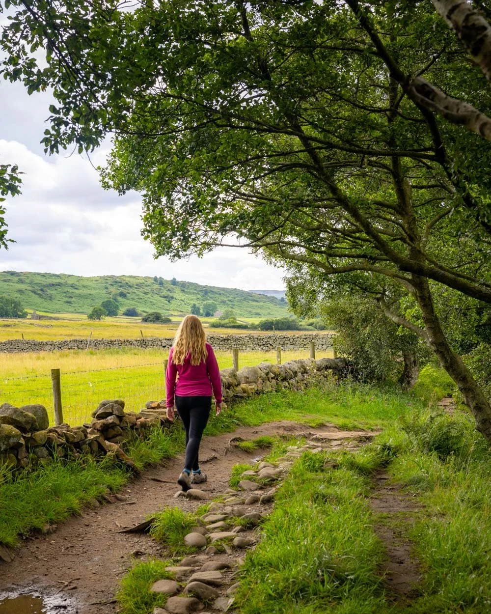

The river has numerous little social trails leading down to the water’s edge and once you’re a little further away from Low Force, it becomes much calmer. These areas would be safer for a dip than anywhere close to the powerful currents of Low Force. Sadly for us the water was on the murky side due to the rain.
There is one short rocky patch along this section of the walk, but for the most part it’s smooth sailing and you’ll reach the Holwick Head Bridge 1.7km (or just over a mile) after leaving Low Force.

To High Force
To reach High Force you don’t cross Holwick Head Bridge, but instead keep left. There is a short 50m uphill section of track which is a bit uneven, before it flattens out again.
You’ll soon reach Moor House Nature Reserve where you’ll walk through some gorgeous countryside, with bracken lined paths and views to distant rolling hills.


Just under 1km after passing Holwick Head Bridge you’ll see a narrow trail leading right, past the black gate you can see in the photo below, strangely as it’s a little indistinct, this leads to the main viewpoint over High Force.

It takes just a minute to reach the lookout, which has a number of rocks you can relax on whilst taking in the incredible view.
High Force Waterfall
At 70ft (21m) High Force is one of the tallest waterfalls in England. It’s often referred to as the tallest, although this definitely isn’t the case!

The lookout is relatively far from the falls, although still offers a great view. It’s a fantastic waterfall with huge power and a beautiful setting. As mentioned, it was a bit discoloured when we visited, but still an incredible sight.

However, if you want to get even closer to the waterfall, you can. From the viewpoint head back to the main trail and look for the second turning on the right. This takes you to the top of the falls.
Unlike the main lookout, this is an unfenced cliff edge, so you have to take extra care. The view is phenomenal as you can look right over the top of High Force, and it’s from here that you can really see and feel the power of the waterfall.


The churning mass of whitewater is mesmerising and it’s a unique perspective that you can’t get from the paid walking trail on the other side of the river.
However, it’s worth noting that the paid trail takes you to the bottom of the falls, which would also be amazing. We’ll be back to do that next time as there is no option to visit the base of the falls along the free trail.
Completing the trail: the two options
If you want a slightly quicker route back, then you’ll need to retrace your steps all the way to the car park. If you don’t mind a little extra walking (0.8 miles/1.2 km) you can form a partial circuit.
You’ll need to walk for just over a kilometre back to Holwick Head Bridge and then cross the bridge to continue walking on the other side of the river.

After crossing the bridge, head left, along the pretty grassy path beside the water.
The track is flat for the next 450m before you have a steepish staircase to climb, followed by a slightly shallower one, which will take you onto the main road.


You’re now directly opposite the High Force Hotel, which is where you would pay for the entry ticket if you wanted to see the bottom of High Force - only open between 10am and 4pm.

To continue the circuit, head over the road and walk inbetween the snack shop and the hotel. You’ll see a metal gate to the right and pass through it onto a grassy path. The countryside views are lovely.

Follow all the footpath signs as the walk takes you across the fields, which are flat and mud free.
You’ll need to head north-east towards Dirt Pit Farm - the co-ordinates are 54.656097, -2.170498.
As you near a country lane, the path will gently descend towards a gate in the fence (you can see it in the photo below).

At this point you’ll reach a country lane (5.9km into the walk) - it’s around 800m after leaving the hotel. Follow the yellow footpath sign, which takes you along the lane, heading east.


The lane was extremely quiet when we visited, so although it’s not as nice as the rest of the trail, it’s not too bad and the views were nice.
You do have a 350m climb using this route though, it’s not steep, but you will notice it.

After the hill, the path will flatten and you’ll pass over the cattle grid beside the sign for Ash Hill Farm.
The rest of the path is then either flat, or a gentle descent back to the visitor centre, which you’ll reach 1.4km later.

An optional side track to a second waterfall - Summerhill Force
Distance: 1.2km
Elevation gain: 25m
Once you’re back at the car park, if you’re up for a little more walking, you can add on the short walk to Summerhill Force & Gibson's Cave. It’s an easy trail which is predominantly flat.
From the car park, head past the toilet block and you’ll reach the site of an old quarry after 200m.

There’s nothing much to see here, but 100m later, on the left, you’ll see the first cascade. This is not Summerhill Force, but it’s a pretty spot and worth a peek before you continue on.

After the cascade you’ll head up a staircase before the path flattens and you’ll pass into a lovely stretch of woodland.
This next part of the trail gets very muddy after rain, although it wasn’t slippery. The path follows the river and Summerhill Force will soon come into view.


From what I’ve seen, it’s usually a fairly dainty waterfall, which definitely wasn’t the case on our visit! It was quite a raging torrent and looked very dramatic, especially as it flows into a dark overhang - Gibson’s Cave.
It would be a fun waterfall to walk behind, but there is a stone wall to discourage you from doing that unfortunately.

Parking for and getting to High Force Waterfall
You have a couple of different options for parking. The easiest place to park is the Bowlees Visitor Centre, postcode DL12 0XE, which is a donation based car park. The suggested donation is £2-3 for a half day. You can make a donation at the pay machine in the car park if you have coins, or at the visitor centre if you would like to pay by credit card.
If preferred, there is a lay-by on the righthand side of the road if driving in from the west and you can park here for free.
If you would like to arrive by public transport, there is a bus stop only a couple of minute’s walk from the visitor centre and directly on route to Low Force, but from what we could see online the service (from Barnard Castle) is infrequent.
High Force Waterfall is roughly a one hour drive from Middlesborough and Durham and less than ten minutes from Middleton in Teesdale.
This post may contain affiliate links, meaning at no additional cost to you, we will earn a small commission if you click through and decide to make a purchase. This helps towards the costs of running our website. Thanks for your support.


