

We first heard about Kinder Scout when listening to this podcast about the 1932 mass trespass, which led to the formation of the Peak District National Park. We’d highly recommend a listen if you’re interested in public rights of way in the countryside.
But I digress, this guide focuses on the circular walk around Kinder Scout via Kinder Downfall, one of the best walks in the Peak District.
It’s a relatively easy walk despite taking you to the highest point in the Peak District. The scenery is varied and the views are just spectacular, in short it’s a must do.
Here’s everything you need to know about the Kinder Scout walk via Kinder Downfall.

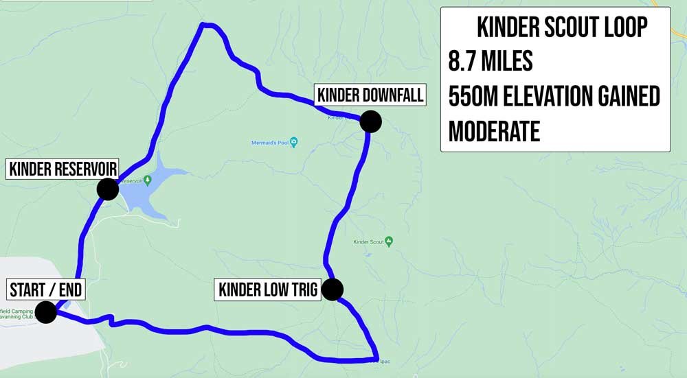
Kinder Scout via Kinder Downfall
The stats
Distance: 8.7 miles (14km) circuit
Elevation gain: 550m
Difficulty: Moderate
This walk has a few steep climbs, but nothing that lasts very long or is overly taxing. There’s also plenty of flat track to break up any ascents and descents. The paths are generally in great condition, there are rocky patches and a few eroded sections, but if you follow our route you ascend these, so it’s not slippery.
It would potentially be slippery if descending. The other thing to note is we walked on a glorious dry day, if it’s been raining some of the rocky bits of the track, including the stone steps could be slippery.
We didn’t encounter any bog whatsoever on this walk, but again we did walk during summer, although I was on the look out for where boggy patches might be and nothing stood out, so it might not be as prone to mud as many other walks in the Peaks are.
The trail is not signposted, but we have written detailed directions below, however it’s a good idea to also carry an offline map.
Starting the trail
From the parking area (details below) you’ll head left along Kinder Road. The first 750m of the walk are along a quiet country lane.
It’s flat to begin with and then heads gradually uphill, but it’s never steep. You’ll soon come to a gate beside Kinder Reservoir and head right, continuing along the road.

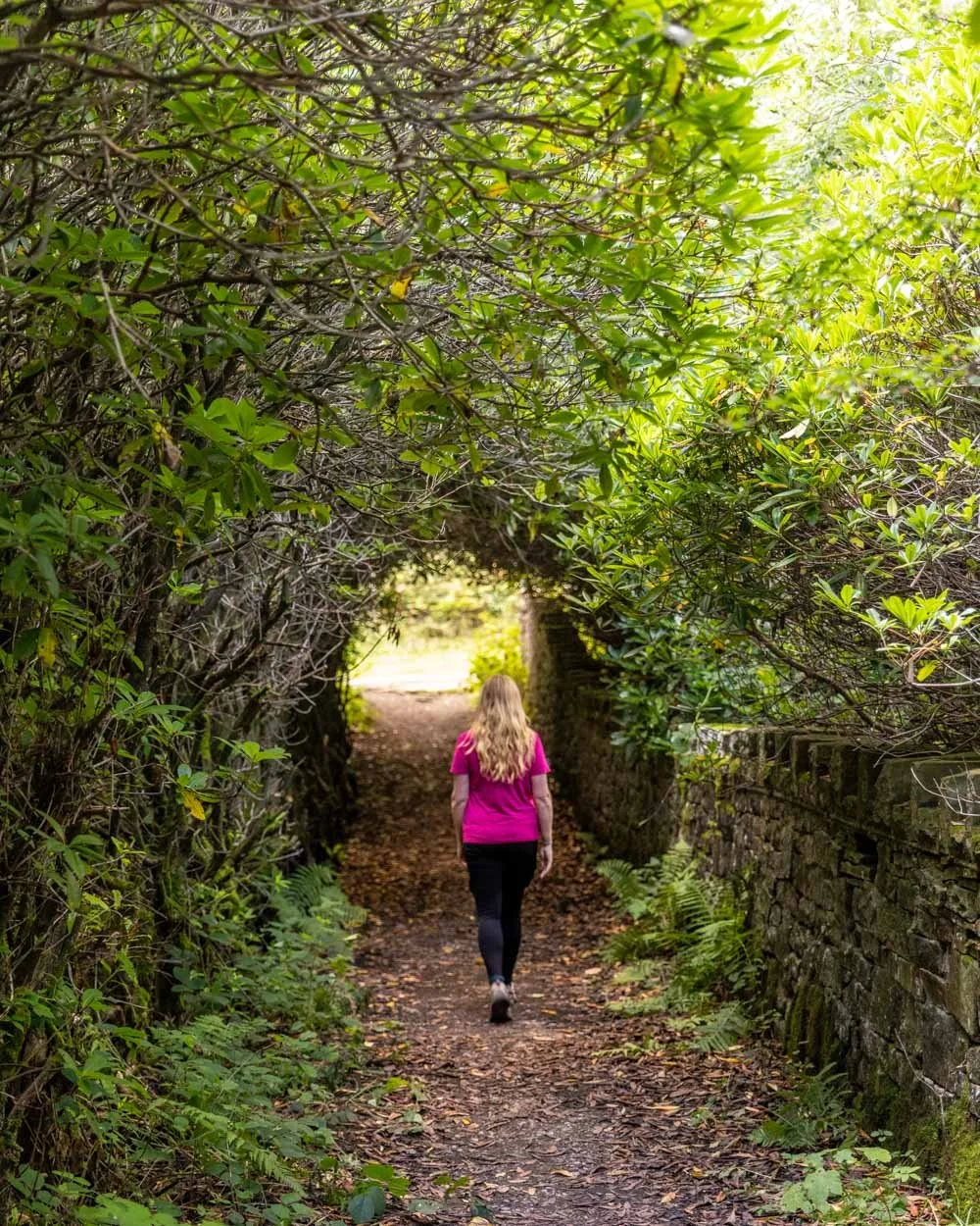
Roughly 100m later you’ll see a footpath on the left and follow it alongside the stream within a lovely little patch of woodland. The next 300m are nice and shady, something you won’t experience throughout the rest of the walk!
You’ll then come to a footbridge and follow it, through the little tree tunnel and then right. You’ll see the National Trust sign for White Brow and head through the gate and onto a cobble path.

There’s a brief 200m stretch of steep climbing before it levels out. You’ll then be walking with views of the reservoir, which was looking pretty depleted on our visit!
The path now undulates and at the 1.5km mark you’ll come to a junction and keep straight. There are a few hundred metres more undulating track before the path flattens.


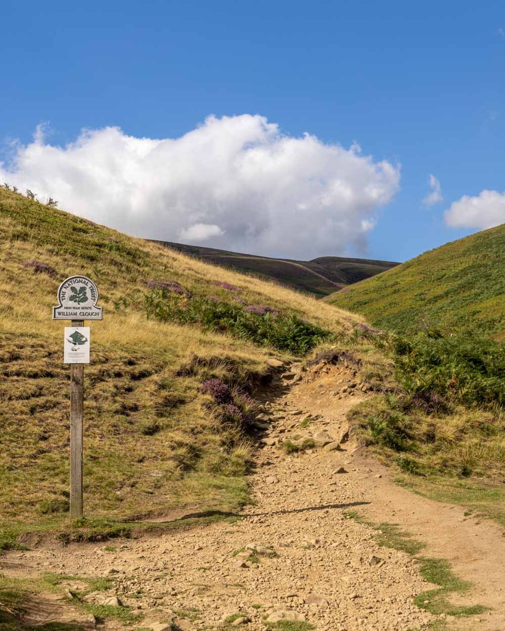
Just 850m from the junction (2.3km into the walk) you’ll reach the William Clough bridge and it’s from here the spectacular scenery really kicks in.
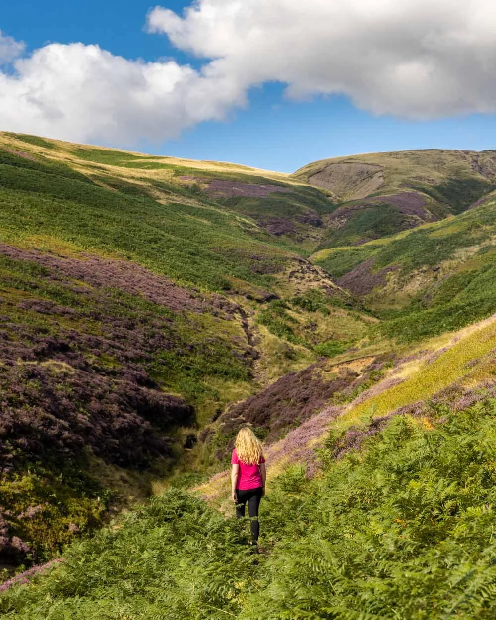
The Snake Path
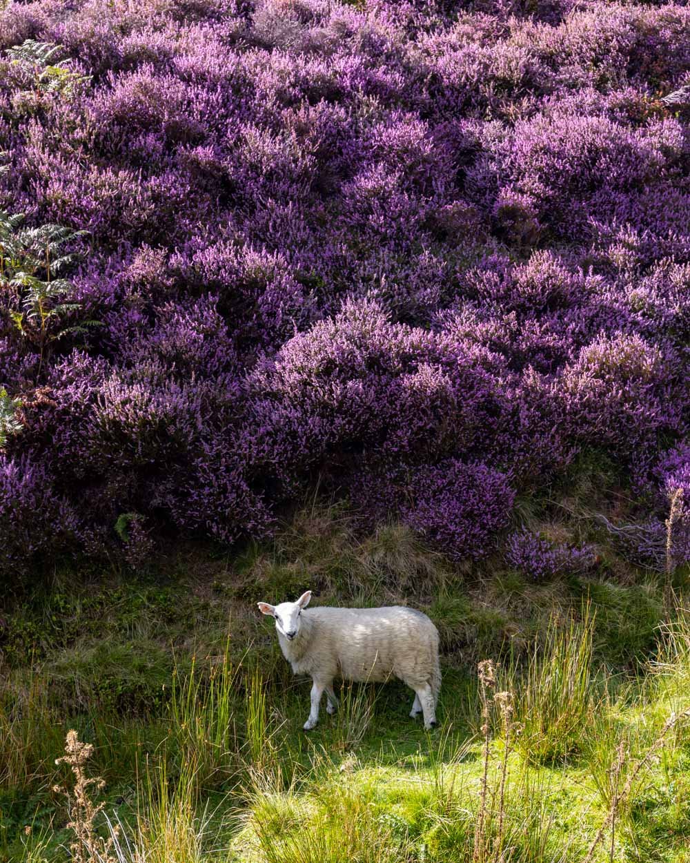
We were lucky enough to be walking this track when the heather was in full bloom, and it really was incredible. If you’re visiting between late July and mid September (with peak bloom being mid to late August) then you really can’t miss it.

You will have seen some heather up to this point, but it’s along the Snake Path that it blankets the hillsides, and you are walking through a sea of vibrant purple. It was a truly wonderful experience.
Once you’re at the William Clough bridge you have two options. A short steep climb up the rough path you’ll see directly over the bridge, or the more gradual climb along the Snake Path. For us it was a no brainer because all the heather was on the Snake Path, plus it was incredibly scenic. It doesn’t hurt it was easier too!
The Snake Path is to the left of the bridge (you don’t cross it) and is flat at first before you begin climbing. The path is generally pretty good, but there are some rough eroded sections and a few rocky bits. When dry nothing was slippery or challenging, but may be more so if wet.
Sometimes the track will split with a higher and lower route available, they always meet up a few minutes further up the trail, so you can just choose whichever you like the look of most.
There are a few times when the path will cross the stream.
There were always rocks to use as stepping stones and often times it’s such a narrow bit of water you could cross it in one step anyway. There is one very short section where there was a bit of mud, but nothing major and nothing that posed a problem as there were rocks to avoid walking in it.
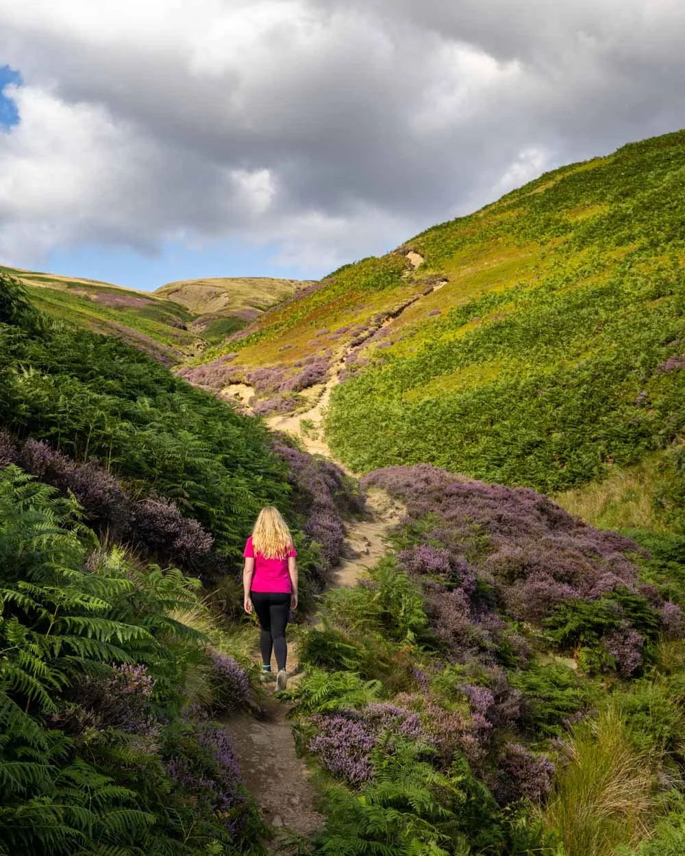
Roughly 1.1km from the William Clough bridge you’ll enter a rocky gully. This only lasts for 100m and is not slippery when dry.


You’ll then hit a series of stone steps, which are steeper and go for 150m. Just beyond the end of the stairs you’ll pass a large cairn and take a sharp right just a few minutes beyond.
This is the final part of the climb and is steeper again, but it only lasts for 400m. The path is a bit like a cobbled street and good for ascending - much more so than descending in my opinion.

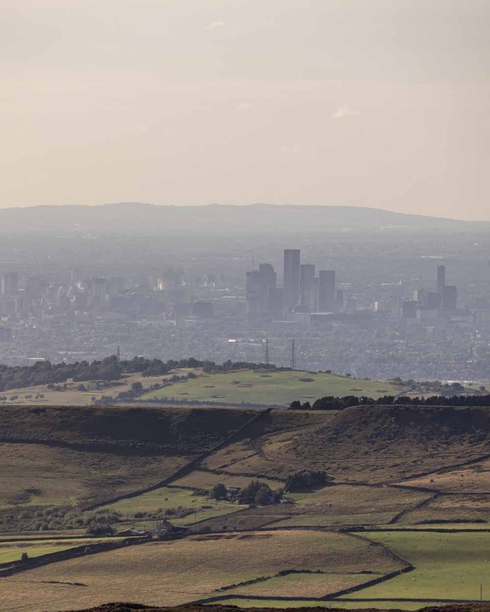
At the top of this climb you’re up on the Kinder Plateau and you’ll see another giant cairn. If it’s a clear day the view is expansive.
You can even see the distant skyscrapers of Liverpool and Manchester, although the rolling green hills are much more appealing!

Along the ridge to Kinder Downfall
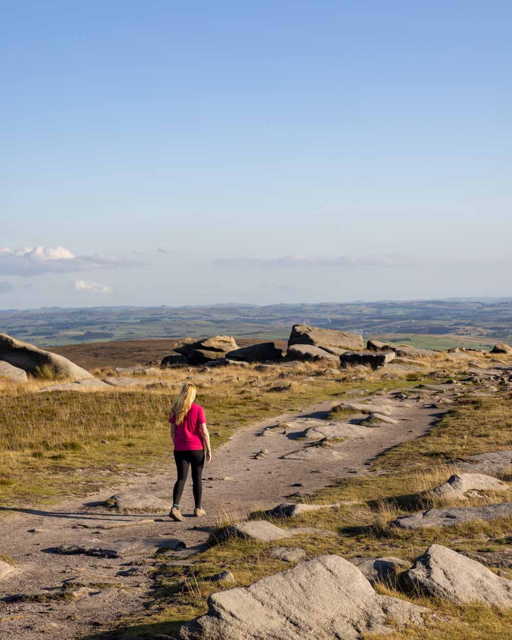
The good news is that all the climbing is basically now behind you. What follows is a long leisurely walk along the ridge.
The views are simply stunning and the scenery diverse. It is very exposed, so if you can, it’s best to go on a day with light wind.

You’ll walk from the cairn up to a rocky outcrop, with yet more fantastic views, and then enter a rugged landscape, which looked like Rohan from the Lord of the Rings movies!
It’s completely different to anything you’ve seen up to this point, and absolutely gorgeous. It’s easy walking and you’ll quickly come to more and more interesting rock formations.

Although there is no signposting, the path is obvious for the first couple of kilometres along the ridge. As well as the great rock formations you also get regular glimpses down into Mermaid’s Pool, where a mermaid is said to appear at midnight on Easter eve.
It’s possible to go for a dip here, which was my original intention, but sadly we took so long photographing the heather that we ran out of time - a reason to come back for sure!
We couldn’t believe how scenic this whole stretch of the track was, yet we barely saw another soul. I don’t know if we just got lucky, but it was on a beautiful day in August which seems like it should have been packed!


Roughly 6.6km into the walk, and 2.2km beyond the cairn at the top of the cobble stone climb, you’ll reach the point at which you need to cross over the stream from one side of Kinder Downfall to the other.
It’s marked by a small cairn and easy to cross with rocks to use as stepping stones.
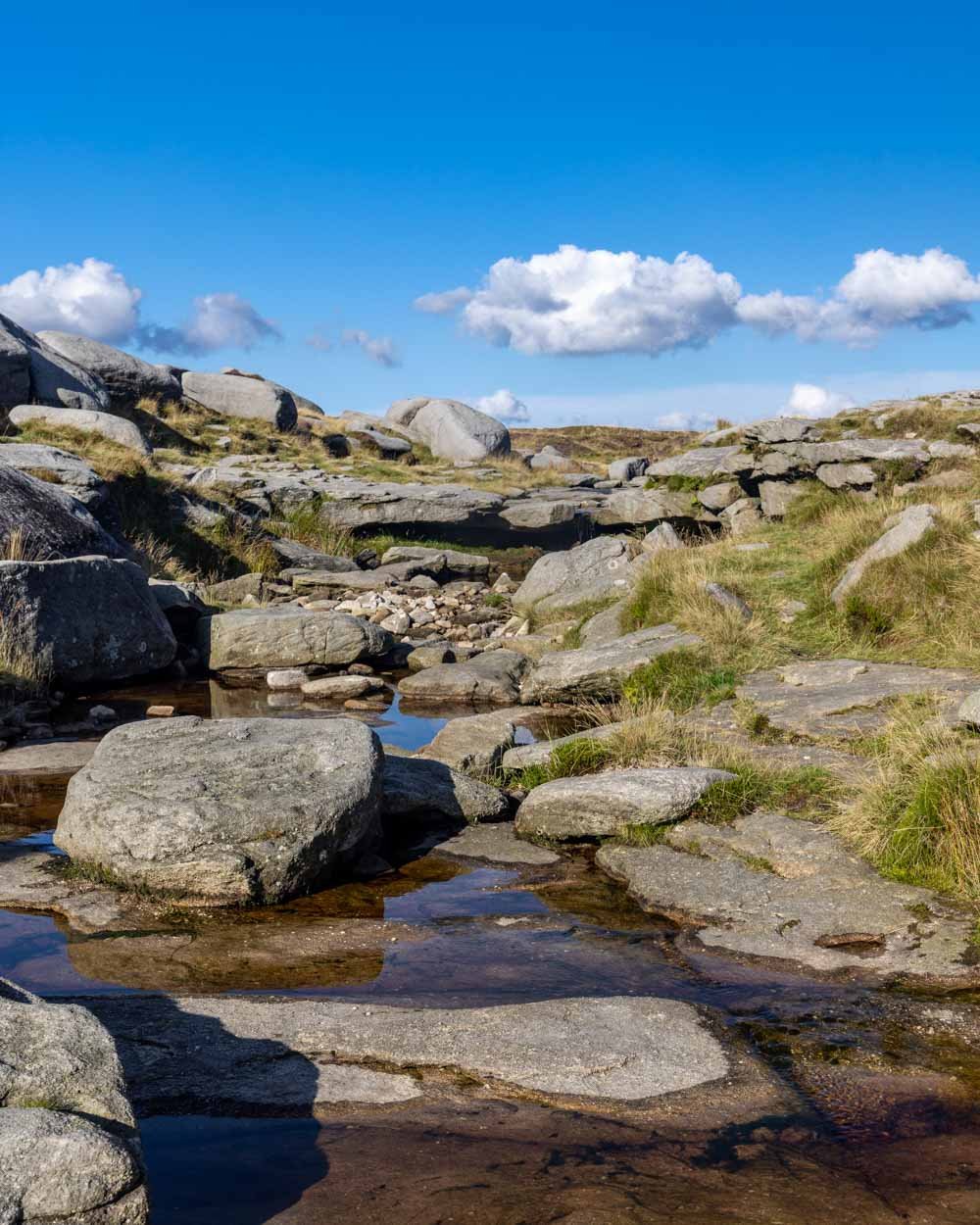
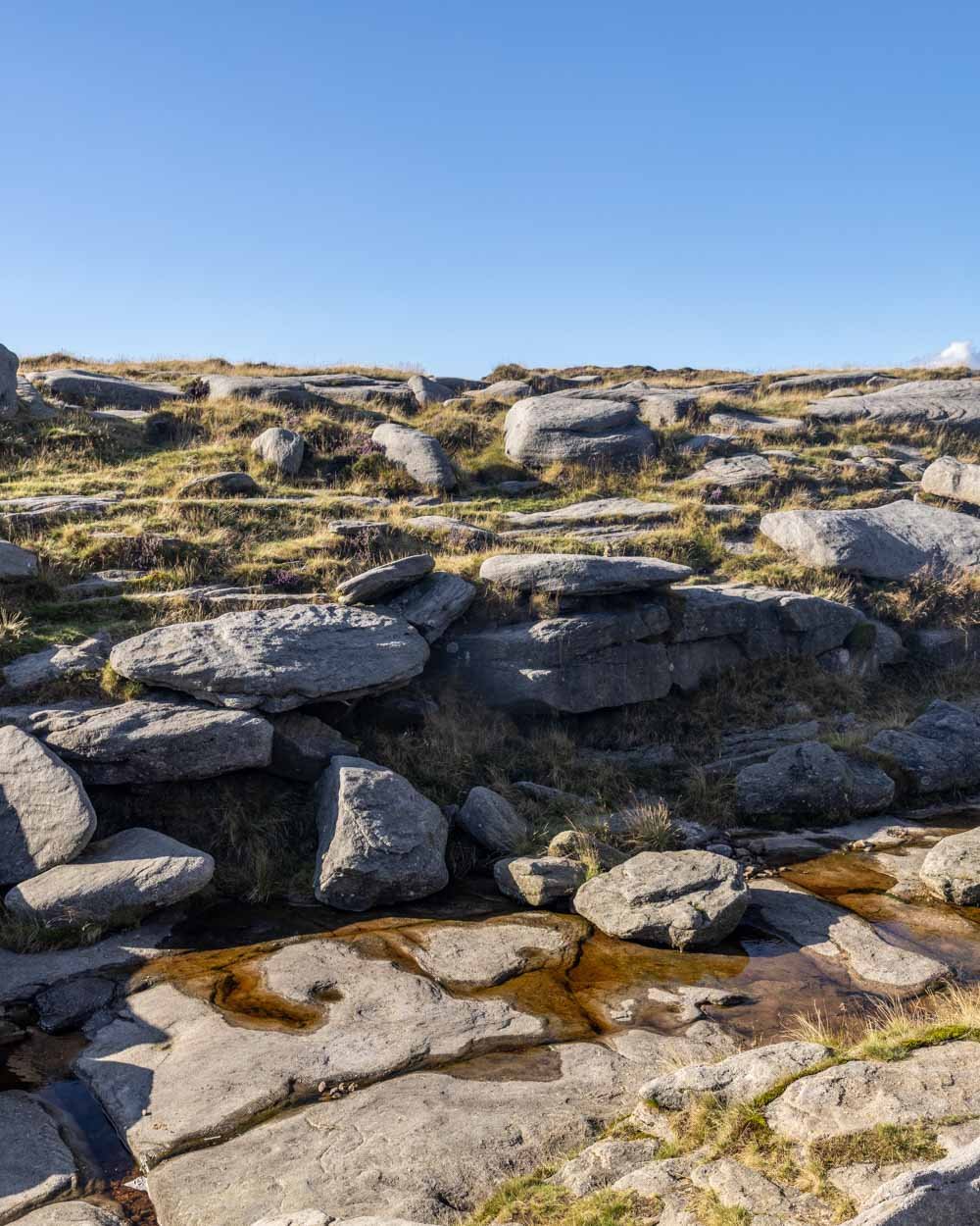
For us the crossing was bone dry, which was the only disappointing bit of the walk, as the waterfall can be pretty magnificent after rain, and is famous for blowing backwards in the wind.
However, though it would have been nice to see, we definitely weren’t complaining as the rest of the walk was so special.
To Kinder Low, the high point of the walk
After the stream crossing you’re now walking through a rocky landscape on the other side of Kinder Downfall.
The path is obvious for the next 1.2km, but then there is one turning that is easy to miss, it’s 7.8km into the walk, and 1.2km from the stream crossing.

It’s a faint grassy track heading uphill. It quickly leads onto the obvious path again, and then you’ll keep heading through the rocky landscape until you reach Kinder Low 1km later.
Kinder Low is the high point of the track (630m) and where you’ll find the trig point. It’s not a typical high point though as it’s a flat rocky expanse, rather than a hill top. The views are good but feel distant.
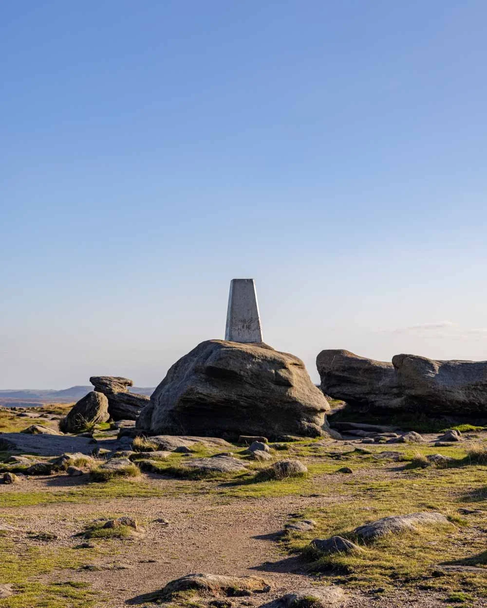
It’s not actually the point known as Kinder Scout though, that’s off trail, and we heard it requires traversing some bog to reach.
We weren’t really that fussed about finding it, but if you like to bag official peaks then you might want to seek it out!
Beginning the descent
From the trig the walk heads along the flagstone path in a southerly direction, passing a large cairn after 600m. A little beyond the cairn you’ll see a mount with steps up it on the right, and another path skirting the edge of it on the left.

The path to continue the circular walk is to the left and you’ll quickly begin descending on a stoney trail. After 150m descending you’ll come to a junction and head right, followed by a second right turn through the gate 150m later.
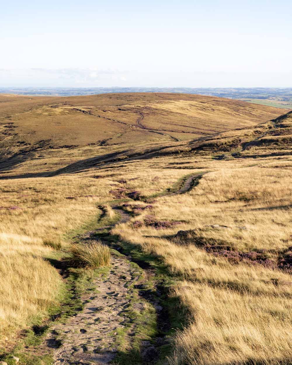
From here you’re walking on a wide stoney path which is easy gradient-wise, but the terrain is a little tedious. After an initial brief climb, it’s virtually all flat, but the rocks make it a bit of a pain and slow you down.

Keep following the wide stony track for the next 1.5km and you’ll then come to a bridle path on the right, which is signposted as Glossop bridle path.
Head through the gate and continue following the narrow path through open moorland.


After 600m you’ll reach another gate and head left along the grassy path. As you continue walking downhill you’ll cross over three stiles and 1.5km from the gate, you’ll reach a junction and keep straight.
Throughout this section the trail conditions are good and despite the fact there are a few steep parts to the descent, it’s easy enough.

The views are also lovely, looking out over various peaks. From the junction you’re now just 500m from the car park. It’s partly on the road, but again it’s a very quiet country lane.
All in all, this is a beautiful walk through a variety of landscapes and definitely one of our favourites in the Peaks. If your walk coincides with heather season it will add even more wow factor.
Parking for the Kinder Scout walk
The walk begins from the Bowden Bridge car park in Hayfield, postcode SK22 2LH. This is a Peak District National Trust car park and is going to cost you between £4 and £4.75, depending on whether you opt for four hours or all day - although for just 75p difference you may as well opt for all day and save yourself the worry of taking too long. There are cheaper prices, but they are for under 2 hours parking, which wouldn’t be possible for anyone other than a quick trail runner!
The charges apply between 10am and 6pm. If you have a Peak District National Park permit then parking is free here. There are toilets located at the car park.
Bowden Bridge car park is located just under 25 minutes from Buxton, 35 minutes from Bakewell and almost an hour from Ashbourne and Sheffield.
This post may contain affiliate links, meaning at no additional cost to you, that we will earn a small commission if you click through and decide to make a purchase. This helps towards the costs of running our website. Thanks for your support.


