

The Salt Cellar is one of the Peak District’s best loved photography spots. This unusually shaped rock formation sits high on Derwent Edge, overlooking Ladybower Reservoir and Derwent Valley. It’s a sensational spot at any time of year, but if you if you manage to time to your visit to coincide with sunset and the peak heather bloom, then you’ve achieved the holy grail.
Although there are several different ways of reaching the Salt Cellar, we’re sharing the quickest, easiest route, which is perfect if you want to head up for sunset.
Here’s everything you need to know about the Salt Cellar walk.

The Salt Cellar Walk
The stats
Distance: 2.8 miles (4.5km) each way
Elevation gain: 250m
Difficulty: Easy - moderate
Summary: The quickest route to the Salt Cellar is all along a well maintained path. It’s not always smooth underfoot, but it’s generally in good condition. The majority of the way to the Salt Cellar is uphill, but it’s never steep, which makes for a relatively easy ascent and descent.
The Salt Cellar itself is not signposted and it is hidden off the main trail, so we’ll detail exactly how to find it in the trail notes below.
Starting the trail
From the Cutthroat Bridge parking area (details below), cross over the road and head straight through the gate. The first part of the trail is a little rocky and begins as it means to go on, by heading gently uphill.
The path will soon smooth out and you’ll walk between huge swathes of heathland backed by rolling hills.

The path is very easy to follow and you will reach a junction at the 2km mark. You turn right here, following the sign for Derwent Edge.


The view from the junction is terrific, looking out over Ladybower Reservoir - although it only gets better as you climb a little higher.

The next 200m are a little steeper and rockier, but after that the gradient slackens and the path smooths out again.
The view at the end of this 200m stretch is even more extensive, looking over the reservoir, tree covered peaks and a patchwork of pretty green fields.

Heading up to the Coach and Horses
If you’re walking in August you’ll be treated to a riot of colour along the next section of track. There has been a lot of heather up to this point, but from here there’s barely an inch of land not covered in a sea of purple. It’s spectacular.

You’ll keep following the well maintained track gradually uphill and catch a sight of a prominent rock feature in the distance, the Coach and Horses, also known as the Wheel Stones.
You’ll reach a junction after just under 3km, but keep heading straight, towards the rock formation. You’ll reach it 550m later (3.5km into the trail).

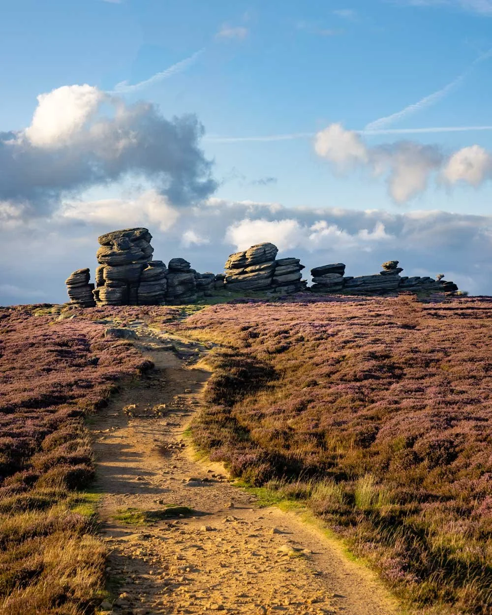
It’s a large collection of boulders, which as well as being good for photography, are also fun to climb up and through, before continuing on to the Salt Cellar.
Reaching the Salt Cellar
The path continues past the Coach and Horses towards another collection of giant rocks in the distance. The trail is flat until you reach the last little bit up to the top of the rock formation, which is on stone steps.

This section of track between the two rock formations is breathtaking in August. We’d been doing quite a few heather walks over the preceding month and this one stole the show.
It’s quite literally the most heather I have ever seen.

The next 550m to the Salt Cellar turn off are all on flat track and you’ll have some more wonderful views of the reservoir.

At this point you need to look for a path on the left which leads out towards the edge. You won’t see the Salt Cellar (as it’s tucked behind a large rock slab) but if you’re looking for it 550m beyond the last rock formation, you will see the trail.
If you did miss it, there’s another path fractionally further along, but it’s a bit narrower and therefore less easy to spot.

When you’re getting close, plug these coordinates (53.3996751, -1.7067580) into Google Maps and you’ll see roughly where you need to make the turning.
This path leads you to the Salt Cellar within 50m.
The Salt Cellar
Even if the Salt Cellar did not exist, it would be a wonderful spot. There’s a large flat boulder which has a direct sunset view and the vista itself is stunning.

The fact it’s just off the main path gives it a hidden tucked away feel and most of the year you’re likely to get this spot to yourself.
However, on a day with a decent weather forecast during the peak heather bloom, you will likely share it with a few photographers.


Everyone was friendly and respectful and despite the fact the conditions were not overly great, everyone was in high spirits.
You definitely don’t need to visit this spot at sunset, or when the heather is in bloom to appreciate the beauty, but if you do, then it definitely makes it magical.

Heading back
Although you could continue the walk and make a much longer Derwent Edge circuit via Black Tor and Lost Lad, we chose to retrace our steps as it was already getting dark.
The way back is easy due to the good path and gradual nature of the descent. In fact, bits that I considered uphill on the way basically felt flat on the way back, so it shows how gentle it is!

Parking for the Salt Cellar walk
Parking for the Salt Cellar walk is in the north-east area of the Peak District and begins at the somewhat alarmingly named Cutthroat Bridge. The best place to park is opposite the trailhead (you can see the trailhead on Google Maps by clicking here) which has room for about three cars.
If you can’t get a space here (which wasn’t hard even in August when going for sunset) then you can park 250m further down the road at Cutthroat Bridge Car Park.
Although there is a little footpath between the two, it’s very narrow and a bit overgrown with stinging nettles, so watch your step. Unfortunately it is a busy road, so parking directly opposite the trailhead is more ideal. The parking is free and time is not limited.
Getting to Cutthroat Bridge
Cutthroat Bridge is a 20 minute drive from Sheffield, 35 minutes from Bakewell and 45 minutes from Buxton. The car park has room for about a dozen cars.
If you want to arrive by public transport from Sheffield, then you can take the 257 bus from the city centre. It should take about 25 minutes and stops directly at Cutthroat Bridge Car Park. At the time of writing, this bus leaves every hour. The 257 also runs from Bakewell to Cutthroat Bridge Car Park, but takes about an hour.
This post may contain affiliate links, meaning at no additional cost to you, we will earn a small commission if you click through and decide to make a purchase. This helps towards the costs of running our website. Thanks for your support.


