

Mam Tor is one of the most famous spots in the Peak District and it’s easy to see why. The views are great and the walk is incredibly quick and easy. However, unless you are really limited on time, it’s well worth doing a longer circuit walk. The circuit takes in some of the Peak’s best views, including a gorgeous ridge line and a spectacular limestone valley. You can even stop in one of the tearooms for lunch half way!
If you only want to climb Mam Tor via the shortest track possible, then you can just read the beginning of the trail notes below as the longer circuit follows this route too.

The Mam Tor Walk
Distance: 8 miles (13km)
Elevation: 500m
Difficulty: Moderate
If you simply want to walk to the top of Mam Tor and back, you’re basically climbing one path all the way. It’s well maintained stone steps, which though steep are not slippery (when dry) and it only takes 10-15 minutes each way.
If you want to complete the longer circuit walk, there’s plenty more elevation gain, but the climbs are broken up with a fair amount of flat track. The terrain is generally good, but the path up or down Cave Dale (depending on which direction you choose to walk) is made up of loose stones and can be a little slippery even when dry.
For the most part, the circuit is not signposted. The first 4km up to Lose Hill are easy to follow, but there are some turns after that which are not obvious - especially the sections across farmland between Lose Hill and Castleton, and Cave Dale and Mam Tor.
You’ll want to download an offline map, or screenshot our directions for guidance - a map will be preferable though, because this walk had so many turns, it was hard to describe it with 100% accuracy.
Which direction to walk the circuit
We walked the trail clockwise, which is the most common way of doing it. However, in my opinion I think the views would be better walking in the opposite direction.
The only downside to going anti-clockwise is that you are walking down the steep section at Cave Dale, rather than up. It’s not a very long section, but it is made up of loose stones and even when dry, they were a little slippery. Going up this section was much easier.
I’d also say that Back Tor would be more slippery walked in the anti-clockwise direction too, it’s not loose rock like Cave Dale, but it is very uneven.

The other thing to note (if you choose to go anticlockwise) is that you’ll start on the less interesting part of the circuit, heading from Mam Tor across farmland for several kilometres to Cave Dale, which is not very inspiring. This section is very easy, so you’d be starting on the easy bit, rather than ending in a leisurely fashion.
On balance, I am glad we walked clockwise, but if I wasn’t bothered by slippery terrain I would head in the other direction!
Starting the trail: climbing up Mam Tor
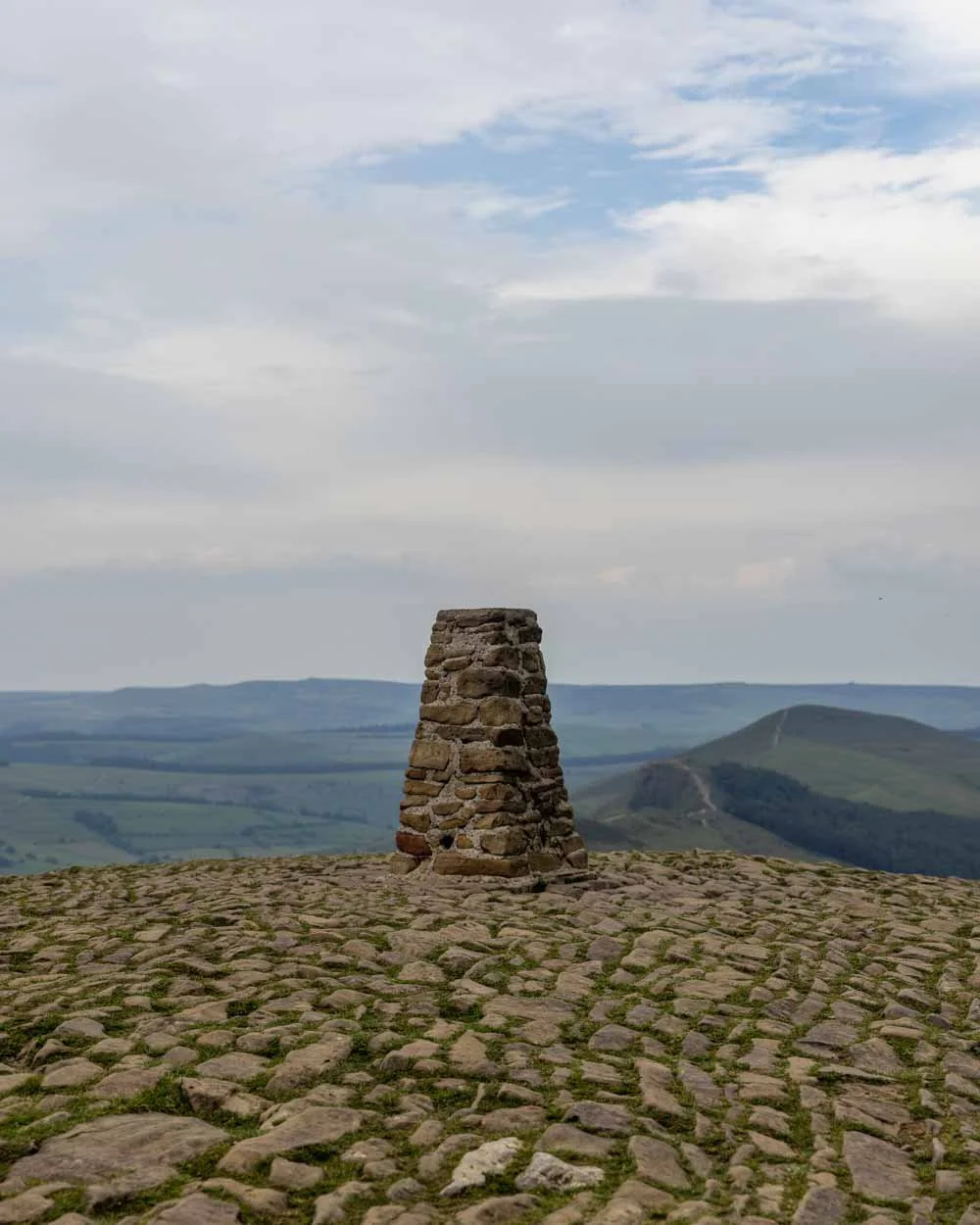
The walk from the car park up to Mam Tor is just 560m long. It’s uphill from the off and remains relatively steep up until 100m before the trig.
The majority of the path is made up of stone steps which are nice and grippy when dry. You’ll start to get views almost immediately and whilst it is steep, it takes less than 10 minutes to reach the top.

If you’re only planning on walking to Mam Tor, we’d recommend heading up for sunrise or sunset, which is when you’ll get some beautiful light and it’s generally less busy.
There’s plenty of room to sit and relax at the top and you’ll get great views of the Edale Valley, as well as the Peak District’s highest hill, Kinder Scout, and out over the picturesque Great Ridge.
Along the Great Ridge
From Mam Tor you’ll begin heading downhill, again on stones steps, but this time they are a lot shallower. You’re now heading along the Great Ridge, one of the most popular ridge walks in the country.
The path flattens, and then undulates as you pass over several humps, the first of which is Hollins Cross. After Hollins Cross, the terrain changes slightly and becomes a little rubbly, but it wasn’t slippery.
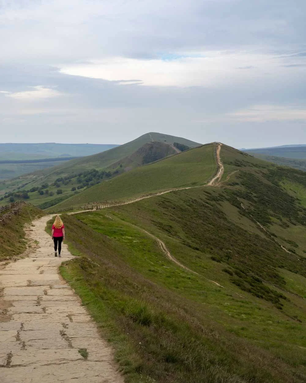
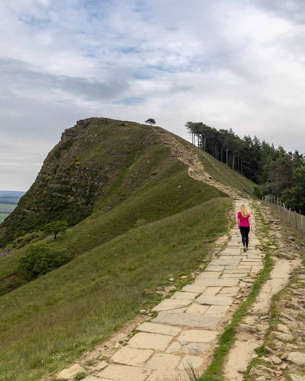
The next notable hill comes 1km later (2.9km into the walk), when you head up to the top of Back Tor. The path looks like it might be a little challenging from a distance, but as you get closer you’ll see it’s uneven, but easy enough.
Keep looking behind you because the views are just gorgeous, back over the ridge to Mam Tor - this is the point at which I thought that the views were more dramatic walking in the opposite direction!
Looking clockwise

Looking anticlockwise
It’s just 150m of rocky path up to the top of Back Tor, where you’ll find the trig point and plenty of space to sit and take in the views.
I found the views more beautiful than from Mam Tor, as this angle of the Great Ridge was especially picturesque.

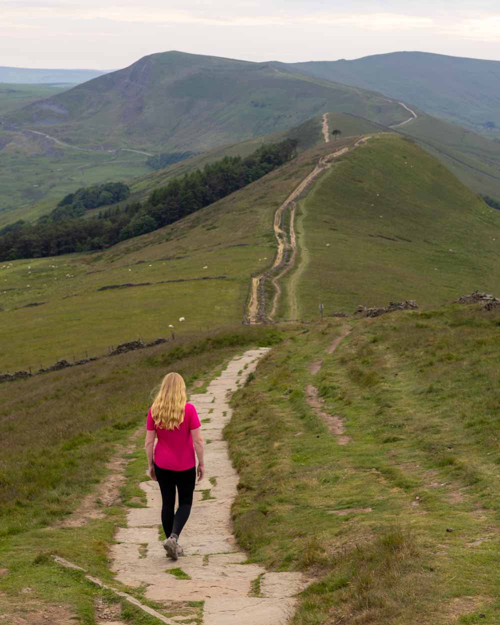
You now have 400m of flatter, but still rubbly track, before you start the final climb along the Great Ridge, which takes you to the top of Lose Hill.
The first 300m are on the same terrain, before you pass over a stile and hit a paved path for the final few hundred metres to the trig (which you’ll reach 4km into the walk).
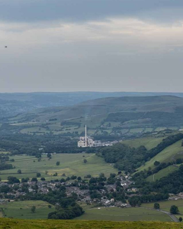
As with each of the hills along the track, the views are great, only marred slightly by the belching factory of the Hope Cement Works.
Through the fields
The next part of the walk is more easy going as you begin descending a rocky path towards the fields. From Lose Hill, you’ll zig zag across farmland, ending up in the middle of Castleton.
Heading south, the descent is quite steep, but easy enough in dry conditions. I can imagine when wet it could become slippery.
Approximately 300m after leaving the trig on Lose Hill, you will reach a stile. After this, the gradient slackens for a short while. Look out for a gate and giant cairn to your right.


The path continues heading downhill through the fields and 450m after climbing over the stile, you’ll see another gate on your right. It’s a very short, but steep grassy path down to the gate.
Cross the next field for 250m where you’ll come to another gate and take a sharp right, heading in a westerly direction.

After crossing the field and passing through yet another gate, you’ll need to turn left and begin to head in a southerly direction once more.
After a couple of minutes you’ll see a stile that leads over into a field that is really easy to miss (we did and ended up at a dead end). While walking along the path, keep an eye out for the little handmade sign saying ‘footpath’ on the left
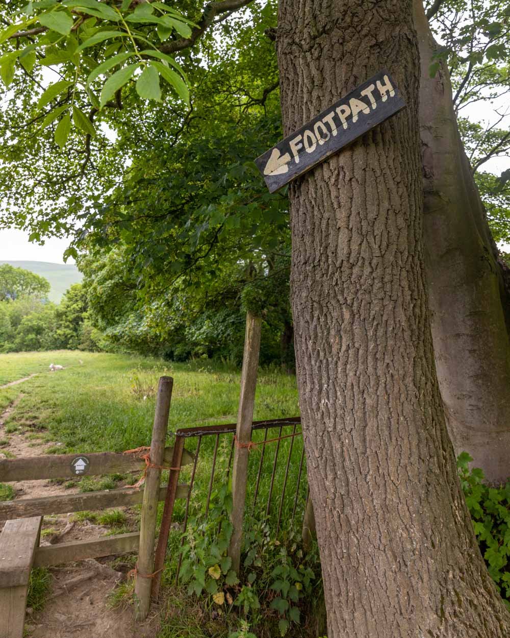
It’s close to the gate and if you get to the farm you’ve gone too far.
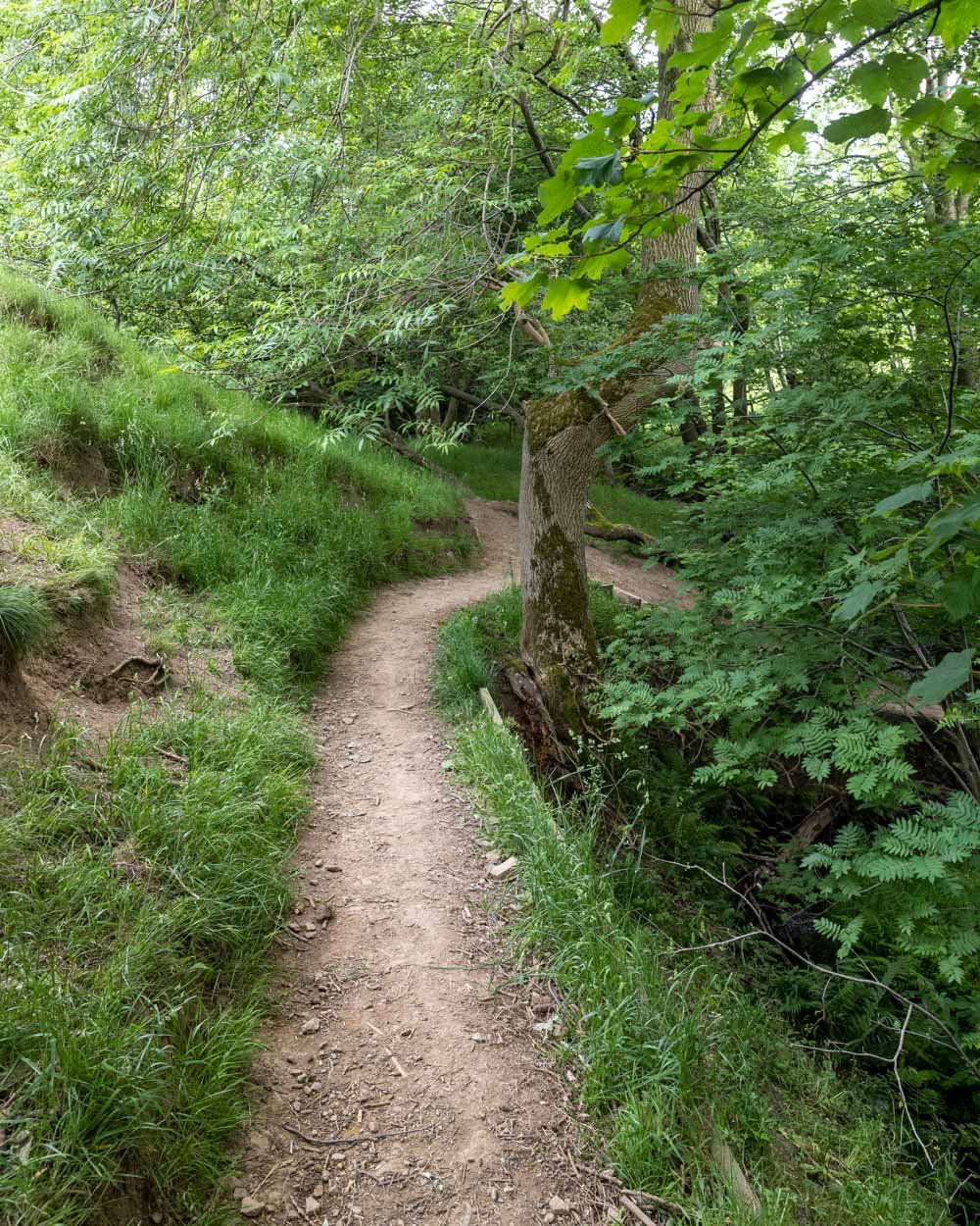
From here you continue through a field until the path leads you down into a short but pretty section of woodland. All too quickly you’re back in a field, but the path is now easy to follow.
You’ll then come to a gate and head out on to the country lane. Head right along the road for 100m before you cross onto the gravel path on your right.
It’s flat and easy, and has distant views of the atmospheric Peveril Castle, which you’ll get much closer to later in the walk.

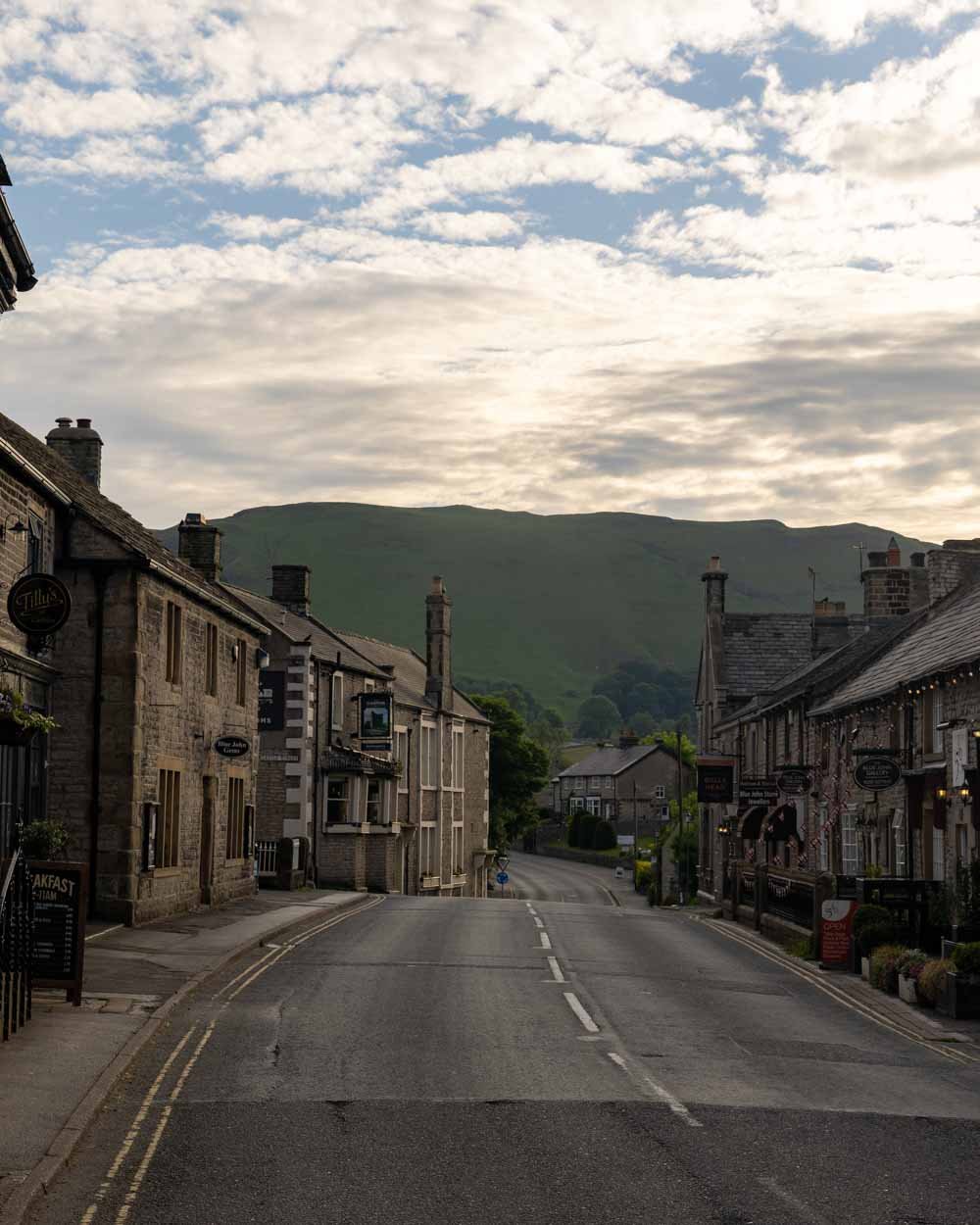
Into Castleton Village
The footpath will soon lead you out onto a quiet country lane, and this will take you into the village, which you’ll reach just over 7km into the walk.
You’ll pass the Nags Head pub on your right and this is where you can make a short detour into the village centre if you want to stop for lunch or a drink.
There are several tearooms and pubs, but beware, if you’re looking for a late lunch at the tearooms, as they stopped serving food long before the time advertised online when we visited!
Assuming you don’t want to make a detour, the circuit continues alongside (to the left of) the Nags Head, away from the main part of the village.
The houses you pass are very picturesque, and you can get some quintessential Peak District cottage photos.
Just 200m beyond the Nags Head you’ll pick up a sign for Cave Dale and within minutes you’re ready to begin our favourite part of the walk.


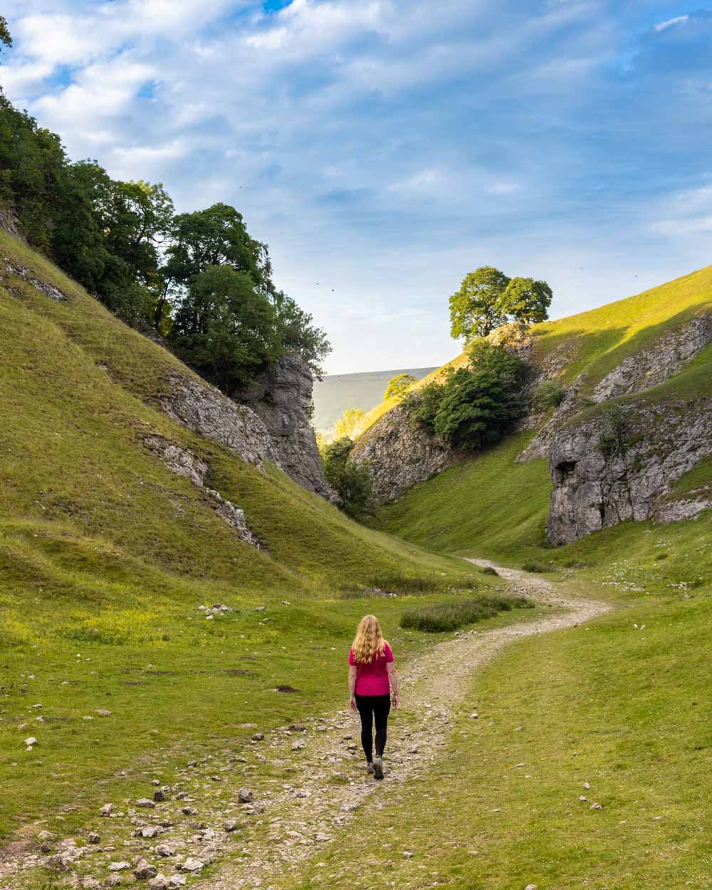
Through the stunning limestone valley of Cave Dale
Even the tiny little bit of gorge you see before crossing the gate into Cave Dale is really pretty, but what comes next really blew us away.
This next section is almost all uphill and relatively steep at points. The terrain is loose and rocky the higher you go, but it was ok when walking uphill in dry conditions.

I barely noticed the climb because the scenery was utterly gorgeous. You’re walking surrounded by steep limestone cliff walls and it feels really dramatic.
You’ll pass lots of tiny little holes in the cliffs, some of which have trails leading up to them, but none were big enough to go inside.
As you make your way up through the gorge, you’ll notice Peveril Castle sitting just above you on the right. Normally I’m all about wild views and don’t care so much for buildings, but the castle really did add an extra touch of magic to this scene.

It’s an 11th century ruin and looks picture perfect above the gorge, like something from fairytale.
At time of writing, to actually visit the castle, you need to book tickets in advance, but just seeing it was very special.

The 700m section through the main part of the gorge is over all too quickly, and you’ll then find yourself walking on a rocky path alongside farmland.
It’s still uphill, but not as steep as the latter section in the gorge. Roughly 900m after leaving the picturesque part of the gorge, you’ll see a gate on the right and head over the stile.
The gradient slackens again here, but it’s still a gradual climb uphill.


Completing the circuit
The path is obvious at first, but then does branch off 300m after the stile, when you want to head left. After 400m you’ll come to a large stone stile, which is different to any we’ve encountered before, and you’ll pass over two of these before walking along a gravel road between the fields.

The gradient is gentle here and almost feels flat.
Head straight over the next stile (200m later), and right over the next (800m later). You’ll now be back walking in fields again.
None of this final section is really going to blow you away, the last of the wow factor is at Cave Dale, but it’s an easy finish, without any tricky terrain.

After crossing the field for 500m you’ll come to a stile which had a lovely view of Mam Tor and the surrounding peaks.
I enjoyed this next field a lot more for that reason, you’re looking directly towards the peaks which made it a lot prettier than simply crossing farmland.

You’ll leave the fields after another 800m and come out to the road. You then cross the road and continue on a gravel path for the next 400m.
You can now see the car park in the distance (it’s 500m away from when you leave the fields). The last 100m is along the main road, but it’s still pretty quiet (or it was around sunset anyway!).
Parking for the Mam Tor Walk
The car park for Mam Tor in the route described above is run by the National Trust, but the ticket machine didn’t have the usual way of printing tickets for members - we ended up paying because we couldn’t see how to do it. According to their website it is free for members, so maybe you could just leave your card on the dash?
For non members, you have to pay by phone - the charge is £4.50 for up to 4 hours parking, £6 for over 4 hours. You could also start the walk in Castleton Village, but the parking was paid for there too, so after a quick drive around we chose to use the main Mam Tor car park.
You may be able to scout out off street parking in the village on a quiet day, but there wasn’t any on our visit.
The car park for Mam Tor has two levels, but that doesn’t equate to that many spaces if you’re visiting on a weekend on in the school holidays. You might want to consider walking early or late if visiting during peak periods.
Getting to the Mam Tor car park
Mam Tor is located just outside the village of Castleton. It’s a 30 minute drive from Bakewell, one hour from Ashbourne and 50 minutes from Sheffield.
This post may contain affiliate links, meaning at no additional cost to you, that we will earn a small commission if you click through and decide to make a purchase. This helps towards the costs of running our website. Thanks for your support.


