

Many of the Peak District’s best waterfalls require a bit of effort to reach, but Waterfall Swallet isn’t one of them. This pretty waterfall sits in a wooded gorge and takes less than 10 minutes to reach from the nearest parking area. The trick is knowing where to go, as it’s not signposted and is very well hidden.
It’s worth noting before you set off, that this particular waterfall does require a decent amount of recent rainfall to flow. If you visit during a dry spell, then you are going to be met with a damp cliff wall. I guess that’s one perk to visiting during a rainy period! We visited after a fair amount of rain and it was still only a light flow, so the more rain the better.
Here’s everything you need to know about visiting Waterfall Swallet.

The walk to Waterfall Swallet
The stats
Distance: 170m each way
Elevation gain: 20m
Difficulty: Moderate due to path condition
Finding the falls
To find the quickest route to Waterfall Swallet you need to use these coordinates 53.2902792, -1.7032805, which will take you to a small lay-by with enough room for a couple of cars to pull fully off the road.

You then need to head back down the road for 70m in the direction you drove in from. You’ll see a little gate on the right and some stone steps leading down into a wooded gorge.
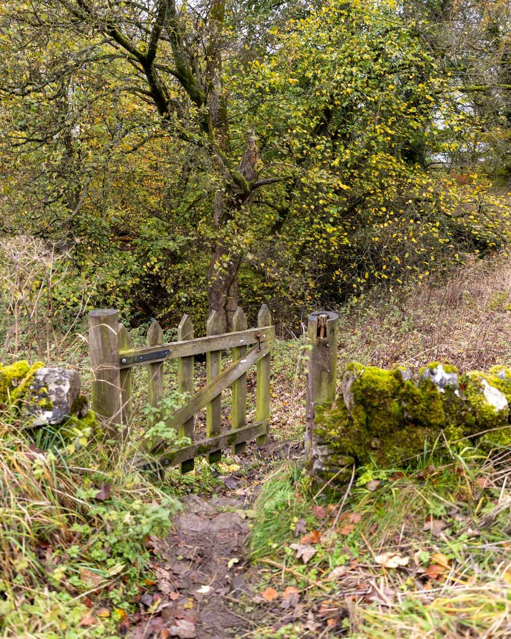
I say steps, but they are on the rustic side. During our visit in autumn they were almost entirely covered with leaf litter, and quite slippery.
It’s steep and very uneven, but if you take it slowly it’s not as hard as it looks to get down (the photos don’t really convey how steep this short descent is).


Without all the damp leaf litter it would probably be easier - although as you need water for the falls to be running then you will likely always find the path to be a bit wet and slippery.
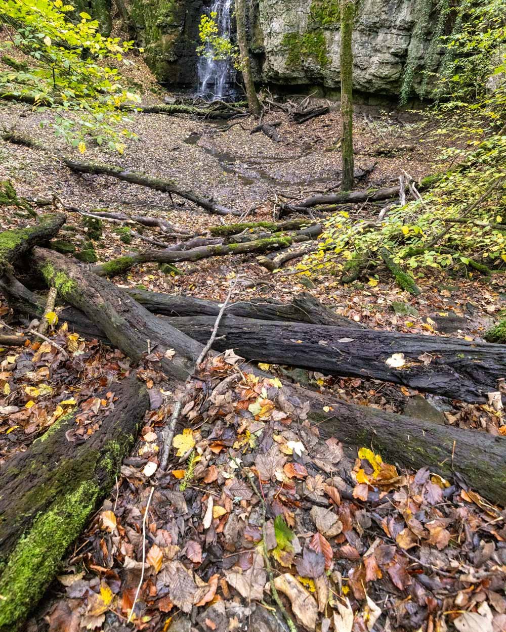
There are a few fallen logs over the track, but you can avoid almost all of them by taking the left path partway down.

Between the gate and the waterfall it’s just 100m, and some of that is flat ground at the bottom, so though it’s not a good path to get down, it doesn’t take long.
The path at the bottom and all the ground around the falls can get very muddy, so don’t bring any shoes you want to keep clean!
Arriving at Waterfall Swallet
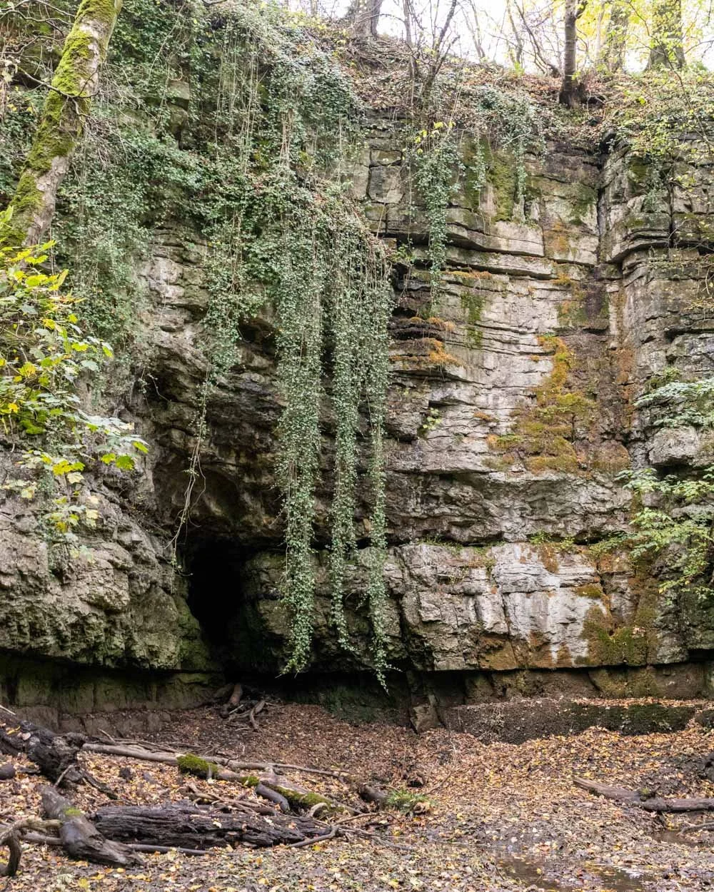
You can walk right the way up to the waterfall and stand beneath it. Looking up at it from below was definitely my favourite view and it’s particularly picturesque because of the high cliff walls, which are partially covered in moss.

The surrounding gorge is also really pretty, with lots of trees which had some lovely autumn colour - however we were probably a couple of weeks beyond peak time to see them as many of the leaves had already dropped.
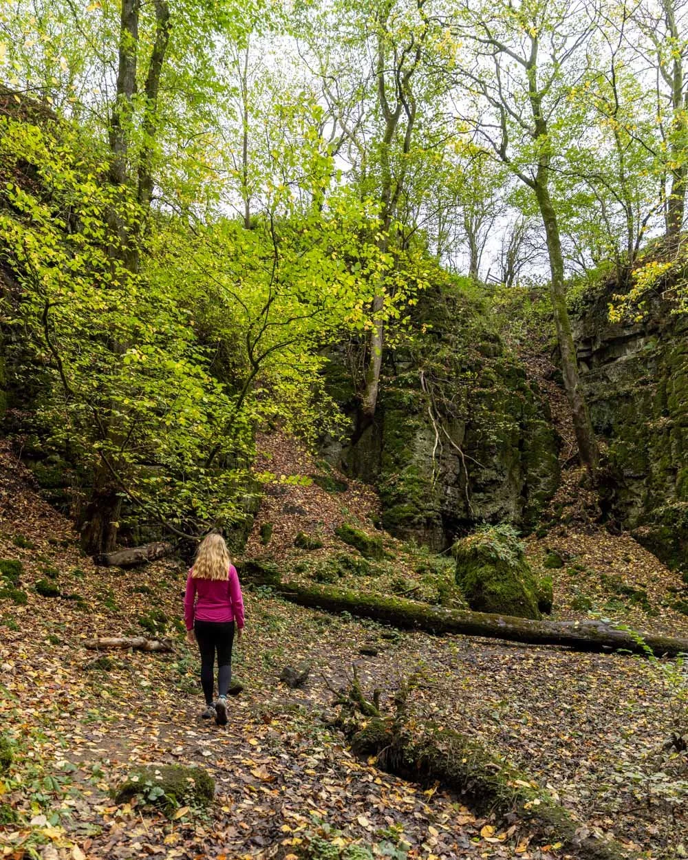

You can walk a little way around the gorge, but it is very muddy, so you have to be careful not to take a slide. However the main path leading to the bottom of the falls was not too bad, it was more when you strayed from it that you started to get some proper bog!

Apart from the falls and the setting, the other lovely thing about this spot is the serenity. There was no one else around and it felt incredibly peaceful, with only the sound of water hitting the rocks and wind rustling through the trees. It’s definitely one of the quietest Peak District waterfalls we’ve visited so far.
When you’re ready to head back to the car, the walk uphill is much easier. I didn’t find the path at all slippery going uphill and it only took a few minutes to reach the gate again.

Getting to Waterfall Swallet
Waterfall Swallet is located in Foolow, very close to the village of Eyam. It’s a 25 minute drive from Buxton, 15 minutes from Bakewell and 40 minutes from Ashbourne.
Finding the start point for Waterfall Swallet is the hardest part as it isn’t marked on Google Maps. Look for an unsealed road that heads north from the road between Foolow and Eyam. The road has a mirror at the entry (photo below) and the parking spot is about 50m down the road. The co-ordinates for where to park are: 53.2902792, -1.7032805.

This post may contain affiliate links, meaning at no additional cost to you, that we will earn a small commission if you click through and decide to make a purchase. This helps towards the costs of running our website. Thanks for your support.


