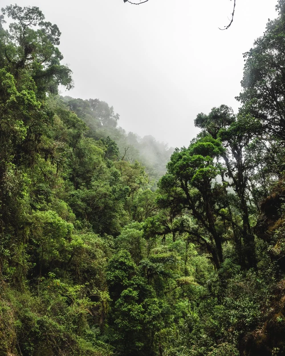
Rio Savegre Waterfall is gorgeous. I didn’t really have any expectations before visiting and definitely wasn’t expecting to be wowed by what is a relatively unknown waterfall in a country that boasts of some of the most beautiful waterfalls in the world. The walk to get to the falls takes you through a wild part of the cloud forest and when the cloud rolls in, it creates a real air of mystery.
There’s even some fabulous wild swimming spots on route if you’re willing to brave the cold. To top it all off you’re unlikely to see another soul on the trail, even in the middle of the day. A real result in Costa Rica’s peak season.
However, those are the good points. Unfortunately the trail to reach Rio Savegre Waterfall turned out to be one of the sketchiest we’ve walked in Costa Rica. Not in terms of terrain, but in terms of trail conditions.
After years of neglect, you’ll see bridges with many planks and rails missing, stairs that have turned into ladders after the steps fell out, and a few bits that require the use of a rope. It definitely won’t be for everyone, although the first part of the walk is in great condition, and well worth doing even if you don’t plan on continuing to the falls.
Here’s everything you need to know about visiting the Rio Savegre Waterfall.

A note on safety before we get started
Before we get into the trail details, continuing on from the intro, I wanted to point out that this isn’t the safest of trails. It is open, but in many countries it wouldn’t be. The state of disrepair is unlike any trail we’ve ever done. We’re writing this guide so you know exactly what to expect if you do decide to go for it, but know that there is some risk involved in hiking it.
If you only want to go as far as the first cascade (which passes the wild swimming spots) then the track is totally fine. It’s the second section leading to Rio Savegre Waterfall which is sketchy. It’s very much worth doing the first part even if you have no intention of carrying on to the main waterfall.

The walk to Rio Savegre Waterfall
The stats
Distance: 2km each way (or half this if you go to the first waterfall on the good track)
Elevation gain: 160m
Difficulty: Moderate if maintained, hard in its current state
Starting the trail - it’s easy to go wrong early on
The walk begins at the side of the road and there is no sign or official car park, you can find the trailhead on Google Maps here.
You’ll walk straight into the forest on a easy level path beside the river. It’s beautiful from the off, but it only gets better the further you go. The first 150m are flat and then there’s a very gradual incline. After you’ve been walking for 330m you’ll come to a trout farm.


Do not follow the pink markers here, which lead uphill on a narrow dirt path. This path leads to a number of different trails, none of which go to the Rio Savegre Waterfall.

We mistakenly thought the pink markers would lead to the falls and made a 2km detour (this has been removed from the stats, so the distance for the waterfall is still accurate).
Instead, take the trail that leads past (not through) the trout farm and stick on this track. After a further 190m you will see a sign for the waterfall.

To the swimming holes
You’ll follow the waterfall sign which heads right, and there is a brief descent on a stony path. You’ll walk beside the river and there is a fallen tree to walk over, but it’s very easy.
You’ll soon come across a sign for Los Quetzales National Park (there’s no entry fee using this route though).

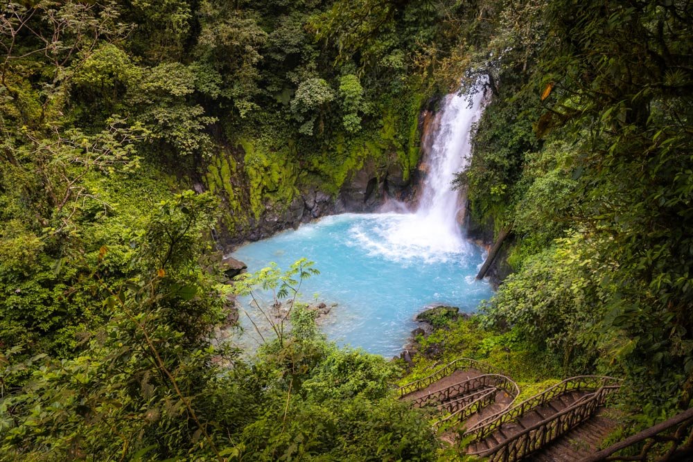
Just 220m from the sign for the waterfall (where you turned right) you’ll see the first swimming hole. It’s a beautiful spot, with a small cascade and pristine emerald water.
There’s easy access to the water here. There is a current, but it’s not overly strong in the dry season.

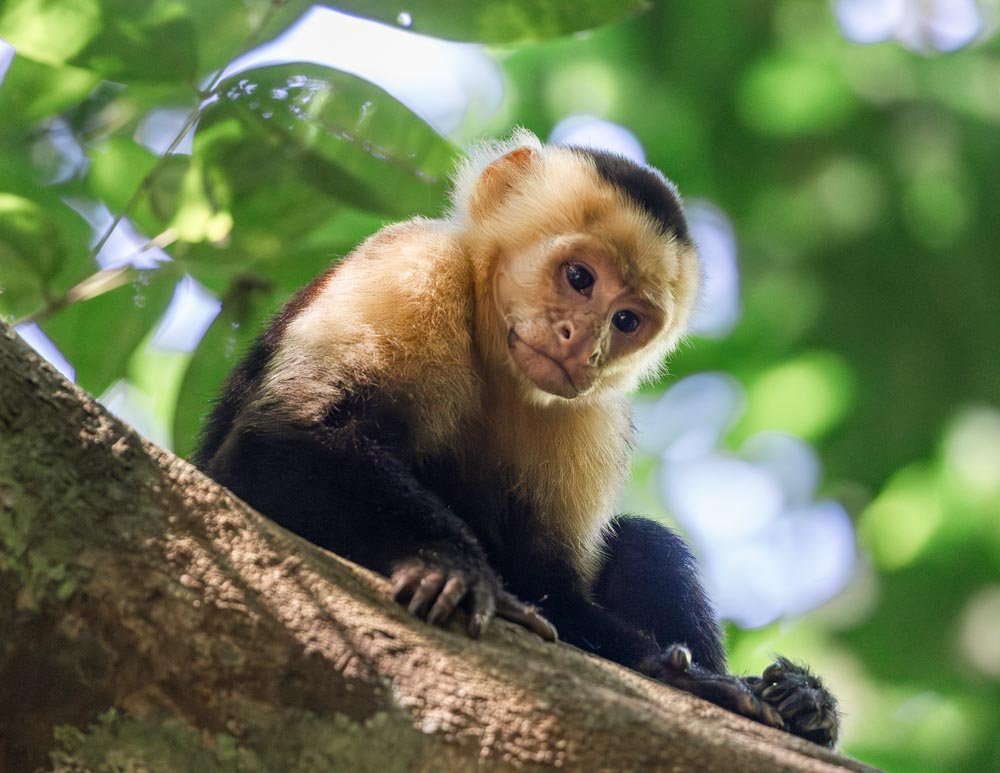
The track continues along the river and it’s easy and relaxing. You may spot some birdwatchers in the forest along this stretch, but you’re unlikely to see anyone on the actual trail.
Just 340m beyond the first swimming hole, you’ll see a small path leading downhill to the right. It takes just a minute to walk down and then you’ll reach another large swimming hole.


It’s stunning, with crystal clear water, a small cascade and surrounded by dense forest. Again it’s easy to access the water, you just need to walk over a few rocks.
Swimming here is incredible, but it is icy cold, we’re talking as cold as a glacial pool. It’s definitely only one for those who like cold water swimming, but even if you don’t fancy swimming, it’s a wonderful spot to sit, relax, and maybe dip your feet in!

As with the first pool, there is some current, but in dry season it wasn’t that strong, and you can swim outside the current.
To the first waterfall
After heading back onto the main trail you’ll continue through the forest and soon come to a small bridge, where you’ll find another sign for the catarata (waterfall).
There’s a gorgeous big mossy wall and the trail gets even more special from here.

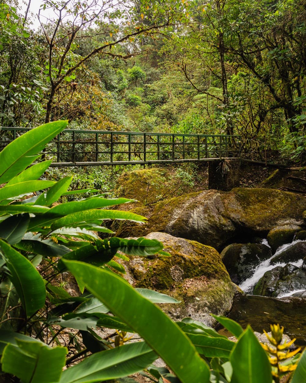
The path gets a little less smooth, with some rocks and tree roots to negotiate, but nothing difficult. Just 50m beyond the small wooden bridge you’ll come to a large metal one.
This takes you over the river and has some great views of the cascades in both directions. The river is really powerful here and there’s a mass of whitewater even in the dry season.

Just beyond this you’ll come to an overhang. There are several metal bridges leading down to the waterfall. They are not in perfect condition, but it’s nothing on what’s to come, so if you don’t like the look of them, then don’t continue on to the main waterfall.

There are a few holes in the bridges, but you’re less than 50m from the ‘viewing area’. After the bridges, there is a short stretch where you have to walk down a couple of slippery rocks, and there’s a rope in place for stability. It only takes a few minutes to walk the bridges and rocks, and it all seemed pretty stable to us.


The downside is that you can hear a powerful waterfall, but all the boulders cover it up. The most exciting thing you can see is part of a cave waterfall. It’s also fairly obscured, but still pretty cool nonetheless.

The start of the sketchy section
After making your way back up over the metal bridges, the track continues and this is where the trail begins to deteriorate significantly. It starts with a rough section with some loose soil, which has a rope to help you down.
It’s not that bad as it’s only around four steps, but there’s a fallen tree across it, which makes it a touch more awkward.


From here you’ll continue along the narrow path and soon come to a metal staircase leading downhill, some of the steps are missing.
For all staircases along this trail we recommend walking on the metal struts and joints, not the stair itself, since so many of them have fallen through.

The path after this is quite narrow, but there are ropes in place if needed - however it’s not a tricky bit.
They have roped large sections of the rest of the way to the waterfall, some of which are badly needed and some are just nice to have.

You’ll soon come to another bridge and this one is much more worse for wear than the earlier ones. You can expect to see large holes in most of the bridges and steps from now on.
At first I was marking each and every one for this guide, but in the end I gave up because there weren’t any that were actually in good condition.

The scenery gets wild
I’ll admit that much of the time we were walking this part of the track, we were absorbed with the trail conditions and how much worse they were than any we’d ever seen.
However, despite this, you couldn’t fail to notice how beautiful the forest is. It’s so dense and has a palpable atmosphere. I loved it despite the slight trepidation about whether the path would get even worse - spoiler alert, it does!

Roughly 250m into the walk (after leaving the first waterfall), you’ll come to some debris over the trail in the form of several collapsed trees.
There are two sets close together and both are fairly easy to climb over.

Just 50m beyond this you’ll come to a ladder leading up to a rock ledge (it’s hard to describe but you can see it in the photo). There’s a rope to help you up the rock and it’s easy enough when dry.


After this there are some sections of normal track, ie a standard dirt path, leading through the forest. It’s spectacular and feels very wild.
There are also a few narrow bits of track, with a little loose soil here and there. We took these very slowly, though they were never more a few steps.

The sketchiest bit of all
Just when you thought the path had improved you’ll come to the swing bridge. This is 700m after you left waterfall one. Ordinarily I love a good swing bridge, the longer and janglier, the better. However, given the state of the track, I wasn’t overly sure about this one.
Even as I write this I wonder if we should have gone over it. There are a number of handrails missing, although I don’t remember any of the actual floor having fallen through. Where there are handrails missing I stopped and leaned forwards to grasp the pole ahead, just to give extra stability as it does wobble.
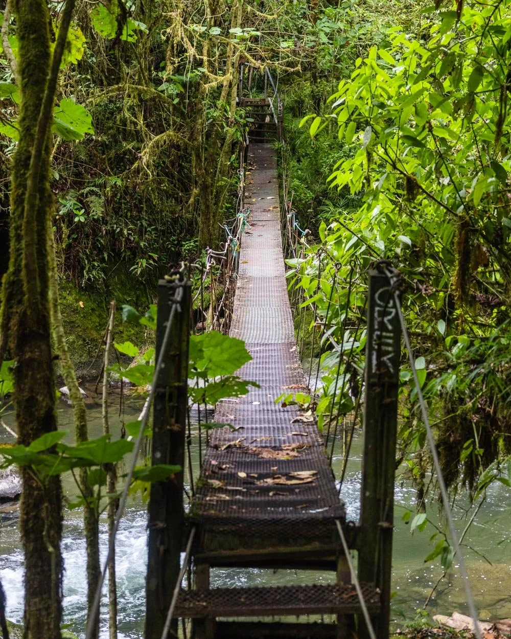
In honesty it didn’t sway any more than other bridges I’ve been on, but the difference was the thought of what had gone before. Each creak that wouldn’t normally phase me did make me question it. However, I think we both had a feeling of ‘summit fever’, we’d come this far and really wanted to see the waterfall.
Once you’ve crossed the bridge you are 150m from the waterfall. This is mainly on a series of staircases leading downhill, each has lost the majority, or all of their steps. You now use them like a ladder and there are usually ropes installed.

The final part involves walking down a little rocky ledge, where again, there is a rope in place. This leads you onto a natural lookout, a piece of jutting out rock that is very stable and allows you to the see the falls in full.
You could potentially go down to the water’s edge, but it looked slippery, and we didn’t see the need when the view was so good from where we were.


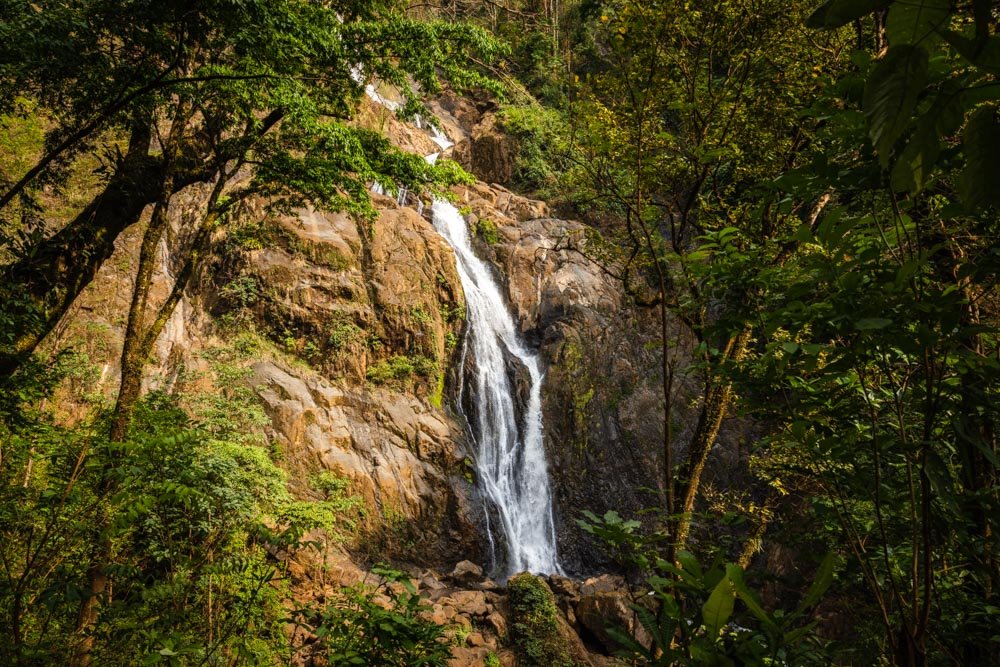
Rio Savegre Waterfall
So after all that you’d think that maybe the waterfall wouldn’t feel enough. However, it felt anything but. Photos don’t do it justice, but it really is a wild beauty. It’s almost canyon-esque and was very dramatic.
The water is a deep green and trees cover most of the rock walls. I loved it.

It’s worth noting that you can’t swim here, there are signs stating that it’s dangerous and the current looked hugely powerful. The spots I mentioned earlier do not have signs and the current was mild.
After enjoying the falls, it’s time to head back the way you came.

We both found the walk back quicker and easier. We knew what to expect now and we felt more confident - well after we passed the swing bridge anyway!
I swam on the way back just as the clouds rolled in, giving us a true cloud forest experience. This is what I’d recommend if you do want to swim, as the water is really cold and you want to be able to warm up quickly afterwards.

All in all, I thought the walk and the waterfall were fantastic, however, it would be better if it was maintained to ensure that it’s safe for everyone to enjoy.
Rio Savegre Waterfall entry fee and opening hours
Although the waterfall is located in Los Quetzales National Park, it’s free to enter. There are no set opening hours as it’s in a patch of forest that you can enter without passing through gates or booths.
Getting to Rio Savegre Waterfall
Rio Savegre Waterfall is located in San Gerardo de Dota, you can find the trailhead on Google Maps. You can walk to it from several hotels in the area. There is no car park, but space to pull off the road.
Getting to San Gerardo de Dota does require navigating some very steep roads, however a 4WD is not required (at least in the dry season). We visited in a Toyota Yaris and had no trouble. The road is paved, but for a few bits that have fallen apart and turned to gravel. No one pothole was too bad on our visit, but if you are worried, check with an accommodation provider in town before driving the road, so you can hear up to date details on it.
San Gerardo de Dota is roughly a two hour drive from San Jose.
Where to stay in San Gerardo de Dota
Lauraceas Lodge
We stayed at Lauraceas Lodge, walking distance to the trailhead for the waterfall. It was our favourite stay in Costa Rica. We had an individual cabin, with a comfy bed and great shower. It had a really lovely feel to it and we fell asleep to the sound of the river (which is opposite the hotel). It was the quietest place we stayed in the whole country and we would have extended our stay if we’d had the chance.
The only thing to note is that San Gerardo de Dota gets very cold at night. They do offer a heater if needed. We were ok with all the bedding and blankets, but I imagine a lot of people would prefer to take the heater!
You can see the reviews and prices on:
This post may contain affiliate links, meaning at no additional cost to you, we will earn a small commission if you click through and decide to make a purchase. This helps towards the costs of running our website. Thanks for your support.