
The great thing about Sydney is that you don’t have to go all the way to the further national parks to do a great bush walk, there are many pockets of wilderness right in the middle of urban areas. The Two Creeks Track in Garigal National Park is one of those trails that doesn’t get talked about much, but is one of our favourite bush walks in Sydney.
There are several different ways of doing the walk from a leisurely one way walk, to a 10km loop (and several varieties inbetween), making it perfect for any type of walker.
Whichever option you choose it will be gorgeous, but if you do the whole loop you’ll experience a beautiful river, bushland, rainforest, small waterfalls, mangroves and even a couple of places to have a dip! See what we mean about this being a real gem?
Here’s what to expect from all versions of the Two Creeks Track, one of the best walks in Garigal.
The Two Creeks Track
Explaining the different ways of doing the trail
Ok, so this may get a little complicated, but bear with us. There are three different ways of doing this hike:
The Two Creeks Track One Way: 6km walk downhill from Lindfield Oval to Echo Point. This requires a car shuffle or hoping on buses at either end.
Two Creeks Track Return: The same as the above, but walking back to where you started. This is harder as it’s 12km and involves walking uphill 211 metres.
Two Creeks, then followed by Little Digger: A 7km loop that starts with the Two Creeks Track and then merges into the Little Digger Track. You can add a side trail to Echo Point Park if you want to have done the entirety of the Two Creeks Track.
Phew. Hopefully that all makes sense!
We strongly recommend option three as it involves going through a beautiful rainforest and pools, but all versions will involve a great walk.
So here’s what to expect.
The Stats
Difficulty: Easy
Distance: 6.3km one way
Elevation: 97m
Starting Point: Lindfield Oval
We’d recommend starting your walk at Lindfield Oval no matter how you are going to walk the track, it is the best way to make this trail a loop or if you are using public transport to get to the trailhead.
Starting the trail
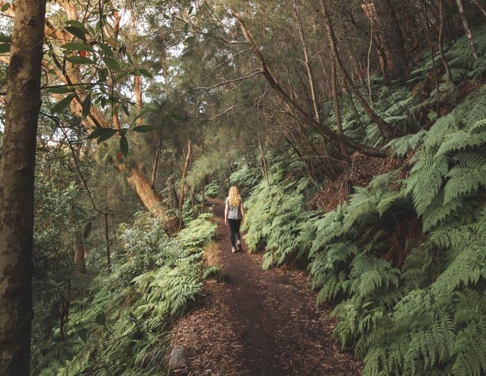
The loop starts at Lindfield Oval, and follows the road to the right of the rugby ground. You’ll see a dirt track lead away from the oval and start heading downhill.
You’re almost immediately in the bush and within five minutes we heard the sounds of kookaburras laughing and cockatoos shrieking overhead. It’s like an instant bush atmosphere! You can still see the odd flash of road in the very early part of the track but it soon ebbs away.
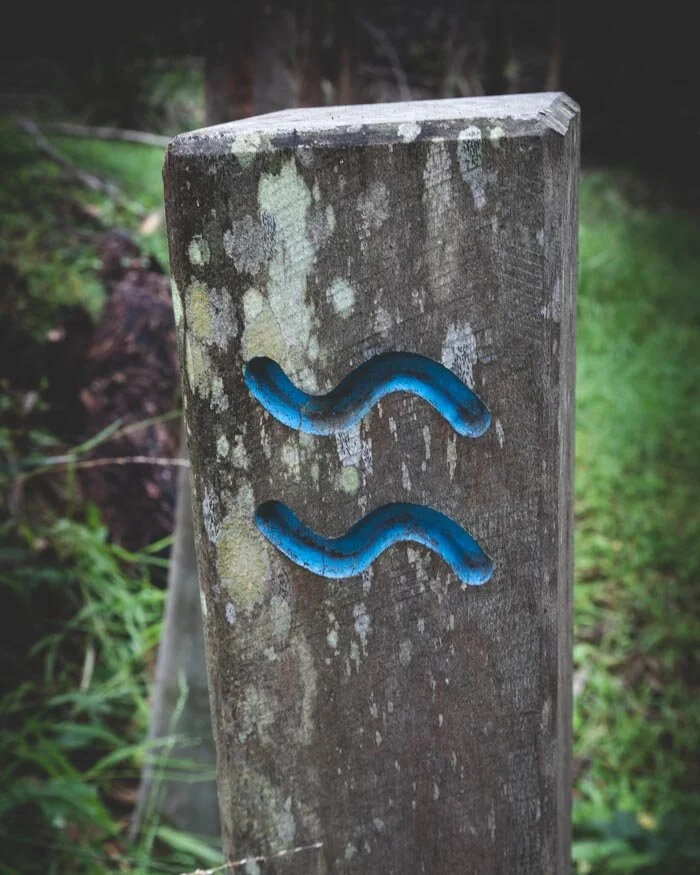
For the majority of the track you will follow posts with two blue waves on them, but ignore the first one you see - this will take you back uphill and to the road.

Lindfield Oval
The signs for the Two Creeks Track
Continue on the downhill trail until you reach the Gordon Creek Track car park. Take a tight right turn and head along the trail.
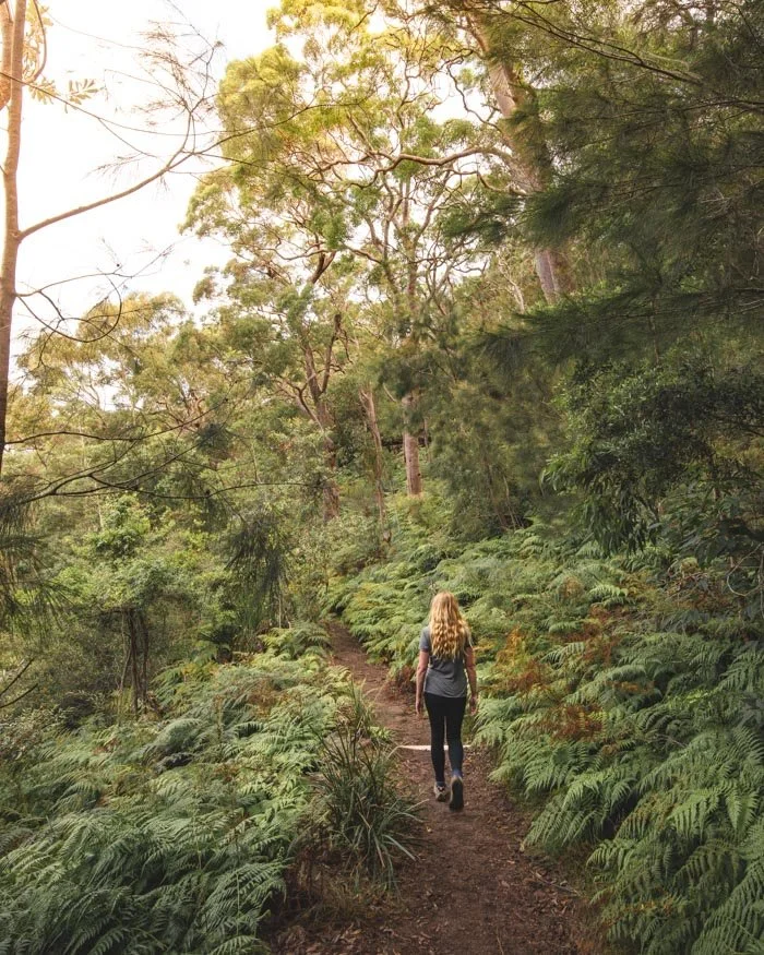
This track will wind through the bushland and undulates a little, but is flat on the whole. It’s nice enough but if you’re wondering why we hyped it up so much at this point, don’t worry because it gets really pretty soon!
After some easy flat walking you will start to climb up a rocky path, it’s a short climb and you are rewarded with a birds eye view of the gorgeous forest.
Reaching the river
After approximately 2.5km you’ll reach the river, the picturesque view that will accompany you for the rest of the Two Creeks Track section of the walk.
The views transform and it now feels like a valley, with a hillside covered in eucalyptus trees across the other side of the river.
It always blows us away that within a short distance, you can go from Australia’s biggest city to Jurassic Park (especially when you hear the noise of cockatoos overhead).


There are the odds steps to climb but for the most part this section of track is flat or downhill. The easiness of the terrain allows you to look around you at the beautiful scenery rather than down at your feet which is always a bonus.
The trail gradually heads down to the shore, before you get your first chance to have a clear and uninterrupted view of the river at the 4.3km mark where the trail follows Moores Creek inland.
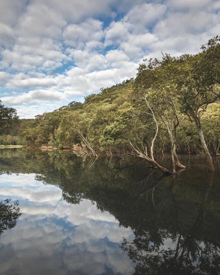
The views here are pretty, especially as you have the park on the opposite shore, and the mangroves that line the start of Moores Creek.
When we walked by there were kids who were looking for crabs under the rocks. They looked like they were having a lot of fun, apart from the sore fingers from some not too happy crabs!
The oasis of Moores Creek
Next comes our highlight of the Two Creeks Track. Whilst the views have been very pretty until now, Moores Creek is a really unexpected oasis that feels a million miles from the city!
After starting off as mangroves, you’ll soon see a palm tree grove appear on the opposite bank! The forest changes from Aussie bushland and gum trees, to tree palms, huge palm trees and a unique tropical grove.

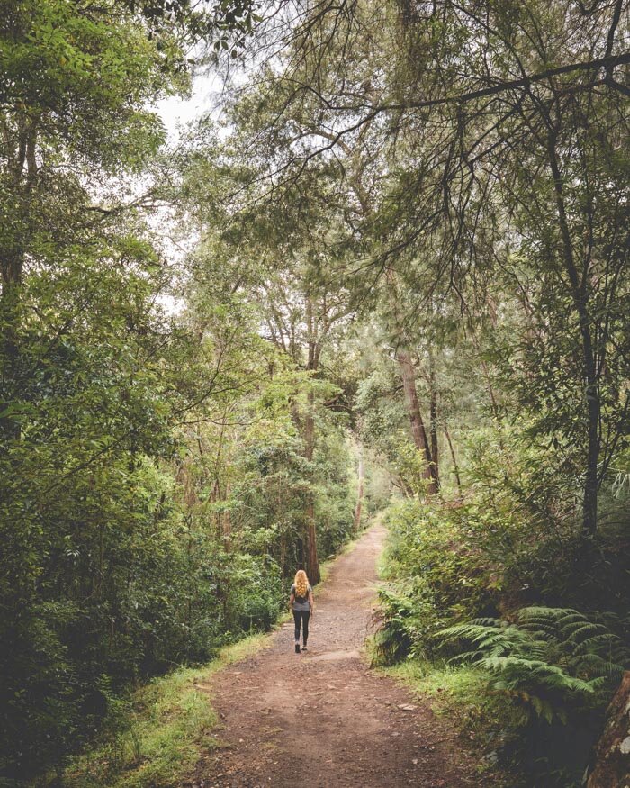
It’s very picturesque and a truly beautiful spot. The walk continues to be very flat and easy.
Make sure you keep an eye out for the wooden bridge on the left, which takes you over Moores Creek and continues on the Two Creeks Trail. If you want to do the Little Digger Track you’ll be coming back here (or you could bow out now if you want to walk the shorter loop)!

Finishing the Two Creeks Track
After crossing the bridge, the trail follows the opposite bank of Moores Creek, before reappearing at the Middle Harbour Creek. It’s bushland for another 1.7km along the river and the water views continue to be gorgeous. You’ll then head under a huge bridge before appearing at Echo Point Park.

This is another pretty area for a picnic, with bbqs, picnic benches and a view of the river. The bank is fenced off, so you can’t get into the water from here though.
By now you’ve walked just under 6.3km and have reached the end of the Two Creeks Track. You can choose to go up to the A38 and get a bus back to the city, or take on the Little Digger Track to complete the loop.

Echo Point Park
If you want to see the rainforest, waterfalls and water holes of the Little Digger Track, read on!
Onto the Little Digger Track
Difficulty: Easy
Distance: Additional 1.8km (unless you go to Echo Point, which makes it an additional 4.4km)
Elevation: Additional 120m
Type of Trail: One way to Lindfield Oval
Starting Point: Moores Creek
Good choice! We thought the lure of a rainforest and waterfalls would be too much to resist!
Head back along the Two Creeks Track to the wooden bridge - this is 1.7km back along the trail you came from. Look out for the signpost for Carlyle Road and turn left. It’s a short walk uphill before you see another left turning for the Little Digger Track. Follow the sign and stay on the track.

Firstly, don’t make the mistake we did! We crossed the big bridge and immediately entered a really overgrown section of track.
You can make your way back to the trail from here, but it’s an unnecessary detour and so few people use it that the fear of giant webs was real! It does however, feel completely wild and off the beaten track which was pretty exciting!

Stay on the northern bank (the creek will be on your left) of the creek and follow the yellow spray paint on the trees.
The trail is very different to the Two Creeks Track as you’ll soon emerge into rainforest. The plants and trees all seemed to change and it felt like being in the jungle!
The trail carries on through the rainforest and it’s a bit less manicured than the Two Creeks Trail, with more rocks and tree roots and the like.
You’ll soon see a turn off for Babbage Falls on your left. It’s an 100m walk to a small waterfall and a big rock pool. On a hot day, this looks like an idyllic swimming spot to cool off in!

Babbage Falls

The pool at Babbage Falls
Heading back, it’s another very short distance before you reach the turn off for Little Falls which is less than a minute off the trail. Like the name suggests, this is a really small waterfall! It’s a pretty spot and there’s a pool here to paddle, but not big enough to swim in.

Little Falls
From here it’s an uphill walk to the end of the Little Digger Track and onto Carnavon Street.
Finishing the loop
If you’re driving, then head back to the Lindfield Oval. This is an uphill walk and is through a pretty enough residential area, but in essence you’re walking on the road. It is only around 650m, so shouldn’t take too long.
If you are taking public transport, the best option is to catch a bus down Archibald Avenue to the city.
Essential information about the Two Creeks Track
Parking
The good news is that there’s plenty of street parking with no time restrictions at the start of our loop, and it’s free. You can park along Tryon Road and not have to worry about rushing back. You can also park at Gordon Creek Track car park if you don’t want to walk the loop trail.
Public Transport
If you’re coming from the city, then the best bet is to get the 209 from Milson’s Point. This drops you along Tryon Road and right by the start of the loop.
If you want only to walk the Two Creeks Track, then head up to the A38 from the trail end at Echo Point Park and hop on the 270 or 271 bus back to the city (these go all the way to the QVB building in the CBD). The bus should take about half an hour.
For those taking the Little Digger Trail, buses run from Archibold Road. You can jump on the 194 bus and go back to the QVB in the city. The bus ride should be about 30 minutes long, depending on traffic.
This post may contain affiliate links, meaning at no additional cost to you, that we will earn a small commission if you click through and decide to make a purchase. This helps towards the costs of running our website.
Like it? Pin it!

Follow us on social media
Are you planning on a walk in Sydney? Have you done the Two Creeks Track before and enjoyed it? Let us know in the comments below!


