The Valley of Rocks is one of our favourite walks in England and we’ve done a lot of walks! A narrow path clings to the side of an imposing cliff wall with incredible sea views that give you that edge of the world feeling, but from a perfectly safe track.
Mountain goats adorn precarious ledges that jut out over the water and create many a fabulous photo op. The walk is quite short but it has real wow factor and there are a couple of ways you can extend it if you fancy a longer track.
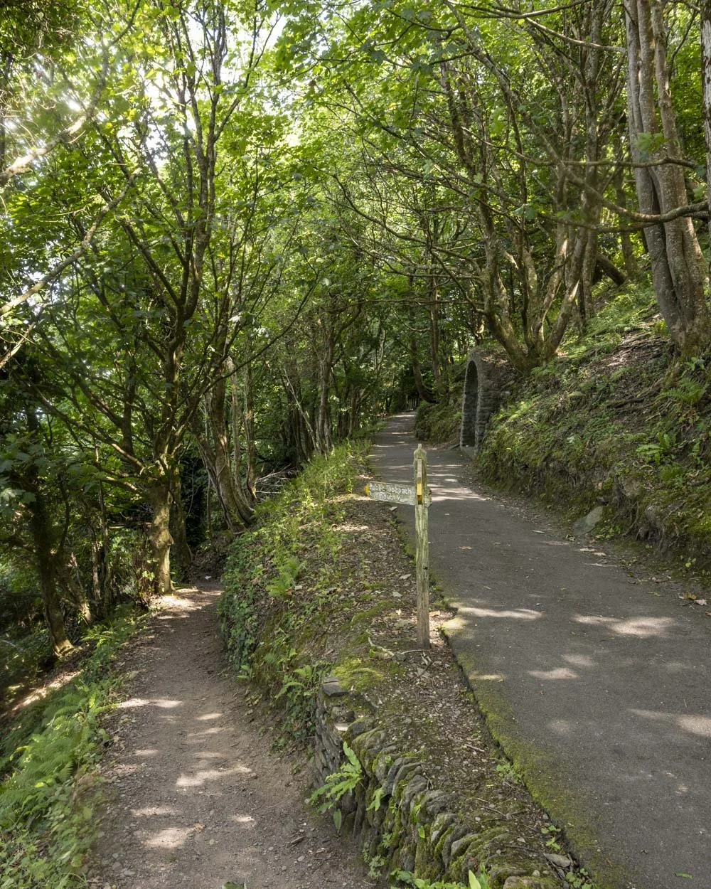
What also makes this walk special is the fact that the majority of the route is paved, making it accessible for all, and it’s rare to get a trail this good where that’s the case.
Here’s everything you need to know about the Valley of Rocks walk, including both the short and longer circuits.

The Valley of Rocks Walk
The stats
Distance: 2.5 mile circuit
Elevation gain: 115m
Difficulty: Easy
Trailhead: SW Coast Path Parking
Summary: There is a short and longer circuit walk possible at the Valley of the Rocks. The shorter circuit is paved the entire way (marked with a dash on our map) and showcases all the best scenery. It has one notable ascent and descent, but they don’t last long and the paved path means you don’t need to worry about slipping or uneven terrain.
The longer circuit only spends a little extra time along the coastal path, the majority of this extended loop takes you through the nearby town of Lynton, it’s nice, but it’s not a must do if you’re short on time. The longer walk is no more difficult than the shorter loop, the difference is only in the distance.
There is one side trail you can do at the beginning or end of the walk which is a very short but steepish climb up a picturesque hill, offering spectacular views, it’s well worth the minor detour.
Starting the trail and the optional detour
Even the road leading to the car park at the Valley of the Rocks is spectacular and you’ll probably spot your first mountain goat before you even reach the start of the walking trail.
From the SW Coast Path car park you head towards the sea and just 250m later you can make the short 250m (each way) detour to the top of the prominent craggy hill ahead.

The path is a touch steep at first, but it only lasts a few minutes before the gradient slackens. It’s a gravel trail with the odd rocky section, but it’s not slippery when dry and the climb is easy enough.
After 200m you’ll reach the end of the formed trail and can opt to explore to the left and right of the track. Both options require a minor easy scramble.


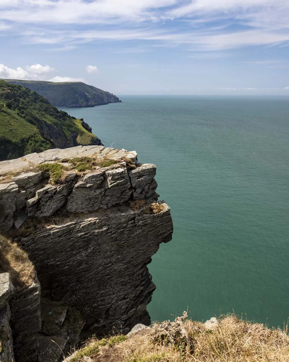
The left side has a few rocks to climb up and then you will reach a large flat cliff edge with exceptional sea views. The water looks so blue and clear on a calm sunny day.
You can then head to the right side, which again involves an easy little rock scramble before you’ll reach a fun natural arch and can walk through it for more sea views.
There’s a bit more optional rock scrambling you can do on this side, but the best views are all accessible simply by climbing up those initial rocks.

Walking the cliffside path
Once you’ve got back down the hill you will begin walking along the paved path which clings to the cliff side. It’s narrow and has a sheer drop off to the left at all times, but it’s not so narrow as to be worrying unless it’s very windy or you suffer from vertigo.
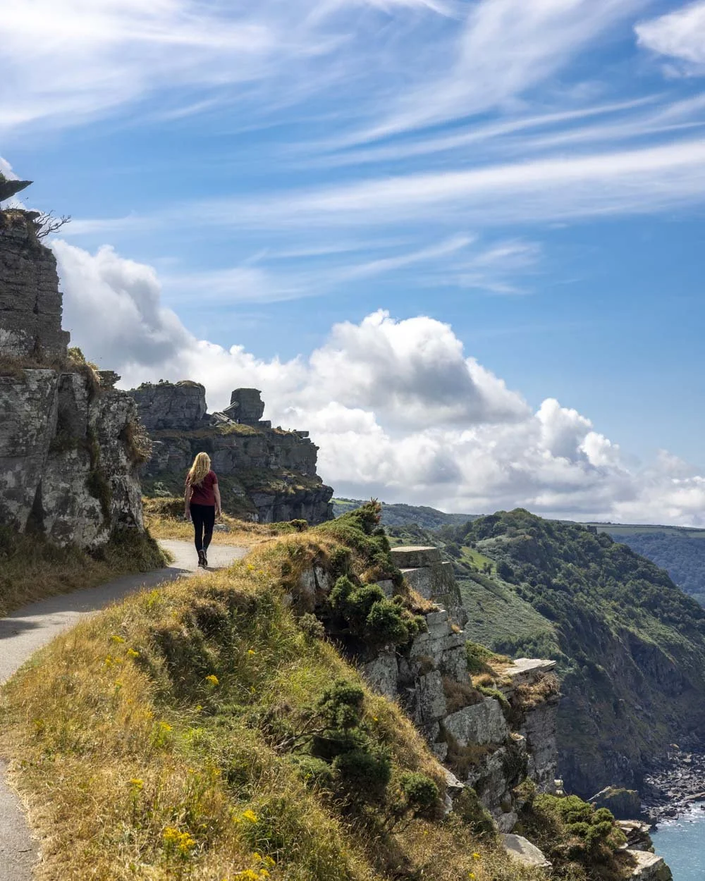
For me the narrow path and the fact you have the sea on one side and the cliff on the other is what made it so magical. The views are simply stunning every step of the way.

The first 450m of this paved section of the walk are completely flat and this is where you’ll also find the majority of mountain goats.
The ledges they willingly not just walk out to, but actually choose to laze around on, look quite death defying and it makes for some wonderful photo ops.

They were a lot of fun to watch and looked quite majestic as they sat high above you on the edge of the cliff, beards swaying gently in the wind.
Though this herd is considered rare, goats have been around a long time in this area and were even mentioned in the Doomsday book.
This current herd is so cherished that the Lynton Feral Goat Preservation Society was established in 1997 to protect it.


They made an already incredible walk even more memorable.
After the initial long flat section you have a 200m uphill climb before you can choose whether you want to make the short or longer loop. Assuming you climbed the hill at the start this junction will come 1.4km into the walk.

Continuing on the longer loop
If you want to do the shorter circuit, you turn right at the junction at the 1.4km mark, or 900m mark if you didn’t make that first detour. There is a little more uphill climbing to do and then the path descends somewhat steeply down to the road where you have a few minutes road walking to do to get back to the car park.
However, you could, and we would recommend, continuing for another 500m along the coastal path for more great views, including a closer look at a set of steep cliffs you haven’t really properly seen yet.

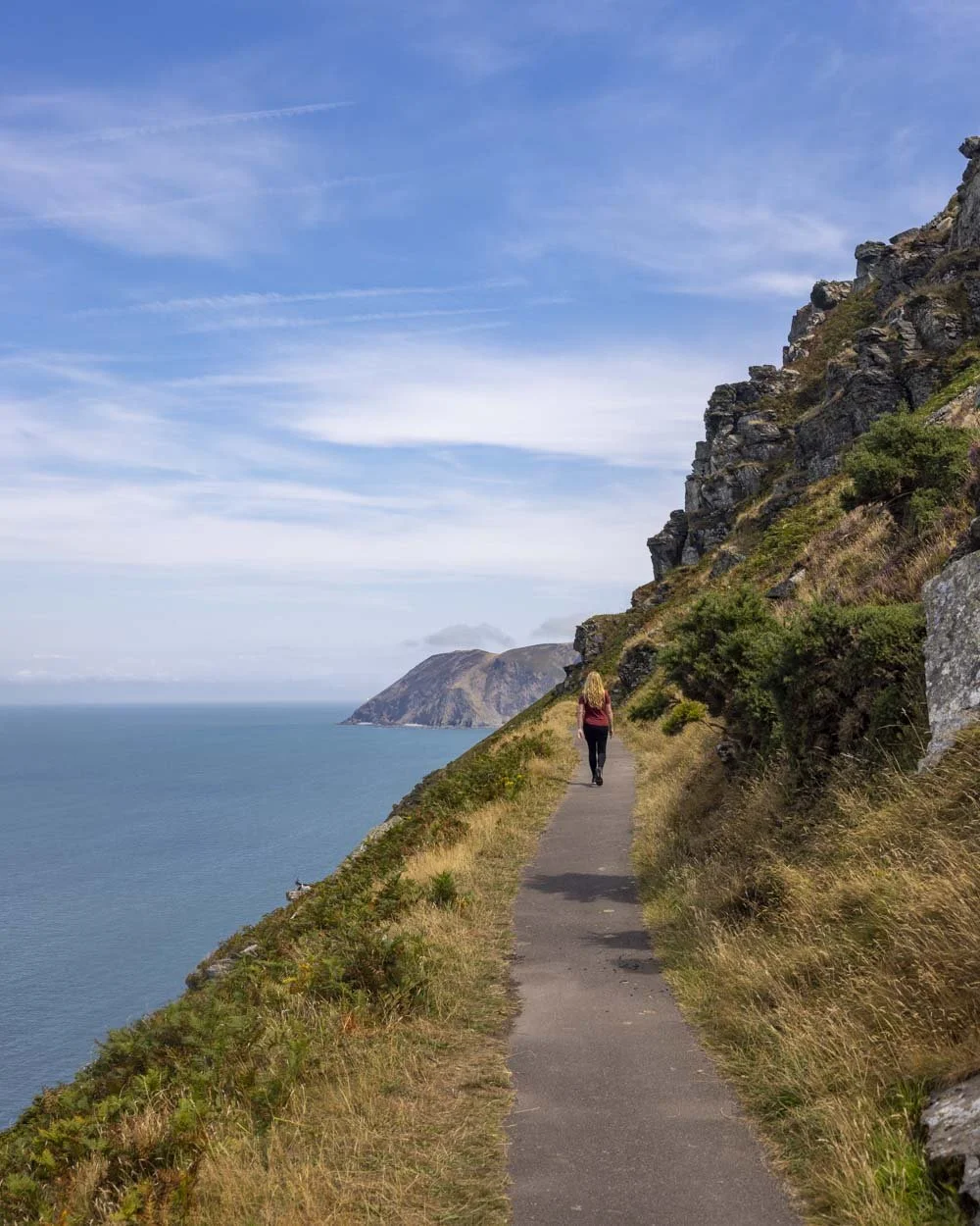
You would then head back to the turn off, adding a total distance of 1km to the walk. This section is really beautiful and still paved and easy.
To continue on the full longer loop you will leave the coastal path behind and head through the gate into a small patch of woodland (1.9km into the walk, including the detour up the first hill).
Just after the gate there is a junction and you want to keep high, avoiding the path leading downhill to the left.
Just 100m later you’ll leave the woodland and pass the Chough’s Nest Hotel as you head along a quiet laneway. Roughly 400m later you will come to a great viewpoint over the Lynton and Lynmouth Cliff Railway, one of the world’s steepest funicular railways.


You’ll also be much closer to the impressive cliffs you’ve been staring at from afar along the coastal walkway.
Approximately 50m from the unofficial viewpoint over the railway you need to head slightly right (not the sharp right that leads into a hotel). You’ll now have another steepish hill to climb before you arrive in the town of Lynton 100m later.

You can explore the town which has loads of lovely looking cafes and shops, but if you simply want to get back to the car park you’ll head right, all the way through town and into a residential area.
There are no turnings to make so you can’t go wrong. It’s not an exciting end to the walk, but it’s pleasant enough and it’s flat and leisurely.

After just over 1.2km you’ll pass a cricket pitch and then the cute little Mother Meldrum’s Cafe just before the car park. If you climbed the hill at the beginning and made the longer circuit you will reach the car park at the 4km mark.


Parking for the Valley of the Rocks Walk
There are a couple of different car parks you could use for this trail, but to follow the route as we walked it, you need to park at the SW Coast Path car park in Lynton, postcode EX35 6JH, you can see it on Google maps here. There was plenty of parking available even when we visited in August.
There are no toilets at this car park, but there were some beside the lower car park (which is 0.4 miles east of the SW Coast Path car park).
The current charges for the car park are:
1 hour: £1.40
2 hours: £2.80
3 hours: £4.20
4 hours: £5.60
5 hours: £7.00
All Day: £14.00 (there are other hours inbetween if needed)
This post may contain affiliate links, meaning at no additional cost to you, that we will earn a small commission if you click through and decide to make a purchase. This helps towards the costs of running our website. Thanks for your support.