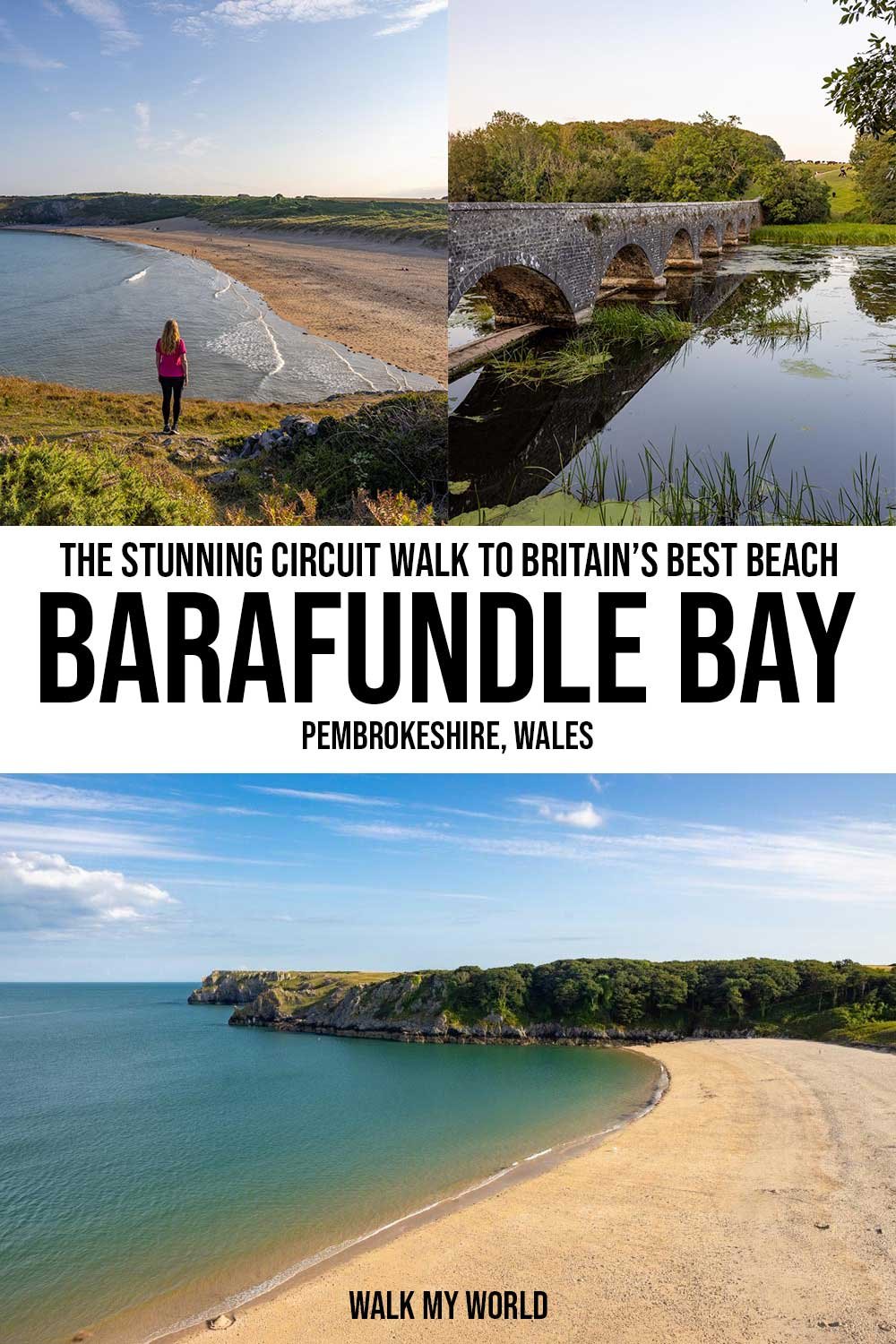
Having spent the last ten years living in Australia, we were somewhat sceptical about Barafundle Bay being voted one of the best beaches in the world! But with a claim like that we knew we had to see it, and let’s just say, we weren’t disappointed! Barafundle Bay really is a stunning beach, with crystal clear water and a large sweep of golden sand, backed by the rugged cliffs that make Pembrokeshire so special.
Visiting the beach is a must do, but if you have the time for a longer walk, then you can’t miss the beautiful circular trail. It takes you over the cliff tops, past secluded bays, giant sea caves and round the picturesque Bosherston Lakes. It’s a relatively easy walk and showcases some of the best scenery in the county.
If you only want to do the shortest walk to the beach, you’ll find that in the notes below too, as the long and short walk both follow the same track until you reach the beach.
Here’s everything you need to know about the Barafundle Bay circular walk.

The Barafundle Bay Walk via Stackpole Quay and the Bosherston Lakes
The stats
Distance: 1.2 miles (2km) return, or 6 mile (9.8km) circuit
Elevation gain: 175m
Difficulty: Moderate
Summary: This Barafundle Bay circular walk does have some hills to climb, but there aren’t any prolonged steep climbs and any hills are broken up with long stretches of flat track. On the whole the terrain throughout the whole walk is very good, it is uneven in parts, but there aren’t any slippery sections.
The path is only partially signposted, so you’ll need a map downloaded, or you can screenshot our directions below to keep you on track.
A significant portion of the trail is fully exposed to the elements, so if it’s sunny, windy or rainy, you will feel it.

Starting the trail: to Stackpole Quay
The walk begins from the Stackpole Quay National Trust car park (full details below) and heads left, passing a nice picnic area. After just 100m you’ll see a path on the left leading down to Stackpole Quay. You’ll arrive at the small bay just 70m later.
We visited a few hours after low tide and there was still a decent sized stony beach and the sheltered harbour makes for a pretty little swim spot.

To continue to Barafundle Bay you don’t need to retrace your steps back to the main path and can instead take the staircase you’ll see on the right, which leads you back onto the main trail.


To Barafundle Bay
After heading up the stairs, you’ll come to a junction and you want to continue on straight, up more stairs. They only last for another 60m before you’ll reach a much flatter dirt track which follows the cliff line, although set back from the edge.
You’ll continue along the flat path, which soon becomes grassy and has some lovely views out to sea. When we walked in summer there were also lots of beautiful little yellow wildflowers. As you continue, the headland starts to come into view and it gets prettier and prettier.

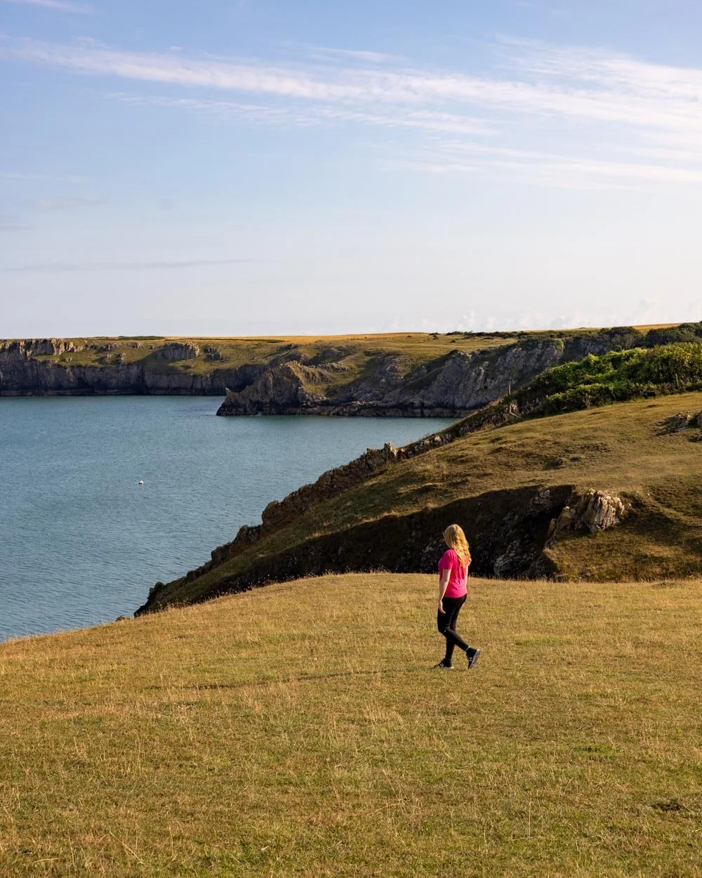
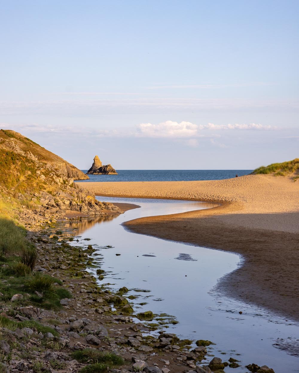
Once you’ve been walking for half a mile/850m (from the car park) you’ll pass through a little archway and take the stone stairs down onto Barafundle Bay.
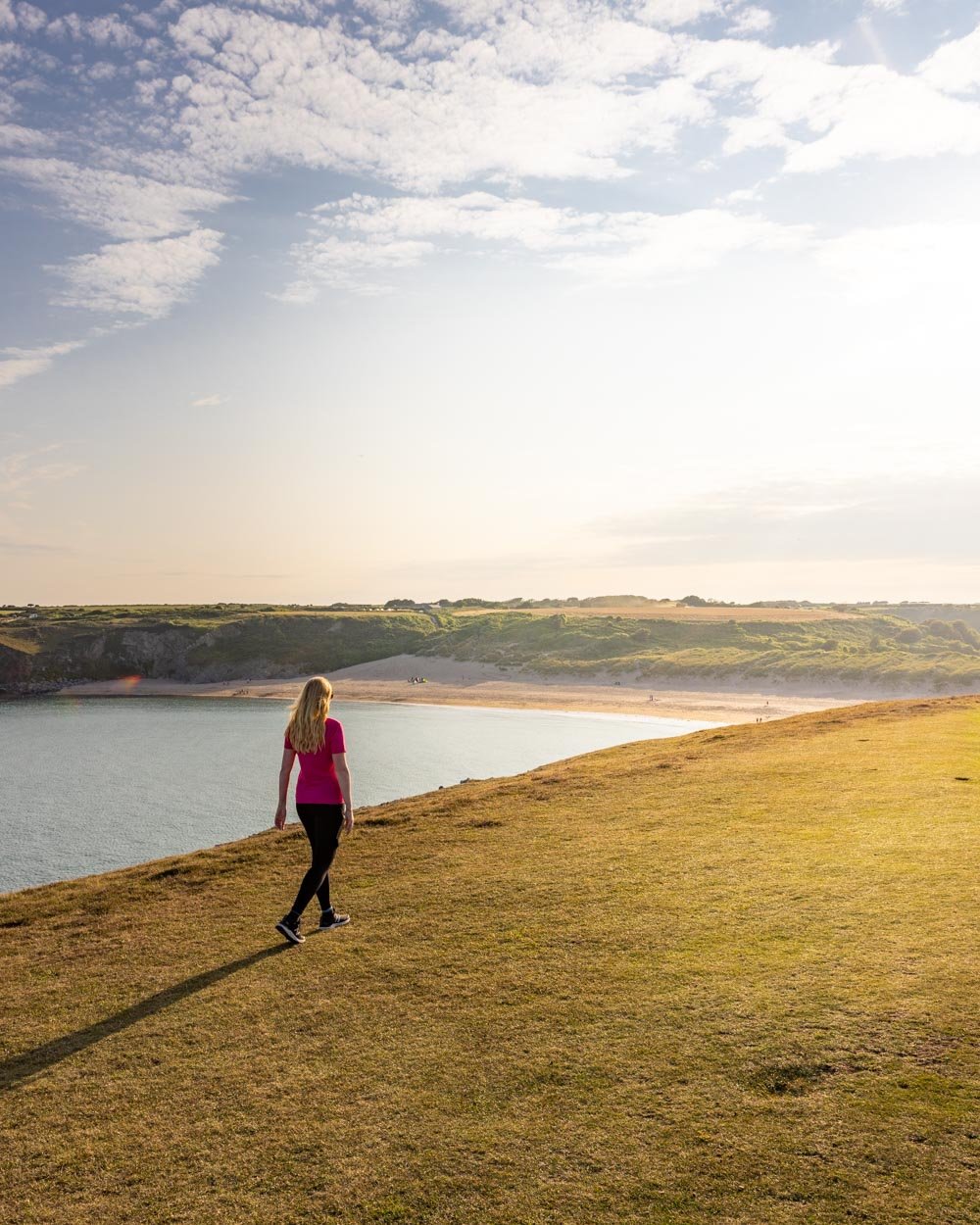
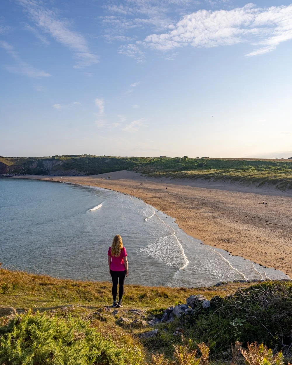
The views from the top of the stairs were my favourite of all. The beach looked magnificent, with pristine golden sand and water that was almost turquoise.

The beach could definitely be in Sydney, but the headland was very much classic Pembrokeshire and the two combined are just spectacular.

The beautiful Barafundle Bay
The stairs drop you down onto the back of the beach and you’ll reach the water’s edge 0.6 miles (1km) into the walk. The water is so clear and it was incredibly calm when we visited, the perfect place for a late afternoon dip.

And on that note, early morning or late afternoon is the best time to visit if you’re planning your trip during the school holidays like we did.
There was barely another soul on the beach, and the rest of the walk was almost entirely empty too, which made it all the more special.


To continue the walk you cross the beach, which is around 250m from the staircase and you’ll see a narrow little track leading up into the woodland. There’s a 100m hilly section before the path flattens again.

Along the cliff tops
You’ll keep following the obvious path, which becomes a grassy track along the cliff tops after passing through a small gate, roughly 70m after the trail flattened.
From here you get some exceptional views of the craggy cliffs and an abundance of sea caves and arches.

It was walking this section of the track that had us vowing to come back with a kayak and explore the coast line from below. It really is incredible.
Some of the formations had names, such as the Lattice Windows, but most remained a mystery to us, despite looking every bit as impressive as some of the more famous spots.

You’ll pass Stackpole Head, with a particularly dramatic sea arch and although there are sometimes social trails leading off to the right, the best route for this walk is to hug the coastline, where you’ll get the best views.


This whole section of the walk is pretty much flat, the path can be uneven so you occasionally have to watch your footing, but overall it’s nice and leisurely.
To Broad Haven South Beach
As you continue along the cliff tops there are quite a few nesting birds, although sadly mainly gulls on our visit, although we’ve heard you can also see guillemots.
Just over 0.75 miles (1.2km) after leaving the beach you’ll come to a little fenced off area, where you need to keep right, which briefly takes you away from the cliff side. This path will drop you back at the cliffs again 300m later.

The cliffs are incredibly sheer and dramatic along this section and we saw some noisy nesting seabirds on one of them, although none were close enough to identify the breed.
We passed a couple of stunning bays that had no route down on foot, perhaps people can visit by sea kayak - although it looked pretty wild and remote.


You will pass through a couple of gates as you continue hugging the path close to the cliff line. Just over 2 miles (3.2km) after leaving Barafundle Bay and 2.7 miles (4.4km) into the walk the next major beach, Broad Haven South Beach, will come into view.
Broad Haven South Beach
You pass through a gate and can then get some great photos of the beach from above before you keep walking on the higher path, which takes you around the back of the beach into some sand dunes.
From the gate to the beach it’s all sandy, so it’s slightly harder to walk on than most of the track to this point as the sand is quite thick.
The path takes you downhill through the dunes and then you’ll get to a signposted junction.

You’ll take a left and this is where you could detour on to Broad Haven Beach itself. You could have also dropped down onto the beach instead of taking the route through the sand dunes if you wanted to walk further along the beach.
It’s another stunning beach, though as it’s easier to access than Barafundle Bay, it does get busier. Still, in the late afternoon when we visited, it was almost empty and we enjoyed the view out to Church Rock in total serenity. The beaches in Pembrokeshire really are some of the best in the UK!

Looking for otters at Bosherston Lakes
If you don’t want to go onto the beach itself, you would take the almost immediate right after that initial left at the signpost. This takes you inbetween some rock walls and then you’ll see the lakes ahead of you.
This next section of the walk doesn’t have all the wows and show-stopping views of the first half of the trail, it has a more subtle beauty and tranquility, which still makes for a lovely second half.

For the best light and the highest chance of seeing the resident otters, we’d recommend walking this section in the early evening, around golden hour.
The woodland and lake looked especially pretty in the golden light and the path was very quiet. The lilies and abundance of water birds made this leisurely trail all the more special - despite the fact we didn’t spot the star attraction, the elusive otters.


The path around the lake is flat, but for the odd stairs here and there and the track condition is very good. You don’t really have to watch your feet at all, so it’s very relaxing.
You’ll cross the lakes a few times on various bridges and then come to a signpost for Eight Arch Bridge. Every time you see a sign for this bridge, it’s the route you want to take.

Eight Arch Bridge and completing the circuit
You’ll reach Eight Arch Bridge 1.9 miles (3.1km) after first arriving at the lakes (5 miles or 8.2km into the walk). It’s a picturesque stone bridge and apparently the best place to look for otters, though as mentioned, we sadly didn’t spot any.

After crossing the bridge you’ll head into a field of cows, lots of cows. Never my favourite part of any walk after being herded once in Whitby, but luckily these cows were content to ignore us and keep on munching.

The track is a gravel path that heads gently uphill and though there are turn offs at times, you always continue straight.
There is one point where you have to climb over an electric fence, but luckily it’s very low, low enough for you to lift most dogs over easily enough.
You’ll arrive at the car park 1 mile (1.6km) after first entering the fields. Although the second half of the walk is not as exciting as the first half, the combination of the two makes for a truly memorable trail.
Getting to the Barafundle Bay walk plus parking info
The Barafundle Bay walk begins from the Stackpole Quay National Trust car park, postcode SA71 5LS. The car park is free for members, otherwise the fees are: £3 for 3 hours, or £6 for all day parking.
You’ll find toilets very close to the car park and at Bosherston Lakes. There’s also a tearoom at Stackpole Quay for some pre or post walk refreshments!
This post may contain affiliate links, meaning at no additional cost to you, we will earn a small commission if you click through and decide to make a purchase. This helps towards the costs of running our website. Thanks for your support.