The Mount Ku-ring-gai to Berowra walk is one of the best station to station walks in Sydney. It’s an absolutely gorgeous bush track with lots of variety, from spectacular vegetation with huge tree ferns and hanging vines, to mangroves and salt marsh.
There are plenty of great creek views, picturesque overhangs and the Berowra Valley’s best lookout. If that hasn’t sold you in yet, there’s even a good chance of spotting a lyrebird.
The terrain is fairly rough for a good portion of the track, but there’s no scrambling involved and the only longish climb comes towards the end of the track, when you’re close to finishing and able to get a nice cold drink!
Here’s the full low down on the fantastic Mount Ku-ring-gai to Berowra Track.

Mt Ku-ring-gai to Berowra via Berowra Valley National Park
To avoid any confusion, this is the track that goes from Mount Ku-ring-gai train station to Berowra train station via Berowra Valley National Park (it’s west of the Pacific Highway).
There is another track which goes between the same two stations via Ku-ring-gai Chase National Park (East of the Pacific Highway). It’s easier than this one, but in our opinion not quite as good (though we are comparing two fab walks). You can find the details of that walk here.
The stats
Distance: 10.8km
Elevation: 373m
Difficulty: Moderate - hard
Type of trail: One way
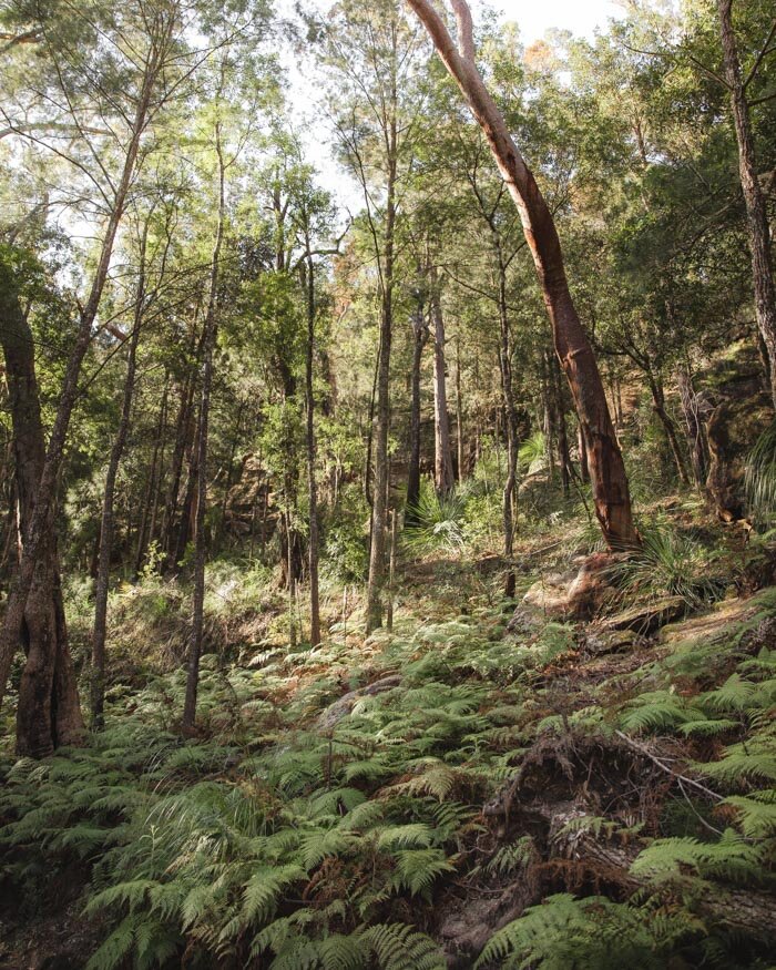
This trail is one of the harder bushwalks in Sydney, and has some rough terrain, the occasional boulder hop and a couple of steep inclines. It isn’t difficult, but you will have more of a workout on this trail than many other Sydney bushwalks!
We took just over three hours to do this track at a fairly steady pace, so if you like your breaks then you will want to add in more time.
Starting the trail at Mount Ku-ring-gai station
On exiting the train station you need to head south down the highway and then cross to the other side of the road using the pedestrian bridge.
From the bottom of the bridge you’ll see a small walkers sign which directs you straight on and then left, where you’ll see the gate into the national park. The section before you enter the gate is 500m long.


You’ll immediately begin descending on a paved trail which is more like a road. There is pretty bushland on both sides of the track though, so it feels nice and bushy from the off.
The fact that it’s paved makes the steep descent quick and easy. After 500m the paved track gives way to a dirt path and it briefly flattens. Then you’ll see a sign for the trail and a Great North Walk register.


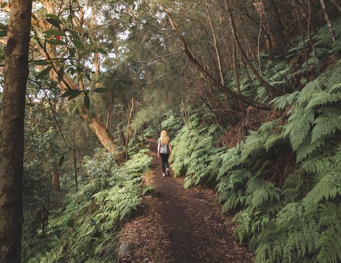
Along Lyrebird Creek
After 350m on a flat path the trail begins descending again. This time it’s fairly rocky so it’s a bit slower going.
From this point in, it feels like a proper bush track and though you hear the occasional bit of road noise at first, it’s soon replaced with only the sounds of the birds and the running creek.

After a few hundred metres more descending (there are handrails in place anywhere it might feel slippery), you’ll be walking by the creek and the vegetation becomes much greener.
We were absolutely thrilled to see two lyrebirds on this section, which is aptly named Lyrebird Creek.
We didn’t manage to get any pictures, but we did see them fly, which is a first for us! They then proceeded to serenade us with lots of different bird calls for around ten minutes!

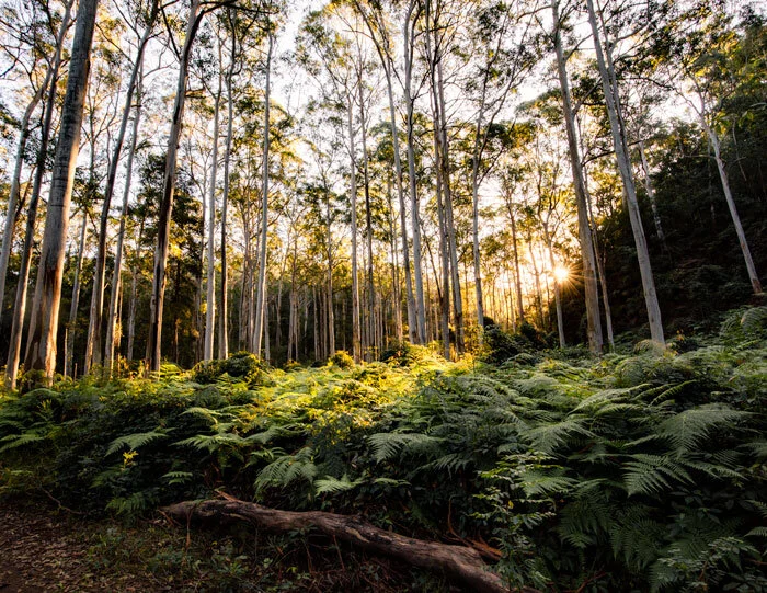
The vegetation either side of track is dense and it’s a lovely shady environment to walk in. The path is quite flat although the rockiness at points means you don’t walk as fast as you might expect to.
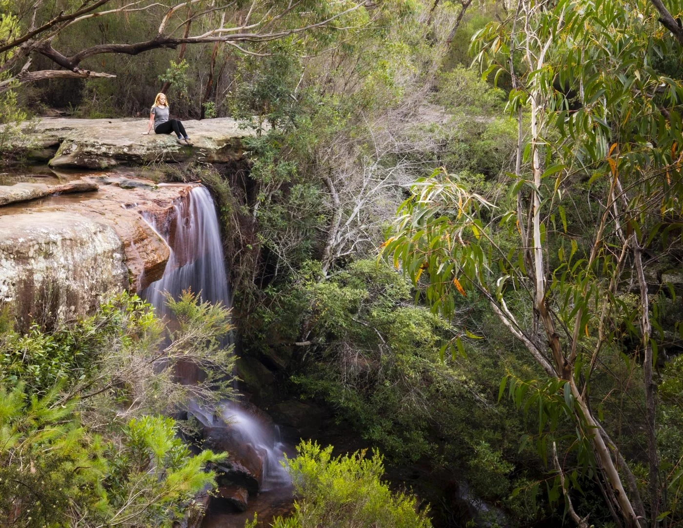
You’ll cross the creek and then continue to walk beside it for another kilometre before coming to a small waterfall, Lyrebird Gully Falls.
You can only see it from above and it won’t have much water unless there’s been a lot of recent rain but it’s a pretty spot.

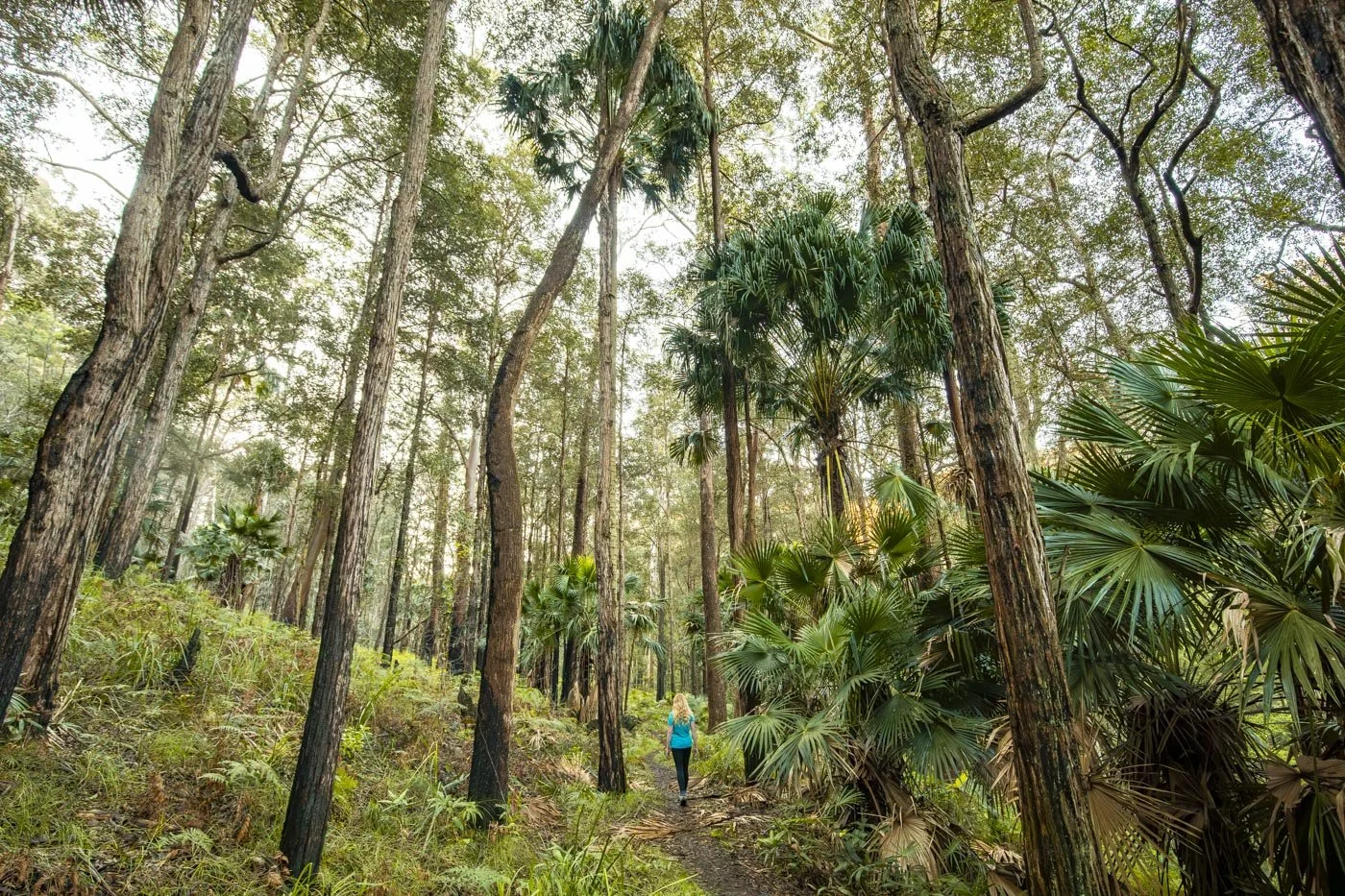
Through the jungle!
Just beyond the waterfall you’ll climb slightly uphill until you reach a really impressive set of overhangs, Lyrebird Caves.
Just beyond the caves is a lovely flat section of track, with hundreds of ferns and some pretty pink wildflowers (in spring).


You’ll then descend slightly until you reach Calna Creek. This next section feels incredibly wild and jungly with the deep green creek, huge mossy boulders and so many dramatic hanging vines.
It’s a fantastic part of the walk, and a moment where I had to stop and marvel that you can get to a spot like this directly from a train station!

It’s absolutely stunning and a real trail highlight for me. The vegetation is a whole new shade of green, almost illuminous, and the creek runs faster.
You’ll cross over the creek on some pretty huge boulders which have footholds carved into them to make it easy.


You’ll continue along the creek in a viney wonderland before coming out at a long patch of mangroves. This is 4.4km into the track, so you can see how varied this walk is already!

Through the mangroves and marshes
Up to this point I’d been saying that though there are never any big climbs on the trail the rough terrain means it’s fairly slow going.
Once you get to the mangroves the path completely smooths out, making quick work of the next section.

You’ll walk on the flat dirt track between the mangroves and the forest, passing a small campsite, before you come to a junction.
You’ll follow the sign for Berowra Waters and head straight onto a picturesque boardwalk through the salt marshes. This is labelled on Google Maps as “The Place of the Winds” which seems like a very poetic name for a unique and beautiful area.


You’re surrounded by marshland with craggy tree covered cliffs ahead of you and it feels completely different to any other part of the walk.
The track then leaves the marshes and gently undulates alongside the creek. There’s another signpost confirming you’re on the right track at the 5.5km mark.

The climb to Naa Badu Lookout
After a couple of hundred metres you’ll be following Berowra Creek which is so wide that it feels like a river. The track is narrow and rocky and continues to undulate a fair amount before arriving at a smaller creek.

After crossing the creek the first part of the climb begins. It’s on a mixture of stairs and rocks and it’s a little narrow in places, but there’s a hand rail if you need.
There’s also a bench part way up! The bush views are fab and it’s not too long (750m) before you reach a junction and some flat track!


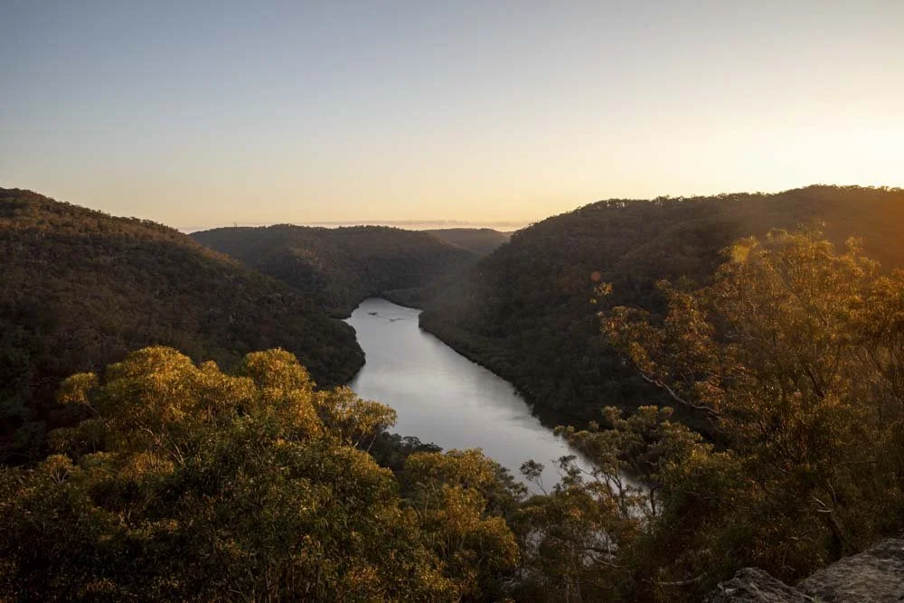
It’s not signposted, but at the junction you want to turn left to make a short detour to the Naa Badu Lookout. It’s only 250m each way to get there and it is well worth it - it’s also totally flat so no hardship!

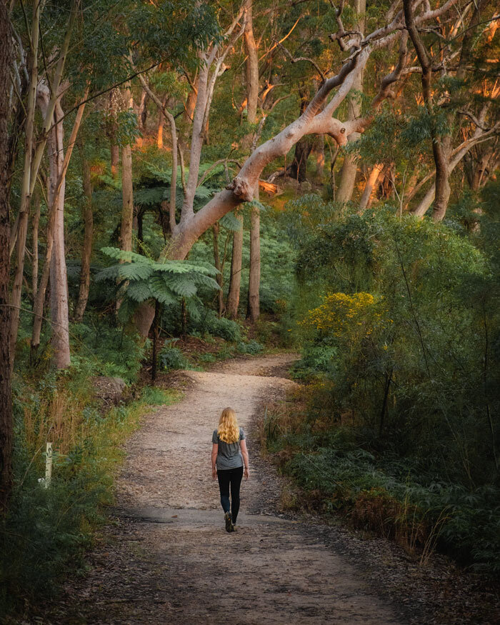
The view of Berowra Creek and the surrounding bushland is absolutely stunning, and one of our favourite views in the area. We happened to get here at golden hour which made it even more beautiful.

Finishing the trail
Once you can tear yourself away from the view, you’ll return along the wide dirt path to the junction. The bush is absolutely beautiful here, with dense vegetation rising all the way up the steep cliffs.

Keep an eye out for wildflowers along this next part of the track if you’re walking in spring.
We were lucky enough to see many Waratahs along the way, which looked truly magnificent against the dense green backdrop.

The track is largely flat, with the odd gentle undulation for the next kilometre and it’s really relaxing after the climb.
At the 9km mark you’ll head briefly downhill before joining a much narrower path.
After another 500m you’ll come to the final part of the climb. It’s only 450m long, although it is fairly steep and back on rougher rocky terrain. It’s not too bad though and there’s a new staircase and a few new steps from the last time we did this walk which helps.
After 450m you’ll come out of the bush and hit the road. From there you follow one road for 650m to the train station.

Overall, it’s a fantastic trail which we rate as similar in difficulty to the Jerusalem Bay Track, whilst it’s shorter and has less climbing, the terrain is rougher for longer which makes it feel a little harder work than it otherwise would.
Essential information about the Mt Ku-ring-gai to Berowra Track
Getting to and from the trail heads
This is a great walk to do by public transport, but if you do want to drive you can park for free on the Pacific Highway by Mount Ku-ring-gai train station and then get the train back (one stop) from Berowra to your car.
From Central station it takes just under an hour to get to Mount Ku-ring-gai and trains generally run every half hour, or every 15 minutes at peak times on the North Shore line. It’s roughly the same amount of time from Berowra back to the city.
This post may contain affiliate links, meaning at no additional cost to you, that we will earn a small commission if you click through and decide to make a purchase. This helps towards the costs of running our website. Thanks for your support.
Like it? Pin it!

Follow us on Social Media
What’s your favourite walk in the Berowra area? Let us know in the comments below!