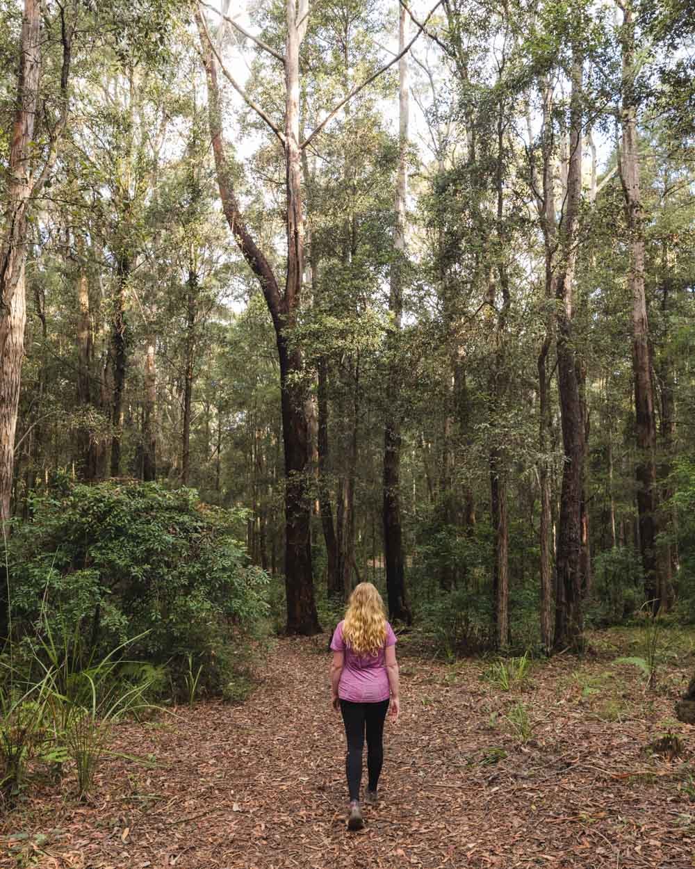
Abbotts Falls is tucked away in a gorgeous rainforest grotto. It might not be one of the biggest waterfalls in the area, but it’s definitely one of the most atmospheric. The walk to get there takes you through a wild and pristine rainforest, there’s a path, but it’s not been stripped back and tamed. You’ll duck beneath giant hanging vines and hop over mossy boulders in what feels like a real adventure.
Signage on the track is an issue at points and reaching the base of the waterfall requires going off track, but we have you covered on exactly how to do it.
Here’s everything you need to know about the Abbotts Falls Track.

The Abbotts Falls Track
The stats
Distance: 8.5km circuit including the base of the falls
Elevation gain: 279m
Difficulty: Moderate
The Abbotts Falls Circuit has a reasonable amount of climbing to do, but also plenty of flat trail too. The path is less well maintained than you would find in a national park and does have a few slippery sections - although nothing too hairy.
To reach the bottom of the waterfall you need to climb down a rock chute which is aided by two ropes making it very doable - without the ropes would be another matter. I would also think twice before doing this trail in the rain as I think sections could become quite slick and there is plenty of leaf litter which would make otherwise straightforward descents a bit trickier.
Signage is an issue throughout the trail, but we took coordinates for the most important turns so that you don’t go wrong or miss the falls entirely - which happens to more people than you’d think!
It’s a great summer walk because it is fully shaded the entire way.

Finding Abbotts Falls
Starting the trail at the Pines Picnic Area
Although you can start the trail at different points we think it’s easiest to start at the Pines Picnic Area. From here you won’t struggle to find the beginning of the track like you might if starting at other points.

From the picnic area head along the road in the direction of the small toilet, continue down the road past the toilet and after 300m bear right.
You’ll see two signs for the Abbotts Falls Track in quick succession.


The trail is quite eroded at the beginning and whilst the bush is pleasant, I’ll admit I began lowering my expectations for the walk.
Happily that only made me more thrilled when it later became absolutely spectacular.


After 550m you reach a crossroads, continue straight. You will have been gently descending up to now but a few hundred metres later it becomes much steeper.
In dry weather it’s not too slippery and the forest starts to get a bit more lush.

Descending into the rainforest
The path will take you downhill and over a small creek and then head briefly uphill. It’s easy enough to follow and though not manicured, it’s not in bad condition.
At the 1.3km mark you’ll reach an un-signposted t-junction just after a grey post, you need to turn left. You’ll then quickly pick up a red trail marker (170m later) to reassure you you’re on the right track.


The track then begins descending steeply again. I took it a lot more slowly which gave me plenty of time to check out the new surroundings.
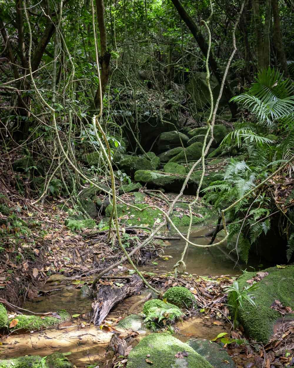
We’d left the eucalypt forest behind and suddenly entered an incredible rainforest.

It has full jungle vibes with several little tree tunnels where you have to duck to make your way under the mass of leaves and vines.
It was from this moment that the trail began exceeding all my expectations. I had no idea we would be walking in a wild stretch of rainforest.


There are plenty of rainforest trails within a couple of hours of Sydney, but few, if any, feel quite as untamed as this one. It was fabulous.
The descent continues and the dirt path does have a few slippery sections - which would be worse if very wet. It’s not awful, but unless you are really confident, requires a bit more care. I’m prone to slipping and just took it slow and steady, the scenery really warrants this anyway!
Through the jungle
The descent lasts around 400m before the trail flattens and you find yourself in Indiana Jones territory.
The path is fully surrounded by a tangled mass of hanging vines and twisted roots and you feel like you’ve entered another world. You’ll then head up a few mossy steps and reach Dora Creek a few minutes later. The creek is surrounded by giant boulders and the huge palm which has fallen over the water only adds to the wild feel.


You’ll cross the creek and soon reach a glorious patch of giant palms. It reminded me a little of the forest I fell in love with at Minyon Falls, close to Byron Bay. It’s truly beautiful and a joy to walk through. I only wish it lasted longer.

From here the path can be a little hard to see at points, you might think for a moment there’s no path at all but then walk a few steps further and you’ll spot it again.
It will begin winding down towards a bigger creek which you’ll reach roughly 300m after leaving the palm grove.


Finding the route to the bottom of the falls
You’ll cross over the creek, which is easy as there is a big boulder to use to get onto the rock platform. We visited after weeks of heavy rain and it was fine so it would have to get really bad here for it to get your boots wet.

Once on the other side of the creek there’s a trail marker pointing you uphill. You’ll be able to see the cascades and hear the waterfall below, but you’re quite high above it.

Finding the trail to the base of the falls
After approximately 250m you will see a faint path heading uphill on your left - or in fact you may not as it’s really not obvious. For this reason we took the coordinates: -33.0686519, 151.3529761 (click here to see the spot on Google Maps.

This is the spot where you can either turn left to carry on the loop, or straight on to head down to the bottom of the falls. It may feel wrong (it definitely did for us), but you need to keep walking further away from the sound of the waterfall. There are a few very small arrows etched onto tree trunks as you go.
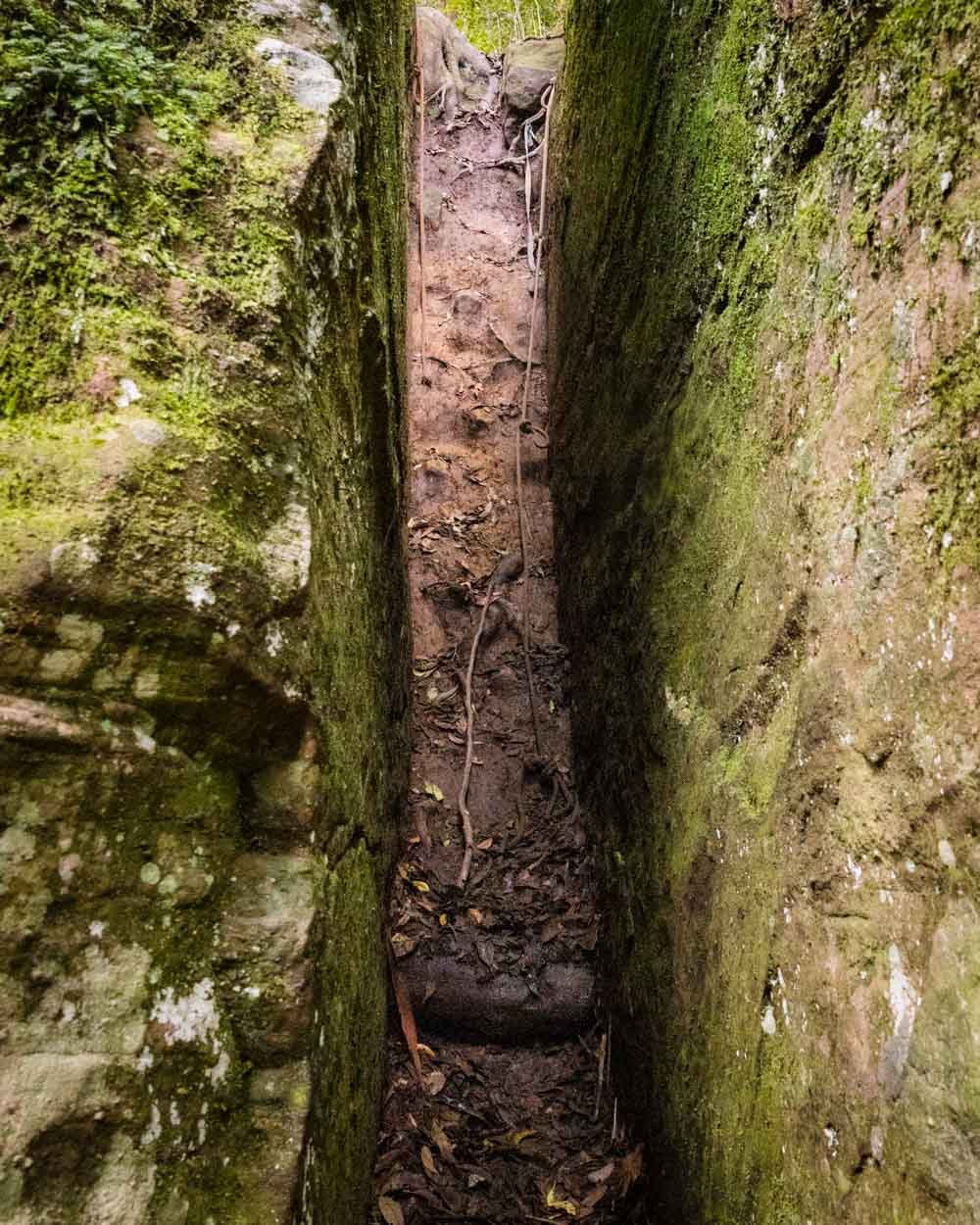
The forest is gorgeous and though this is technically off track there is very much still a decent path to follow. Roughly 150m after the turn off to continue on the main trail, you’ll come to a rock chute. The coordinates for the rock chute are: -33.0693284, 151.3539698 (or you can find it on Google Maps by clicking here).

It actually looks bigger than I thought it would be and a little intimidating. It brought back memories of Gerringong Falls but I found it much easier than that - thanks entirely to the sturdy ropes! The best way to tackle it is going down facing the wall like a ladder.


There are footholds cut into the mud and a hefty rope on either side of you. The first foothold in my opinion was the smallest so once you’re down that one it feels more stable getting to the bottom.
There is no exposure because the walls are closed in around you.
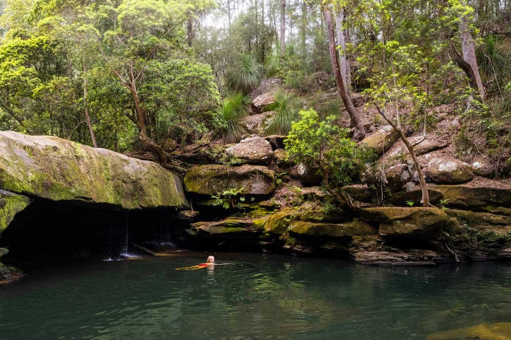
Arriving at Abbotts Falls
From the bottom of the rock chute the path curves to the right and is narrow, but easy to follow.
It looks like you used to be able to stick high beside the cliff wall, but currently there is a lot of debris over the path. It’s easier to first start low and then when you see the short steep little trail up to the overhang, take it.


You will then walk through the overhang and have just a few rocks to climb down to the sandy beach and the base of the falls.
It’s a wonderful little spot. The waterfall is not tall and grand, but the huge overhang and grotto walls give it an air of mystery and seclusion.

It’s also surrounded by dense rainforest which combined with the cave keep it slightly dark and cool, even in the height of summer.
The water didn’t look inviting for a dip as it’s a little dark but it was cool and refreshing for a paddle.


We visited in the school summer holidays and we were the only ones there which was unexpected and made it feel like a real hidden gem.


Once you’re ready to leave the falls, retrace your steps to the junction with the main trail, which will be on your right from this direction. The rock chute is very easy to ascend as you can see every foothold and don’t have to worry about losing your footing.

Through the forest
Once back at the junction, the trail begins heading uphill through dense rainforest. It can be indistinct at points and a little overgrown, but you will always spot it if you stop for a second.
You’ll continue through the rainforest for just under 500m. It is mainly uphill but not very steep.

At this point the forest begins to open up but is still lovely and shady. The track gets quite a bit steeper as you head towards the road which is now just 300m away.

At the road you’ll see a signpost to head left for the Pines area. I am not generally a fan of any walks which spend significant time on roads, but to be honest this one doesn’t feel like a road.


It’s feels like a slightly wider than your average bush track and the forest is beautiful, especially in the golden light of the late afternoon. I hadn’t been looking forward to this part of the walk but I actually really enjoyed it. It was full of birdlife and incredibly peaceful.
There is still some uphill to go at first, but it soon flattens for a considerable length of time. After heavy rain there will be some giant puddles along the track, but it’s easy to skirt the sides. The trail will head uphill again after a time, but it’s not steep.

Roughly 2.7km from beginning along the ‘road’ you’ll reach the main road and follow the walking sign to the left.
Completing the circuit
The last part of the walk is really hard to describe because there are so many little turnings to make. Essentially you spend most of it traversing through various campsites which are shady and pleasant - and very quiet even in summer!
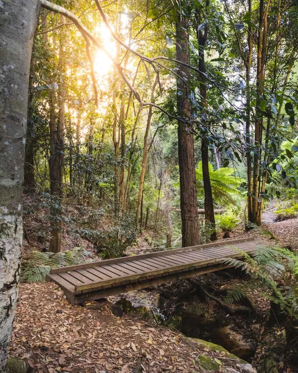
You need to head to Casuarina campsite, followed by the Turpentine Campsite (500m beyond Casuarina) and follow the red signs for the Pines Campsite (you’ll cross a small wooden bridge and then walk over a grassy area to reach the campsite).
You can then head left back into the forest from the campsite and you’ll see a small wooden bridge over the creek.

There’s a small waterfall which is a one minute detour on your left down the stone steps - it’s not a must do by any means but a pleasant enough spot.
The main trail continues to the right, through the forest, keeping the creek on your right. Look out for wallabies on this stretch, we startled a couple : )

You will then emerge into the Pines Picnic Area and can cross back to the car park. This last section was hard to follow at points and hard to describe, so keep a close eye out for the red signs to stay on track.

A word of warning before you hike
If you are really leech averse this might not be the hike for you. I should probably rephrase that because who isn’t leech averse? I hate them, but have had to begin tolerating them after two years of very wet weather and therefore ideal leech conditions! After rain this trail is very leechy.
Not as leechy as Dorrigo’s Blackbutt Trail but we still had to remove plenty. I know everyone has their own way of dealing with leeches but my preferred method is spraying a bit of OFF on them.
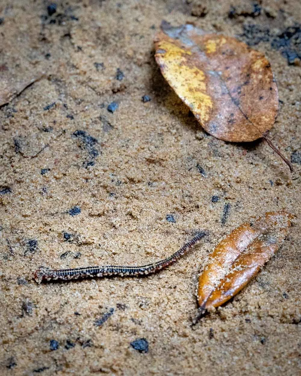
They curl up and then they are easy to flick off with a stick. If they haven’t latched on to you yet, you can remove them with a stick without spraying them and they’ll live to fight another day.
I don’t want to put anyone off because I loved this trail and my leech tolerance is quite low, but I didn’t feel I could not mention it when you are likely to see them. You will see less if it’s been dry.
They are predominantly in the rainforest part of the walk so you can relax when you’re in the dry forest!
Getting to the Abbotts Falls Track
The Abbotts Falls Track is located in the Olney State Forest in the Watagans. We started at the Pines Picnic Area, which is on Google Maps. The last 6km into the picnic area is on an unsealed road. It’s passable for any car (at time of writing) but it is potholed and corrugated. It’s not a nice road to drive, but if you take it slowly it’s ok.
From Sydney CBD it will be around a 1 hour 45 minute drive and from Newcastle a little over an hour.
The car park has pit toilets and there are picnic facilities too. There are plenty of free (designated) campsites in the forest and they were all gorgeous.
This post may contain affiliate links, meaning at no additional cost to you, that we will earn a small commission if you click through and decide to make a purchase. This helps towards the costs of running our website. Thanks for your support!