Some of the most beautiful hikes in the world can be found in Costa Rica. From rainforest walks teeming with wildlife, to hiking old lava trails with incredible volcano views and jungle tracks with blue waterfall after blue waterfall. And if you’re looking for hikes that include wild swimming and even a dip in natural hot springs, we definitely have you covered.
We’ve put together this list based on our favourite hikes so far, but there’s no doubt we’ll be back for more one day because hiking in Costa Rica is magical.
Here are 19 of the best Costa Rica hikes.

19 of the best hikes Costa Rica
A quick note on hiking in Costa Rica
As hiking is usually a free or cheap activity, we thought we should point out early on that most hiking trails in Costa Rica are neither. Whether you’re walking on private land or in a national park, the fees for foreigners are quite high. For every hike we’ve recommended in this article we include all the details on fees in the individual guides linked in each section. We’ve also included tips for avoiding the crowds to help you make the most of your money.
Also in relation to the difficulty of these hikes. you’ll want to factor in the weather. Any hikes which are exposed to the sun (which actually isn’t many in this list) will be harder due to the heat and humidity.
1. Drake Trail
Area: Drake Bay
Distance: 8.5km - 11km one way (you can get transport back to the start)
Elevation gain: 150m
Difficulty: Moderate
The Drake Trail is wild, it’s the side of Costa Rica you were probably dreaming about when you first thought about visiting. You hike past endless pristine beaches and small coves, and the further you get from Drake town, the more remote they start to feel. If you’re looking for Robinson Crusoe vibes, this is your trail.

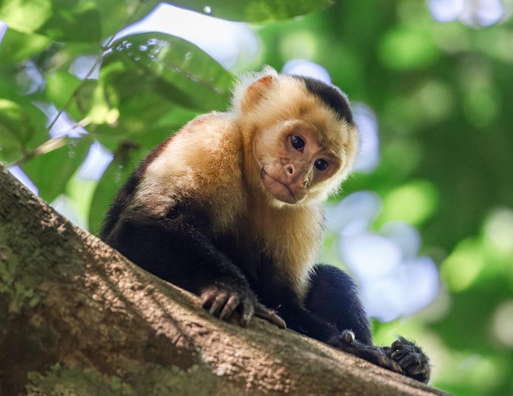
The tree tops are alive with Capuchin monkeys and Scarlet macaws soar overhead. We saw people at the beginning of the walk and at the end, but nobody at all on the whole 10km inbetween.
The walk is long, even longer if you choose to walk both ways (we’d recommend organising a taxi one way) and the sun is intense.
But in terms of the trail itself, it’s reasonably flat and pretty easy due to the predominantly good paths. However, this does change if you go past Playa San Josecito, which makes it a good turnaround point.
All the details on the Drake Trail and how to organise your one way hike are in this guide.


2. The Manuel Antonio Circuit
Area: Manuel Antonio
Distance: 6.9km circuit (inc side trails)
Elevation gain: 290m
Difficulty: Easy - moderate
There are plenty of beautiful trails in Manuel Antonio, but if you want to see the best of the park we’d recommended this route: head along the Official Road Trail to Las Gemelas twin coves before climbing up to the Mirador Lookout. Next head for the main beaches and then on to Punta Catedral before walking back to the entrance via the Sloth Trail. These trails combined create one epic circuit. More details on each spot can be found in this guide.
You’ll start on what is definitely the least inspiring bit of the hike, as it’s really just a gravel road (that cars cannot use) but this is where you’ll see the most wildlife. We saw multiple sloths, an anteater, an agouti and many birds, all without a guide.

You’ll continue on to small coves with sensational views before heading up to the Mirador - the only steep part of the walk. It offers fantastic views and the chance to see more wildlife. After visiting three more stunning beaches the circuit ends with the Sloth Trail.
The paths along every section of this circuit are well maintained and generally either concrete, or compact dirt, so they’re nice and easy to walk on.


For more tips on visiting Manuel Antonio, we have you covered in this guide.
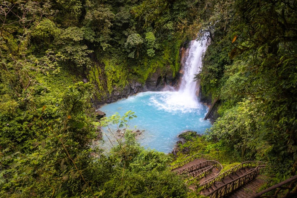
3. Rio Celeste Waterfall
Area: Tenorio National Park (most people visit from La Fortuna)
Distance: 3.2km return to the waterfall, 5.7km return for the whole trail
Elevation gain: 225m
Difficulty: Easy, but not flat
Rio Celeste is one of the most spectacular waterfalls in Costa Rica. The colour of the water needs to be seen to be believed. Most people simply walk to the falls and back, but those who venture further will find a swing bridge over electric blue water, a hot spring and even the confluence where two rivers meet; one is brown and one is the astonishing turquoise colour you’ll see at the waterfall - it’s such a crazy sight.

The walk to Rio Celeste Waterfall is all on a well maintained track. Almost all of it is gravelled or concrete. The only significant climb is down to the waterfall and back up again, which is on stairs that are in good condition, and there are handrails.
The path becomes more rustic beyond the waterfall, with some sections that are rocky and tree rooty. This part of the track does have a few bits which could become muddy in the rainy season, or after heavy rain.


You can see more details on the trail, as well as where to find some incredible swimming holes nearby in our Rio Celeste guide.
4. Mirador El Silencio circuit
Area: La Fortuna
Distance: 6km circuit
Elevation gain: 325m
Difficulty: Moderate
Mirador El Silencio offers one of the most incredible views of Arenal Volcano, in fact we think it offers the very best view of all, and we hiked in three different volcano reserves.
To reach the viewpoint you’ll walk through primary rainforest teeming with birdlife, and emerge from under the canopy to hike up a section of old lava flow, which takes you up to the lookouts. Arenal looms over a mass of jagged volcanic rock while toucans and swallow-tailed kites soar overhead.

There is a fair bit of uphill on this walk, but the track was in good condition with very little mud (despite the fact we visited after plenty of rain). There are some bits with rocks and tree roots, but nothing overly challenging. The track is a mix of well manicured and rustic paths, but nothing gnarly.


You can read about our full route in this guide (we also detail a shorter route if you have less time).
5. The Santa Elena Circuit
Area: Monteverde
Distance: 6km circuit
Elevation gain: 380m
Difficulty: Easy - moderate
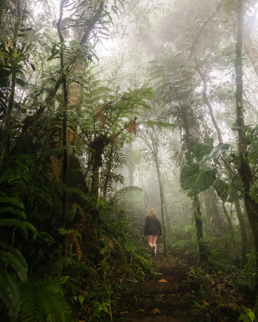
Santa Elena Cloud Forest Reserve is a magical place, much of the forest canopy is so dense that almost no light penetrates, and the effect is total immersion in nature.
The dirt tracks keep the forest feeling wild, and the atmosphere is one of mystery. There are several trails you can choose to explore the reserve and we’d recommend combining the Encantado Track with the Del Bajo Track, before finishing on the Youth Challenge Trail to form a spectacular circuit walk.

The forest is especially dense on these trails with huge trees looming over the path giving it a wild jungle vibe that can be lacking on some of the more manicured trails in Costa Rica’s cloud forests.
The paths are more rustic and prone to mud than the better maintained trails in Monteverde, but in dry season they were in pretty good condition. There is some elevation gain, but never anything overly steep and only one or two very short slightly slippery spots.


You can read more about Santa Elena and the individual trails here.
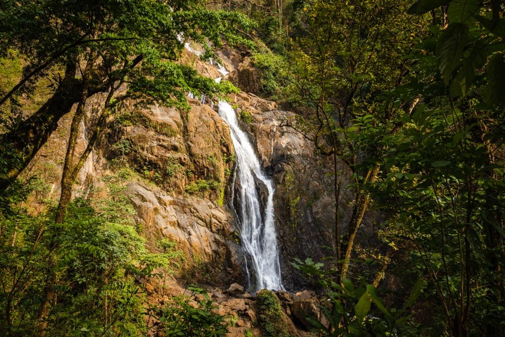
6. Catarata Del Toro
Area: Bajos Del Toro
Distance: 2.7km partial circuit
Elevation gain: 150m
Difficulty: Moderate
Catarata Del Toro thunders into an extinct volcano and then down through a narrow canyon - a truly mesmerising sight. Standing in front of the waterfall allows you to really get a sense of its immense power and you can’t do it for long due to the spray!

The walk to the bottom of Catarata Del Toro doesn’t have any tricky terrain, but it does involve a steepish climb down, and then back up again.
The very last section (which you don’t have to do) has a less well maintained path and can be a touch slippery. However, you will have seen several amazing lookouts by this point, so you don’t have to go to the very bottom if you don’t want to.


Here’s a detailed guide to the trail.
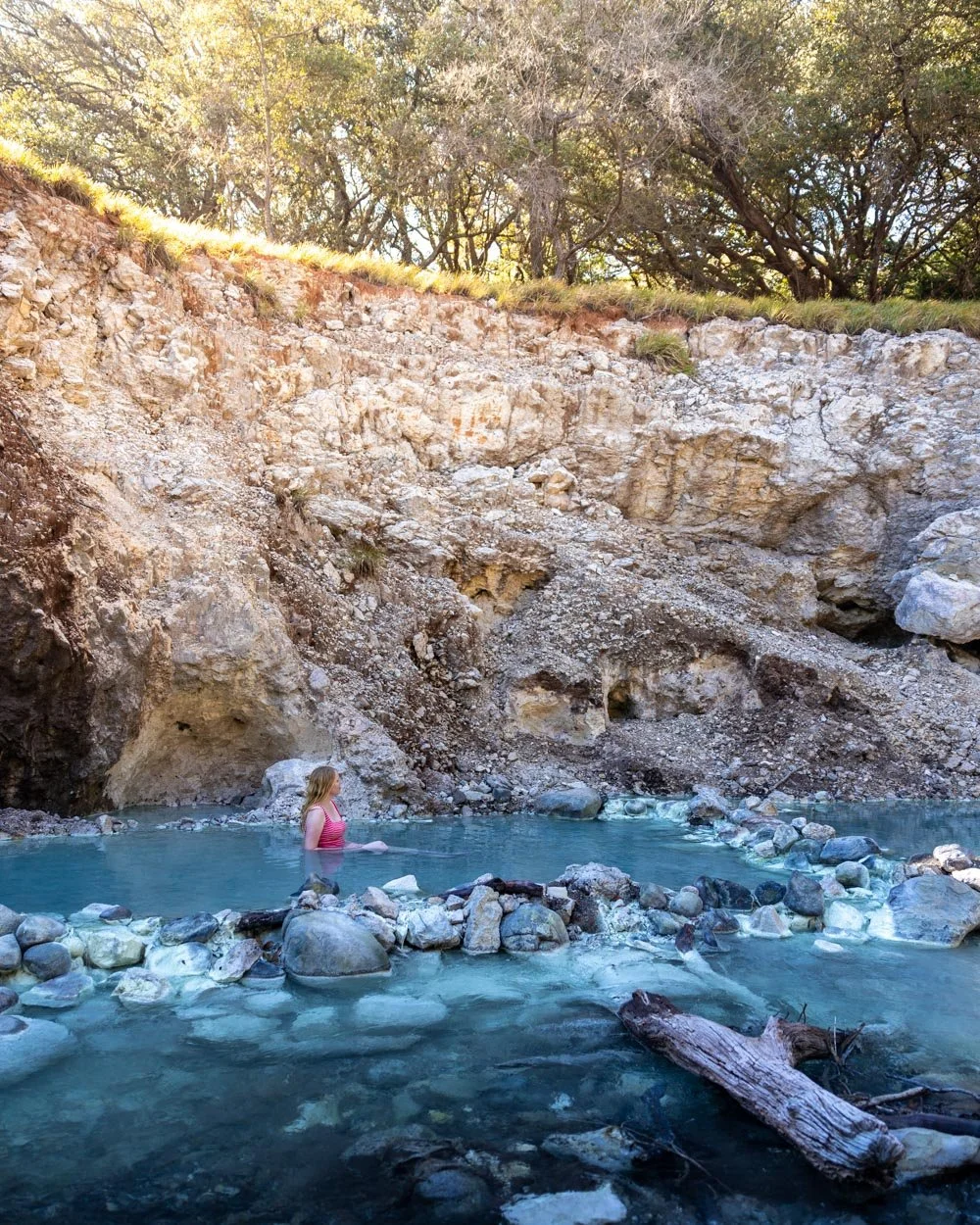
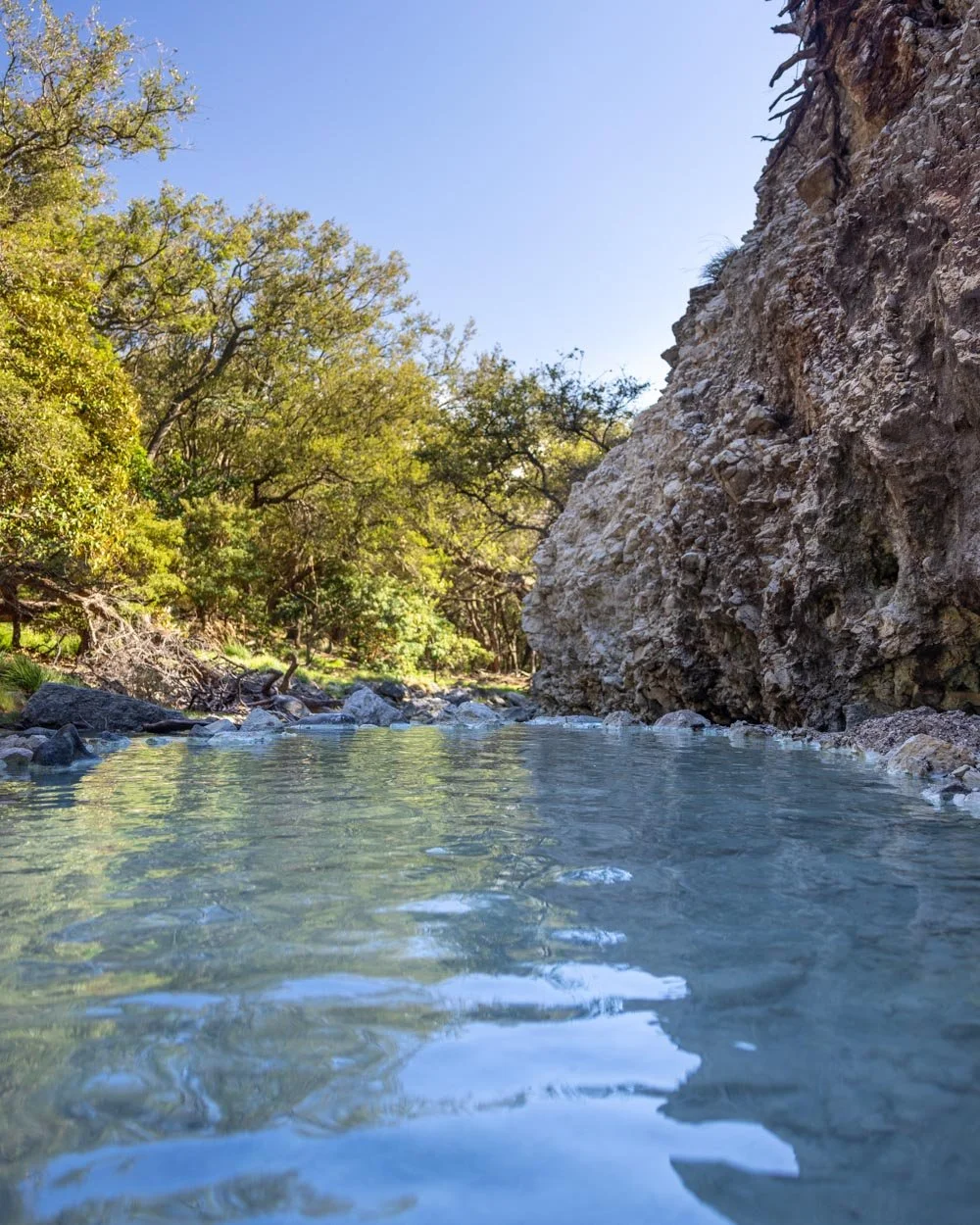
7. Santa Maria Hot Springs
Area: Rincon de la Vieja National Park (most commonly visited from Liberia)
Distance: 6.4km return (including all side trails to the waterfalls)
Elevation gain: 200m
Difficulty: Easy to moderate
The Santa Maria Sector in Rincon de la Vieja National Park must be one of the most underrated gems in Costa Rica. While everyone pays huge sums of money to bathe in the hot springs of La Fortuna, you can soak in natural blue hot springs in the forest for free! Well for the price of the national park entry fee anyway.
The trail to reach the springs also passes two small waterfalls, one of which is great for a dip. However, it’s those enchanting forest springs at the end of the trail that make this walk magical.
The walk to get to the hot springs is not difficult in the dry season. There are a few river crossings, but all are very easy during times of low rainfall, and you don’t need to get your boots wet. In the rainy season, it’s a different story and these crossings are trickier - though there are wires in place to help you.
Aside from the river crossings, the trail is mainly a good dirt path. The track does have a few climbs, but it’s rarely steep. The majority of the walk is in the shady forest.

You can read the full details in our Santa Maria Hot Springs guide.
8. La Leona Waterfall
Area: Liberia
Distance: 2.7km return
Elevation gain: 115m
Difficulty: Moderate
If you’re looking for one of Costa Rica’s best adventure hikes, and one of its most spectacular waterfalls, this is it. La Leona Waterfall is incredible. It flows into a deep orange canyon, forming a stunning blue swimming hole at the base.

The walk to get there involves traversing jaw-dropping blue rivers, climbing small ladders and then swimming using a rope to fight the current, before you’ll finally reach the foot of the canyon waterfall itself.
As you have to visit with a guide, you’ll be in good hands, and if there are any bits that you’re unsure about, they will be able to help. A trip to La Leona might just be your most memorable hike in Costa Rica.


Here’s our guide to La Leona which includes pictures of all the bits which might be considered tricky. You can only access La Leona by a guided tour and you can check out the tour operators and latest prices on Get Your Guide with the button below.

9. La Cangreja Waterfall
Area: Rincon de la Vieja National Park (most commonly visited from Liberia)
Distance: 10.5km return
Elevation gain: 420m
Difficulty: Moderate
The walk to La Cangreja Waterfall is one of the longest on this list, but the reward is worth the effort. The trail isn’t just about the waterfall either, as we saw more monkeys on this walk than any other hike we did in Costa Rica - and we did a lot of hikes!
We saw big troops of both Spider and Capuchin monkeys, who were close enough to shake a fist at us - sounds cute, but you’ve never seen us move so fast in the Costa Rican heat.

The waterfall is also gorgeous, with crystal clear water and high cliff walls. It’s quieter than many in the area, which might come down to the length of the walk.
The walk to La Cangreja Waterfall is not particularly difficult, but the heat does make it more challenging than it would otherwise be. There are two sections which are fully exposed to the sun, which felt pretty brutal on a 35C (95F) day. For this reason we’d recommend hiking in the early morning, or on a cloudy day.


The trail is in pretty good condition; there are some rocky sections, and the odd bit of loose soil, but generally speaking, it was in decent shape. You can read more about the trail here.
10. The Blue Falls circuit
Area: Bajos Del Toro
Distance: 6.3km partial circuit
Elevation gain: 310m
Difficulty: Moderate
The Blue Falls are out of this world. The series of turquoise waterfalls are located in a pristine patch of rainforest, creating some of the most magical scenes in the country.
At first we were disappointed when the predicted sunny weather didn’t happen for us, but in fact the cloud and mist made for one of the most atmospheric walks we’ve done. Watching the mist seep into the mossy forest honestly looked like a scene from a fairytale. It’s an unforgettable place and a must visit if you love waterfalls and wild swimming.

All five waterfalls are located along maintained tracks. They can be rustic in parts and require the odd bit of rock hopping, but generally speaking, the paths are pretty good.
There is some elevation gain as you make your way down and then up from the various falls, but no climb lasts very long. The most challenging waterfall to visit is Tepezquintle.
This one does involve a bit more boulder hopping and a river crossing (using rocks as stepping stones). Bits can be slippery, but your (mandatory) guide will always give you a hand if necessary.
Here’s all the details on the Blue Falls hike.

The Blue Falls hike is only accessible with a guide. You can compare the guides and their prices on Get Your Guide by clicking the link below.
11. Catarata Vuelta Del Canon
Area: Bajos Del Toro
Distance: 10.2km return
Elevation gain: 250m
Difficulty: Moderate
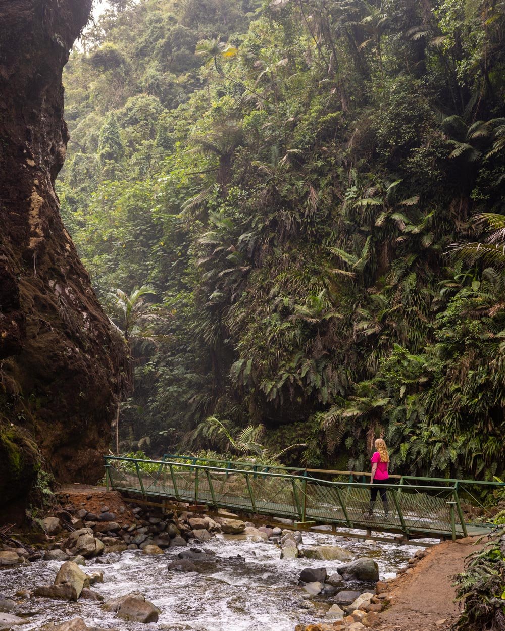
Located deep in a pristine cloud forest lies one of the most atmospheric waterfalls in all of Costa Rica. With towering mossy walls and turquoise water, this double drop waterfall has the wow factor.
The walk to get there is a bit of adventure, requiring traversing the river many times. You’ll also pass through stunning cloud forest and it’s generally very quiet (we never saw a soul).

Depending on recent rain the track will either be relatively easy, or a little more challenging. If there’s been a lot of rain the track can become extremely muddy. We’re talking tie your boots as tight as you possibly can or you’ll lose them type mud, but it can also be very dry, so it’s really the luck of the draw.
Mud aside, the terrain is generally quite easy, there are no steep ascents or descents, in fact it’s mainly flat. However, there are a number of river crossings, but as a guide is mandatory they can help if needed (though the crossings were easy on our visit).


For all the details check out our Catarata Vuelta Del Canon guide.
12. Arenal 1968 circuit
Area: La Fortuna
Distance: 5.4km loop
Elevation gain: 210m
Difficulty: Moderate
Arenal 1968 offers some of the best volcano views in La Fortuna. Unfortunately for us, cloud was obscuring quite a bit of Arenal on our visit, but luckily there’s a lot to love about the hike itself.
You’ll traverse the old lava flow, and if you do the longer trail (which is the one we have the stats for), spend significant time wandering the rainforest, which has proper jungle vibes.
The good news is that most people don’t complete the full circuit and instead wander to the viewpoint and back, this makes the forest section wonderfully serene. A far cry from nearby Arenal National Park - which is why we didn’t include it in this article.

To do the full circuit you’ll walk both the Lava Trail and Los Patos Trail. The path is very well maintained on the Lava Trail, and slightly rougher on the Los Patos Track.
However, any slippery bits on the Los Patos Track were few and far between and had handrails in place. You will have rocks and tree roots to walk over, but I wouldn’t say it’s too challenging.
Both trails have a bit of climbing to do, but never any very steep sections.


You can read more details on the full route here and it’s worth noting the entry fee for this one, because it’s particularly high, unlike the nearby Mirador El Silencio trail mentioned above.
13. El Tigre Waterfalls circuit
Area: Monteverde
Distance: 4.4km one way, or 5.8km circuit
Elevation gain: 150m one way, or 400m for the circuit
Difficulty: Easy - moderate with the 4x4/horses, moderate without
The El Tigre Waterfalls walk takes you through stunning rainforest, past four big waterfalls, endless cascades and over ten rickety swing bridges. There are options for taking a dip along the way and the walk is alive with birds and butterflies, it’s the most Blue morpho’s we’ve seen anywhere in Costa Rica - a real treat!
It’s a beautiful walk, and because it’s not especially manicured, it retains a more wild feel than if the paths were to be made pristine.

The main trail is predominantly downhill and then you have the option to either hike back up the hill, or take transport in the form of a horse or 4WD.
The hike up is nowhere near as long as the map suggests, so if you’re on the fence about whether to take the transport or do the longer hike, make sure you read the section on the big hike in this guide.


If you want to book your trip to El Tigre in advance, you can do so on Get Your Guide using the link below.
14. Monteverde suspension bridge circuit
Area: Monteverde
Distance: 6.1km loop
Elevation gain: 210m
Difficulty: Easy
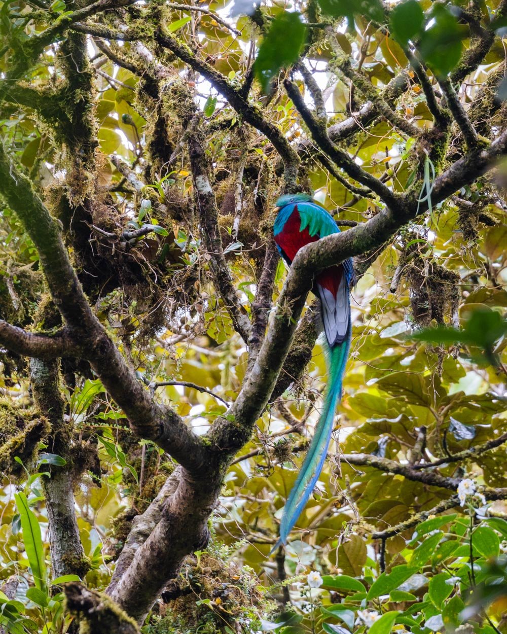
When you catch it in the right conditions, Monteverde Cloud Forest is a magical place. Gnarled trees dripping in moss hide a vast array of wildlife, including the dazzling resplendent quetzal, one of the world’s most beautiful birds.
When the clouds roll in the atmosphere completely changes and an air of mystery sets in. These are the conditions in which Monteverde is at its best.
Catch it on a sunny day on one of the more crowded trails and you may be left wondering what all the fuss is about.

Our recommendation is to hike in Monteverde on a cloudy day - don’t even let rain put you off as it tends to clear out the trails. Though there are many tracks in the reserve, to see the best we’d recommend making a circuit starting on the Sendero Cuecha to the waterfall and taking the Sendero Tosi back. Then head on the Sendero Nuboso to La Venana Observation Deck.
From there, take Sendero Camino to Sendero Puente which takes you to the suspension bridge - one spot that’s not to be missed. Finish by taking the Sendero Wilford Guindon trail back to the start.
Gone are the days of mud up to your ankles and higher, you’ll now find that almost all trails at Monteverde are paved and easy. The route we recommend is almost entirely paved and the unpaved bits were barely muddy (in dry season).

For more tips on visiting Monteverde - including how to buy tickets - we have you covered in this guide.
15. Rio Agrio
Area: Bajos Del Toro
Distance: 2.3km round trip (extra 450m return for the viewpoint)
Elevation gain: 100m (this includes the viewpoint)
Difficulty: Easy
Rio Agrio is a gorgeous waterfall, though it’s very much a case of look but don’t touch because it’s fed by the most acidic river in Costa Rica! To get there you’ll head through a huge fern covered gorge, which if you’re lucky enough to visit on a misty day, really feels like you’ve strayed into Jurassic Park.
It’s absolutely breathtaking and definitely one of the most atmospheric hikes on this list (however, you can hear sounds from nearby Dinoland on the first part of the walk, which may not be for everyone!).

It’s also a pretty easy walk, so it’s a good one to do when you fancy something a little more leisurely. The walk does have inclines at points, but it’s never overly steep. The path is well graded and the terrain is not slippery or muddy (in the dry season at least, we haven’t visited in the wet!).
You can read more, including details on nearby turquoise swimming holes, in this post.

16. Naguala Waterfalls jungle hike
Area: Drake Bay
Distance: 4.7km return
Elevation gain: 80m
Difficulty: Moderate
This is one of Costa Rica’s more adventurous hikes that you can do without a guide! The walk to Naguala Falls takes you through the emerald river, past tapir tracks and dense rainforest. And when we say through, we mean it - you’ll spend a good portion of the trail walking through shallow water, which was pretty much the only time in Drake Bay we actually felt cool - reason alone to do this hike!
When you’re not in the river you’ll traverse a wild jungle track, before arriving at the falls.

In the dry season (or early wet season, which is when we were hiking) the water levels in the river are generally low. This means it’s rarely above the knee and only twice went higher (but still below the hips) and for a short distance.
There is little current and the bottom of the river is almost always gravel, not rocks, which means it’s one of the easiest water walks we’ve ever done.


Do not attempt this walk in the rain, or when rain is forecast as flash flooding is a real risk.
Here are directions for the trail because nothing is signposted.
17. Rainmaker Hanging Bridges
Area: Manuel Antonio
Distance: 2.4km loop
Elevation gain: 135m
Difficulty: Easy - moderate
If you’re looking for a swing bridge hike without the crowds, this is it. The rainforest is spectacular, the swing bridges rickety and lots of fun, and there were incredible swimming spots galore. It’s a beautiful walk and we were so surprised to see only one other couple here on a sunny Saturday in dry season!
The circuit at the Rainmaker is very well maintained. That’s not to say there are no slippery sections whatsoever, as it’s a damp rainforest environment, but any areas which might be slippery have handrails.

The are a few climbs, which do feel quite tiring in the heat, but the rainforest canopy keeps the track shady, which makes it a lot more bearable than it would be in the intense sun. There are also plenty of flat and leisurely sections of track.
We hiked in March and we didn’t encounter mud. In the rainy season you may experience some mud, but the track has a lot of infrastructure in place to keep it in good condition.


You can read more in our Rainmaker guide.
18. Bijagual Falls
Area: Jaco
Distance: 5.6km return
Elevation gain: 320m
Difficulty: Moderate, but a rough trail
Bijagual Falls (or Manantial de Agua Viva - we’ve seen it called both names) is said to be the tallest waterfall in Costa Rica. But then we’ve seen that said about several other waterfalls too! However, none of it matters because if you decide to hike to the bottom of Bijagual Falls, you won’t be disappointed.
It’s one of the wilder hikes in Costa Rica and takes you through a pristine patch of jungle. The screeching calls of the Scarlet macaws will be your constant companion.

In fact, the macaws may be your only companions as we saw eight macaws and just two humans - and this was the middle of the day in peak season. I can imagine you’d be unlikely to see another soul if you’re hiking a little earlier in the day, or outside the height of peak season.
However, when I said the hike was wild, it’s definitely not like the maintained tracks you’ll find to many Costa Rican waterfalls, this one requires a bit more care. It’s steep, sometimes slippery and the roped handrails are not in every spot you wish they were. Please read the summary section of this post to see if it’s right for you.


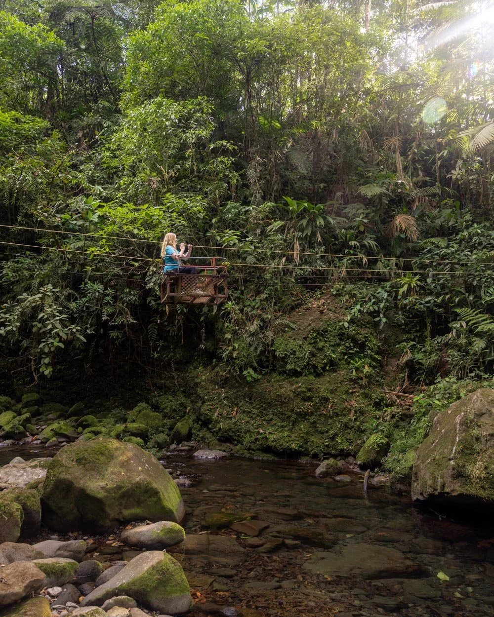
19. Cascada Pozo Azul
Area: Bajos del Toro
Distance: 3.4km return
Elevation gain: 250m
Difficulty: Moderate
The Cascada Pozo Azul Trail is home to one of the tallest waterfalls in Costa Rica, Catarata Caida Nieve y Paz. To reach the falls, you’ll walk through rainforest teeming with birds, butterflies and leaf cutter ants. You can even cross the river on a little basket contraption, which was a first for us, and really good fun!

It’s one of the steeper and more rustic tracks in the area if you want to go all the way to the base of the falls, but it’s worth the effort to see the majesty of the waterfall from below.
The path has some sections of loose soil, but there are often roped handrails in place to help out. Whilst you can’t swim at the bottom of the main waterfall, there are four smaller waterfalls which are located just off the main trail that you can swim in.

All the details on the hike and swimming spots are in this guide.
Keep them wild
Please remember to take all rubbish with you and keep these places wild and pristine - as with anywhere in the outdoors. It’s important to leave them exactly as you found them so they will remain beautiful for generations to come.
Happily we rarely saw a single piece of litter on any hike in Costa Rica : )
This post may contain affiliate links, meaning at no additional cost to you, we will earn a small commission if you click through and decide to make a purchase. This helps towards the costs of running our website. Thanks for your support.