

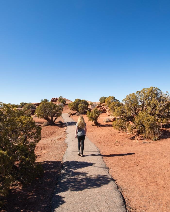
Moab the hiking and outdoor lovers Mecca had been on our list for a long time. We spent a week hiking in this area and felt that it wasn’t long enough, the hikes are everything you’ve dreamed about and more. Moab is blessed with its close proximately to two world class national parks and one fantastic state park, and that doesn’t even take into account all the amazing walks on its doorstep which aren’t in any of these parks.
Some of the best hiking we did in the Southwest was based out of this cute little town, which happily also has a great dining and coffee scene.
One day we’ll be back for more but for now here’s a few of our favourite Moab hikes.

The 8 Best Moab Hikes - Arches National Park
1. The Fiery Furnace
Distance: 2.16 miles (3.48km)
Elevation: 351ft (107m)
Type of trail: Loop
Difficulty: Moderate
Why we love this Moab hike: Without exaggeration it is one of the most fun hikes we’ve ever done, a maze that has just enough challenges to be exciting without being too hard to complete.
The Fiery Furnace is the hike that we just can’t stop talking about. We’re currently in Israel and whenever we do an amazing hike, we say how do you think it compares to the Fiery Furnace? And however good it is, it just hasn’t been able to beat our fave hike in Arches. In fact, it’s high on our list of favourite hikes in the whole of Utah!
Moab Hikes: The Fiery Furnace
In short, this is one trail you need to put on your Moab itinerary.
Once you have your permit sorted (do this as soon as you arrive in Moab) you will be ready for one of the most fun but achievable trails out there. The area is absolutely breathtaking and Parks have worked hard to keep it in a wilderness state.
You won’t see any signposts here, the trail such as it is, is marked only by small arrows and they won’t always be obvious. That’s all part of the fun because that makes the Fiery Furnace feel much more like a maze. You’ll be hiking through sandy wash, on slick rock and there’s even a bit of climbing and slight acrobatics too.


You can read all about it in our dedicated post on the Fiery Furnace.
Getting to the Fiery Furnace
The Fiery Furnace is 14 miles into Arches National Park and should take about 25 minutes to get to from the entrance of the park.
It has its own car park and toilets (at the car park only), and the trail is clearly marked from the northern side of the car park.
Read next: Phantom Ranch - a hike of a lifetime and The best hikes in the Grand Canyon
2. Double O Arch
Distance: 4.44 miles (7.15km)
Elevation: 755 ft (230m)
Type of trail: Out and back
Difficulty: Moderate
Why we love this Moab hike: The narrow ledge is was fun and exciting and had fantastic views. You also get to visit the longest arch in the park.
The National Parks description of this hike initially had me a little worried. It’s graded difficult with narrow ledges and rocky footing. The reality is that if you aren’t massively afraid of heights you’re likely to love the bit of excitement that these ledges provide (and they really aren’t that narrow!).

The first part of the hike is a wide and well graded track to Landscape Arch - the longest arch in the park. You then begin the section of track that is less well maintained.
Straight away you come to an uphill section on smooth rock which looks a little terrifying from a distance.


Once you get there you’ll see it’s not actually too bad and as long as it isn’t wet it’s not slippery at all. You’ll then quickly reach our favourite part of the trail, the walk along a narrow-ish (I can get vertigo sometimes but this was fine for me) ledge with terrific views on either side.
It’s fun and exciting without being frightening. You’ll have a few more rocky sections before you come to the double arches themselves. It’s a gorgeous spot and worth climbing through the arch as the best view is looking back through it.

Moab Hikes: Double O Arch
You then retrace your steps or take the longer route back on the Primitive Trail. We truly wish we’d gone the longer way after how much we loved hiking in Arches! It’s a moab hike we’ll definitely come back for.
Getting to Double O Arch
The trail to both these stunning arches begins at Devil’s Garden at the furthest end of the park. It should take about 30 minutes to drive to from the entrance. We recommend avoiding the middle of the day as the car park gets full quickly, even though there are a lot of spaces!
Read next: The best Sedona hikes including: Devil’s Bridge and Cathedral Rock
3. Delicate Arch
Distance: 3 miles (4.8km)
Elevation: 328ft (100m)
Type of trail: Out and back
Difficulty: Moderate
Why we love this Moab hike: It’s quite simply one of the most picturesque arches in the whole state and spectacular at sunrise or sunset.
The most famous arch of them all (and one of the Southwest’s most instagrammable places) you’ll have seen so many pictures of this one, on Utah number plates and even on the quarter dollar coin. We’re happy to report it deserves all its accolades and more, it’s a true beauty.

This is another trail that is described as difficult but is really not too bad - although it should be noted with all these hikes that we weren’t there in summer when even a short hike could feel brutal!
The track is nice and flat at first but then ascends fairly steeply on slick rock for much of the way before you hit some more flat sections and the narrow ledge described in the park literature.
We’ve included a photo of the narrow ledge as I’d imagined it in my head to be hair raising when in our opinion it isn’t even really narrow at all…..


Once you’ve rounded the corner you’ll get that awe inspiring first look at Delicate Arch which perfectly frames the La Sal Mountains, on our visit in March they were snow-capped. It’s a magnificent sight! You can get right up close and even under the arch by skirting around the sloped rock section (easy if you stick to the top as it gets more steeply sloped as it heads down).

This is a terrific sunrise spot but if like us you don’t make it out of bed, it’s still pretty spectacular at sunset. The sun will not be setting behind the arch but you still get some lovely light and a bit of colour sneaking round if you’re lucky.
Getting to Delicate Arch
The walk to Delicate Arch starts from the car park at Wolfe Ranch. This is about 13 miles away from the entrance of the park and should take approximately 25 minutes.
Read next: Planning trips to Utah’s National Parks: Bryce, Zion, Canyonlands, Capitol Reef and Arches
Canyonlands - Needles
4. Chesler Park Loop/Joint Trail
Distance: 10.7 miles (17.33km)
Type of trail: Lollipop loop
Difficulty: Strenuous
Why we love this Moab hike: The mind blowing rock formations and long narrow slot canyon made this one of our favourite trails in America.
This was one of our favourite trails in Utah. The scenery is amazing and yet there is hardly anyone around! It’s a longer hike than the others on this list but well worth the time invested.

You’ll get up close to majestic hoodoos and explore a narrow slot canyon - without a guide which is a pure joy after all the mandatory tours to see the slot canyons in Page!


The trail has fabulous views throughout which is great because it will keep your interest for the five hours required to complete the hike.
The trail is a little more wild than your average national park track with little sign posting (but heaps of cairns) and uneven terrain for much of the route.
It was a definite adventure and one we highly recommend goes on your Moab hikes bucket list.


You can read more about it in our Canyonlands National Park guide.
Getting to Chesler Park Trailhead
The Chesler Park and Joint Trail is in the Needles District which is about 1.5 hours drive from Moab. Head along the Elephant Hill Access road to the start of the trailhead which has a big car park. The road from the visitor centre is dirt road, but we were able to drive along it reasonably comfortably in a 2 wheel drive.
Read next: Epic hikes in Utah - Slot Canyons in Escalante, Stunning Zion National Park Trails and The Wildcat Trail at Monument Valley
Canyonlands - Island in the Sky
5. Grand view
Distance: 2 miles (3.2km)
Type of trail: Out and back
Difficulty: Easy
Why we love this Moab hike: It’s all about the views and the fact it’s easy makes for a relaxing break from hillier hikes.
The name says it all. The views on this trail throughout are magnificent and it’s hard to believe such an easy track can provide them! The hike is predominantly flat although there are some ups and downs, mainly stepped.

You’re following the rim of the canyon until you reach the finale, the Grand View. This is an excellent spot to sit and soak up just how amazing this part of America really is.
Happily there are plenty of huge rocks to provide a comfy place to perch. We ended up staying here far longer than we’d intended to!

Getting to Grand View, Canyonlands
Island in the Sky is only 40 minutes from Moab. Grand View is at the furthest point in the park and is about a 15-20 minute drive from the entrance.
Read next: Slot Canyons in Page: Waterhole, Upper Antelope Canyon, Lower Antelope Canyon and Which is best: Upper vs Lower Antelope Canyon
Nearby Moab
6. Dinosaur Trail
Distance: 1.85 miles (3km) inc both trails and the road walk between them
Elevation: 0 on the footprints trail and almost nothing on the fossil trail
Type of trail: Out and back
Difficulty: Very easy
Why we love this Moab hike: The chance to see hundreds of dinosaur prints and bones! Amazing!
Have you ever seen dinosaur footprints before? We hadn’t and found it a little hard to believe that not only were we able to see hundreds of them, but also fossils too, and all without the need for a guide. The trail is in two parts. The first, where you can see the footprints is just a few hundred metres long and completely flat.

You’ll come to various sets of footprints which are fenced off for their protection but very easy to see. There are information panels explaining the size dino they would have come from and details about how they’ve been preserved. We were pretty mind blown! Some of them were huuuuge!
The second section of trail is a little further along the sandy road. Our little car couldn’t make it so we walked which took around 10 minutes. If you have a car with a little bit of clearance you should be able to drive no problem.
This trail is slightly longer with a tiny bit of up and down but still very easy. There are panels explaining where to look for the bones and which part of the dinosaur they came from.

We found them hard to spot at first but once you got the hang of it you started to see them everywhere! It was definitely impressive but if you have time for only one then our recommend would be the footprints.
Getting to the dinosaur fossils
The dinosaur fossils are on two small trails around Mill Canyon, which is 25 minutes north of Moab. The road to the first car park is a dirt road, but in reasonable condition. From here the footprints are a 5 minute stroll away with boardwalks and platforms.
The bones are in a separate part which can be accessed on a rougher dirt road (you’ll probably want a 4x4 if you want to drive). You can walk for 10 minutes and then cross the river to the fossils.
Read next: The desert of California - Stunning hikes in Death Valley National Park and Epic walks in Joshua Tree National Park
7. Corona Arch
Distance: 2.5 miles (4.05km)
Elevation: 456ft (139m)
Type of trail: Out and back
Difficulty: Moderate
Why we love this Moab hike: A spectacular arch without the crowds. We also loved the little ladder and rope section for a bit of excitement.
This little beauty is actually outside the national park boundaries so no entry fee for this one. This was the first Moab hike we did and it set the bar incredibly high. Luckily the rest of these hikes did live up to it.

As with many of the trails on this list you’re walking on slick rock, it starts off flat but then has a few ups and downs, including one section with a ladder and one with a cable. It’s not difficult unless you come down in the dark like we did and slightly lose your way….. anyway moving on.


The impressive arch will soon come in to view and you can walk right up to and underneath it. Please don’t climb on it though, it’s illegal to do so and possibly dangerous for you and the arch!
We spent well over an hour here admiring the incredible scenery and the sheer scale of this arch. The trail was also a lot quieter than those in Arches National Park itself.
Getting to Corona Arch
The start of the trail to Corona Arch is 14 miles outside of Moab and takes about 20 minutes to drive to. There’s no entry fee for this hike and a decent sized car park.
Dead Horse Point State Park
8. Dead Horse Point East and West Rim Trail
Distance: 5.7 miles (9.29km)
Elevation: 150m
Type of trail: Loop
Difficulty: Easy
Why we love this Moab hike: For the views and the incredible lack of crowds. Sunset was also a winner.
We’ll be the first to admit that this loop trail is not one of the best Moab hikes for the trail itself, but the views are some of the best in Utah. You can reach the most famous lookout, Dead Horse Point, by car but to get to some of the more remote spots you’ll need to hike.

The trail itself is flat and easy and it follows the rim almost the entire way, so you are never far from those epic views.
Many of the lookouts are just off the main trail and we were the only ones at each of the view points we stopped at. Our favourites were the Rim Overlook and the Schafer Canyon Overlook where there were plenty of rocks to stop and have a break and would also make terrific picnic spots.

Getting to Dead Horse Point
Dead Horse Point is a 45 minute drive out of Moab and not too far from Island in the Sky in Canyonlands National Park. It is a pretty small park and there is ample parking at Dead Horse Point Overlook and the Visitor Centre.
Entry to Dead Horse Point is $20 for the car and isn’t covered by any National Parks pass.
Where to stay in Moab
Hotel Downtown Moab
We stayed in the Hotel Downtown Moab and whilst it had a few issues we thought overall it was great value. The rooms are big, comfy, clean and fairly modern (something we didn’t really experience in this price bracket very often). So we loved it until the wifi didn’t work for our whole stay (although they did refund us $30 for this) and we found some of the staff to be really unfriendly. If it hadn’t been for this we would have given it a fully glowing review.
Check the latest prices & reviews on:
Expedition Lodge
The place I was actually going to book before it sold out was Expedition Lodge as it had fabulous reviews so you might want to check that one out too.
Check the latest prices & reviews on:
This post may contain affiliate links, meaning at no additional cost to you, that we will earn a small commission if you click through and decide to make a purchase. This helps towards the costs of running our website. :-)
Like it? Pin it!

Follow us on Social Media
Are you planning a trip to Moab? What’s your favourite Moab hike? Let us know in the comments below!


