Dobsons Cave is not so much a cave, but a gorgeous ferny overhang with a pretty waterfall and small swimming hole. Well there’s a waterfall after a lot of rain and more of a trickle during drier times - as you’ll soon see in our photos! It’s located on a little known track just before you reach the Southern Highlands, roughly a one and a half hour drive from Sydney.
The walk to reach the cave is quite short, but you could extend it by walking further along the creek, which is also very beautiful.
Here’s how to find Dobsons Cave and what to expect when you do.

The walk to Dobsons Cave
The stats
Distance: 3.4km return
Elevation gain: 105m
Difficulty: Easy, but not flat
Summary: The walk to reach Dobsons Cave is all on a good track, but it’s not signposted in the traditional way. There are however cairns and arrows which mark the way and we note all the turns you need to make in the track notes below.
It’s predominantly flat and downhill on the way and then you’ll have a bit of a climb on the way back.

Starting the trail
From the parking area (details below) the walk heads along the path to the left of the gate. Whilst the gate itself looks somewhat foreboding and doesn’t offer pedestrian access, you’ll see the sign says that walkers are allowed in this area.
Take the path on the left side of the parking area and follow it for 25m, at which point it curves right and will drop you onto the fire trail on the other side of the gate (70m from the car park).


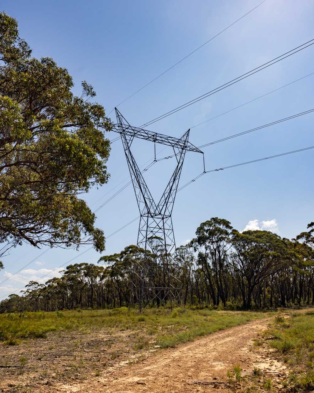
From here follow the flat fire trail for 180m until you reach the large pylon. Turn left here, on to the next fire trail and follow the pylons along the obvious track.
It’s flat at first and then heads gently downhill. Roughly 350m later (600m from the parking area) you will see a path leading into the bush on the right. This path leads to Dobsons Cave.


Through the bush
The narrow trail heads downhill through the bush. Roughly 200m later it will look like the trail has petered out, you need to look for a turn on the left.
There is an arrow marked on the rock, but it’s easy to miss. Head down the rock and then take an almost immediate left turn down the little rocky gully.

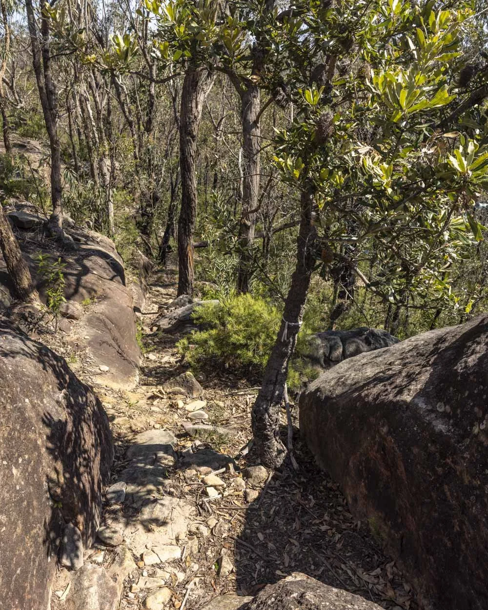
The rocky path is a little steeper here, but soon becomes more gentle again as you continue descending towards the creek. There are some short flat patches of track inbetween the downhill sections.
At the 1.2km mark the trail bends right, there’s an arrow etched into the tree (which is a shame!).

Roughly 100m later, you’ll come to a small creek crossing. For us the creek was very low and it was easy to cross, if you’re visiting after a lot of rain it will be slightly higher, but it’s only a very short crossing.

The trail then briefly ascends before flattening and continuing to descend towards the cave. At just over 1.6km into the trail you need to turn right and this is clearly marked with a cairn and arrow.
You’re now just 100m from Dobsons Cave and the path is straightforward.


Swimming at Dobsons Cave
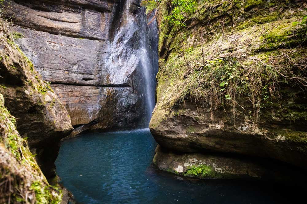
Dobsons Cave is definitely more of an overhang than a proper cave, but it’s a beautiful spot, with dense ferns and foliage covering the cliff walls.
The waterfall is a reasonable height, but needs a lot of recent rain to be running powerfully. We’d visited quite a few waterfalls in different areas around the time we visited this one and all were running really well, so the catchment for Dobsons Cave must be quite small.

Nevertheless it was still lovely and the small deep green pool was the perfect place to cool off on a very hot day. Accessing the water is easy as you can step off the bank and into shallow water.

The bottom of the pool is a mix of sand, mud and a bit of debris and is easy to walk over. The water does get deeper but I could almost always touch the bottom, though it was mainly shoulder height, so deep enough to swim.
The water was nice and clear, but overall this is a spot that is going to be looking at its best after some decent rainfall, so it’s a good one to save for wetter times.


Exploring beyond Dobsons Cave
To see more of the area, walk away from Dobsons Cave, across the sandy track leading down towards the creek. Even the very first bit of the creek you come to is stunning and there are some giant boulders where you can sit and relax.
The water in the creek was very shallow here, but crystal clear and lovely for lazing around in. I went for a bit of a wander a few hundred metres further along the river (downstream) looking to see if there were some deeper pools.

Although there no doubt would be further along, all the pools were shallow along the short section I walked.
Even walking the little section I did was worth it though, as you can walk partly in the shallow creek and partly on the sandy/stony area to the left of the water. It’s very serene and reminiscent of nearby Little River Cascades, which is a must if you haven’t done that one yet.
When you’re ready to leave the creek you simply retrace your steps back to the car park.


Getting to the trailhead for Dobsons Cave
The trail to Dobsons Cave begins at these coordinates-34.2433328, 150.5194880 at the end of Buxton Avenue in Buxton. Please make sure you don’t block the gate across the fire trail. The parking area is small, but this is not a popular walk and I can’t imagine you’d have trouble getting a space.
It’s located around 105km and 1.5 hours from Sydney and 35km and 30 minutes from Bowral.
This post may contain affiliate links, meaning at no additional cost to you, that we will earn a small commission if you click through and decide to make a purchase. This helps towards the costs of running our website. Thanks for your support.