Dargan Arch is a picturesque natural sandstone arch tucked away in a lesser visited part of the Blue Mountains. It’s the result of a long collapsed cave and it’s a fun and unusual spot to explore. It tends to see few visitors, so it’s likely you’ll get the whole thing to yourself.
You can walk over the top of the arch and scramble down to view it from underneath. It’s a really short walk to get there, making it one of the easier hidden gems in the Blue Mountains to check out.
Here’s exactly how to find it.

The walk to Dargan Arch
The stats
Distance: 1.5km return
Elevation: 100m
Difficulty: Easy, but involves a little scramble to get to the very bottom
This isn’t a difficult walk and on our most recent visit we noticed there is even a signpost marking the start of the track now! There’s no set trail for the last couple of hundred metres, but it’s still straightforward enough to find. We’ll detail everything you need to know to get there, including the co-ordinates for where to park, directions for the trail and co-ordinates for the arch itself.

The walk to the top of the arch
The walk from the trailhead to the top of the arch is 650m. The first 450m are along a fire trail, heading gently and then more steeply downhill.
It’s an easy path, but occasionally the small rocks underfoot can be a little slippery.

When you reach the end of the fire trail you will begin walking on a narrow bush track. After around 100m the track will start to get a little rocky. Once you reach the rocky section there is no set path, but you can’t really go wrong if you continue heading gently downhill. You’re aiming for these coordinates: -33.481237, 150.266006
Just be careful not to tread on any of the wildflowers - there were plenty of gorgeous Flannel flowers on our visit.


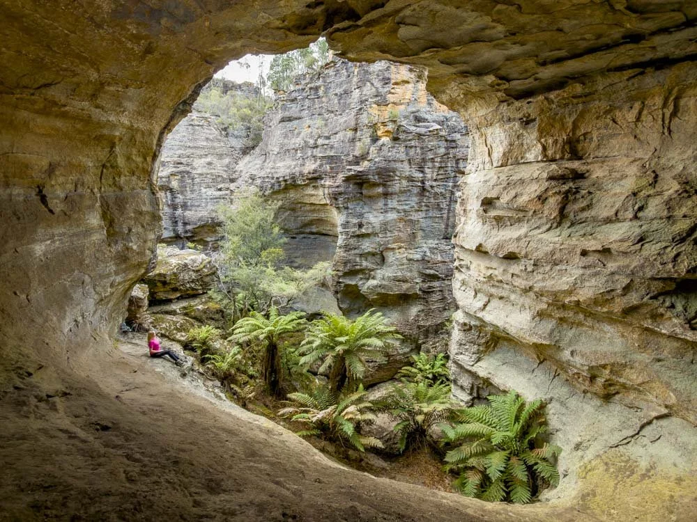
After a couple of hundred metres on the rocky terrain you will see the gaping hole that marks Dargan Arch.
You can walk right over the arch with ease as it’s nice and wide, even if you don’t like unfenced cliff edges, it’s unlikely you’ll have a problem with this one as you don’t need to go anywhere near the drop.
Accessing the arch is easiest on the right side, there’s no rock scrambling involved on this side.

The walk to the bottom of the arch
From the top of the arch to the bottom is only 70m and it’s definitely worth heading down to see it from another perspective.
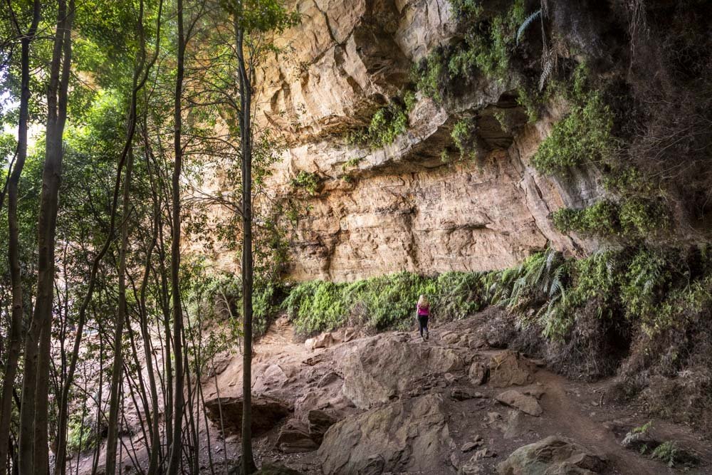
Again there isn’t a path as such, but when you’ve crossed over the arch (from the right) you’ll see a bit of a worn dirt trail before it becomes rocky.

You have to climb down the rock (pictured above) but it’s extremely grippy (when dry), so it might look steep, but it’s actually quite easy.
You’ll then come out at the bottom of the rock and make your way right, over the fallen tree, towards the arch. There’s a hill inside the arch which is easy to climb up and offers more unique views.

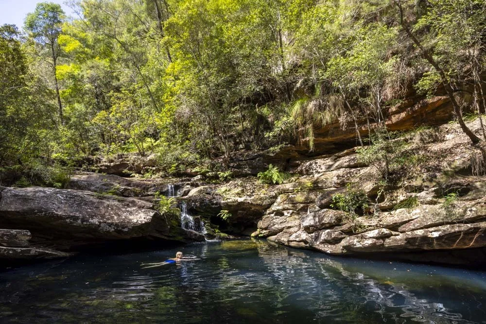
It’s a great spot, it feels so quiet and untouched. If you love photography it also offers the chance to take some interesting shots.


You can continue past the arch to a large overhang, 25m away. It’s easy to reach and definitely worth a look. There are further overhangs beyond, but they get a bit more scrambly to access.

The walk back up
The walk back up to the car park is uphill most of the way, but you don’t need to worry about any slippery terrain, so it’s very straightforward. We walked up in 10 minutes and I was taking it quite slowly.
As Dargan Arch is only a short adventure, you might want to combine it with a walk at the fantastic Goochs Crater, a 30 minute drive away - although you will need a car with decent clearance as the road is not in the best state.
For more easy walks in the Blue Mountains, check out this guide.
Finding the trailhead
Dargan Arch is located close to the town of Bell, and is just inside the boundary of the Blue Mountains National Park. The car park is just a patch of dirt.
The car park is at these coordinates -33.4862408, 150.2631044 and you can click here to find the exact location on Google Maps.
The last 2km of the road to the trailhead is unsealed, but at time of writing is in very good condition and suitable for any vehicle.
This post may contain affiliate links, meaning at no additional cost to you, that we will earn a small commission if you click through and decide to make a purchase. This helps towards the costs of running our website. Thanks for your support.