The Vale of Avoca Track leads you down to a pristine part of the Grose River, with sublime crystal clear water and lots of tiny beaches. The river is lined with blue gums and huge rocks which give it a remote feel. It was our own little secluded patch of paradise and we spent all afternoon lazing around in the shallow water, joined only by the brightly coloured butterflies, of which there were many. It’s hard to describe exactly why, but we both felt like we were on holiday, it just had that relaxing good times vibe.
The walk to get there is steep in parts, but the track was pretty good and I think it’s one of the easier descents to the Grose River.
Here’s everything you need to know about the Vale of Avoca Track.
The Vale of Avoca Track
The stats
Distance: 4.4km return
Elevation gain: 195m
Difficulty: Easy - moderate
Summary: The Vale of Avoca Track is predominantly a fire trail, around half of which is a flat, smooth, well maintained track, with the other half being a little rougher. However, the rougher part is still pretty decent. The road itself is heavily eroded, but for the most part there’s a smoother path worn into the fire trail.
There are a few rocky bits, but none of it was slippery (it was slightly damp when we visited and I think this might have made it grippier than if it were very dry when it could become looser).
The second half of the trail is somewhat steep, but again, I would say it’s not too bad and much, much less steep than say Pierces Pass (which also leads down to a spectacular part of the Grose River).

The lookouts before the walking trail
Before you head onto the track down to the river you can drive around 600m beyond the car park for the Vale of Avoca Track to a couple of great lookouts.
From the upper car park, coordinates -33.6121661, 150.6326202 you can walk for 85m to the first viewpoint. It’s slightly uphill and requires walking over a couple of grippy rocks, but it’s very easy.


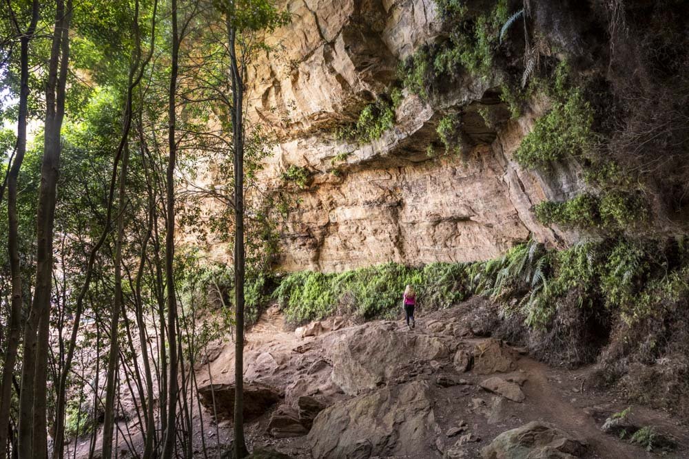
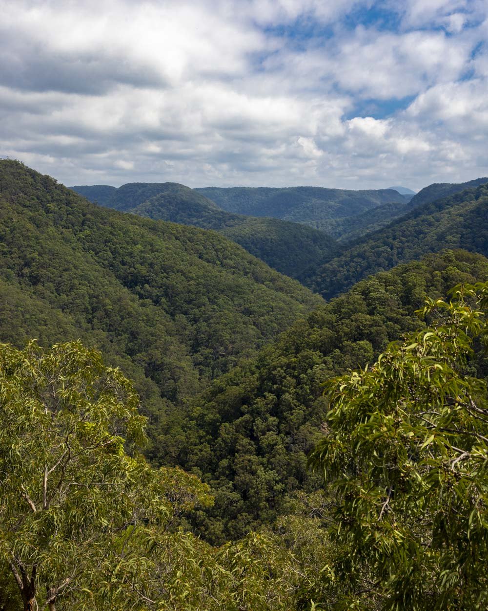
The view is of steep forested mountains, which are just gorgeous. There’s plenty of room to sit and take it all in and as this is a quiet part of the mountains, you’re unlikely to share it with anyone else.
You can then continue along the main path for a further 165m to a second lookout. This one offers a view of the same area but slightly further around. It’s not as impressive as the first viewpoint, but worth a look if you have time.
Though you could also access the walking track down to the river from here, it’s quicker to head back to your car and then park at the lower car park.
It’s worth noting that the road to both car parks is unsealed, and the last 600m to this second car park - which is closer to the lookouts - has a couple of little hills.
When we visited, it was suitable for any vehicle, but if it does deteriorate and you don’t like the look of it, you can access the lookouts via a short walk from the lower car park too. The road to the lower car park is flat and very well maintained.
Starting the trail to the Grose River
From the car park (full details below) the walk heads around the side of the gate which blocks the Waterboard Fire Trail.
Unlike most gated fire trails, there is no pedestrian access around the gate, so you do have to walk over a couple of rails, but it’s not difficult (and walking is allowed, they are just clearly very keen to keep anything but people out).

The first 550m are either flat, or very gently downhill on a smooth well maintained track between the gum trees.

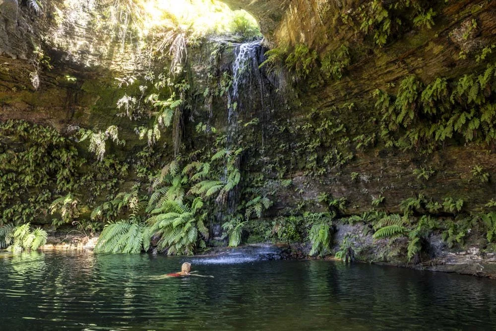
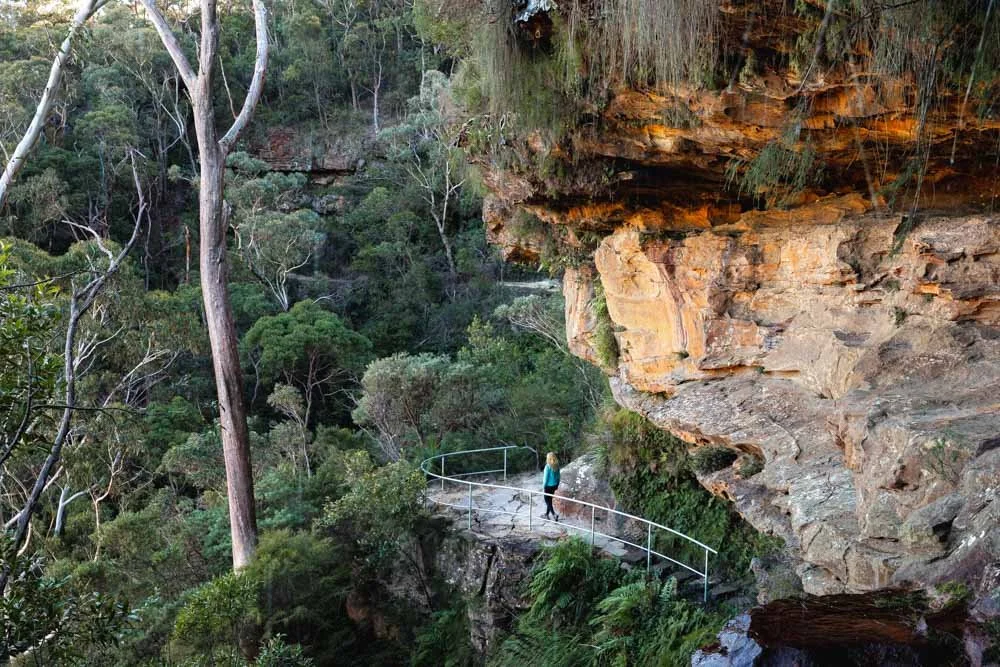
Side note: if you want to see a couple more lookouts, including one which overlooks the river itself, you can detour off the main trail. We only realised this afterwards so sadly missed them, but don’t want you to do the same. There should be a track on the right around 500m into the fire trail, this leads to two amazing viewpoints, you can see the directions here.
After the flat section of fire trail, you’ll have a 200m uphill climb before it briefly flattens and then heads downhill. At the 1.1km mark you’ll come to what feels like a turning circle and large rocks have been placed in front of the next part of the fire trail, we were surprised to see this - they clearly really don’t want anything motorised down here!
The trail bends sharply right and it’s from here that it gets rougher.

The rougher descent
As mentioned, though this next part of the fire trail is rougher, it really isn’t that bad at all. Whilst the road is heavily eroded, there is usually a narrow but smooth makeshift path running to the left or right of the main trail.
It’s steeper than the earlier part of the track, but I felt comfortable going downhill at all times and I am someone that tends to be really cautious on steep tracks. There are a few rocky bits, but nothing challenging.

It may be that it all felt nice and stable as it was damp and perhaps it would be a little slippery if dry and loose, but it was definitely pretty easy going for us.
After 400m you have a brief flat section which is densely forested and feels much more like a walking track than a fire trail.
You’ll then descend again on a similar rougher track for a couple of hundred metres before reaching a concreted road, 1.9km into the track. This very short (less than 100m) stretch of road is steep, but tarmacked, so not difficult.

The path then flattens and heads through the bush, but you’re very close to the river now and it has a more jungly feel.
After 50m on the flat path you’ll see a steep trail heading downhill on the left.

It’s a sandy track with a few rocks and takes you sharply down to the river in just 70m.
This bit is a touch looser and I found it easier to sort of run down it - but again it’s honestly not bad, I don’t want to make it sound steeper than it is!

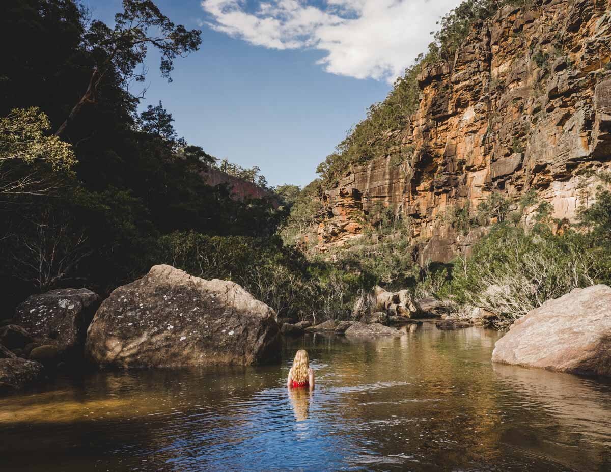
Exploring the Grose River
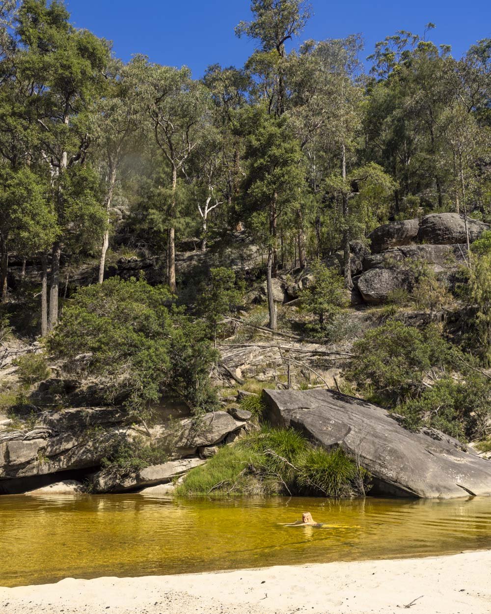
This part of the Grose River is totally gorgeous. Unless the river is up, the water will be crystal clear. From above it looks yellow as you can see right through to the sand, but at eye level it just looks dazzling clear - the kind of water you see and want to get into immediately!
There’s quite a large sandy beach with some washed up logs and debris, but it’s still picturesque, though there are more beaches upstream with no debris.

The forested hills behind the river are not as steep and dramatic as other parts of the river we’ve been to, but there really is something about this spot. It’s pure serenity, with the blue gums, butterflies and rocky outcrops.
This is somewhere you can come and spend all afternoon on the beach, dipping in and out of the water. However, there is a catch. The water is very, very shallow.


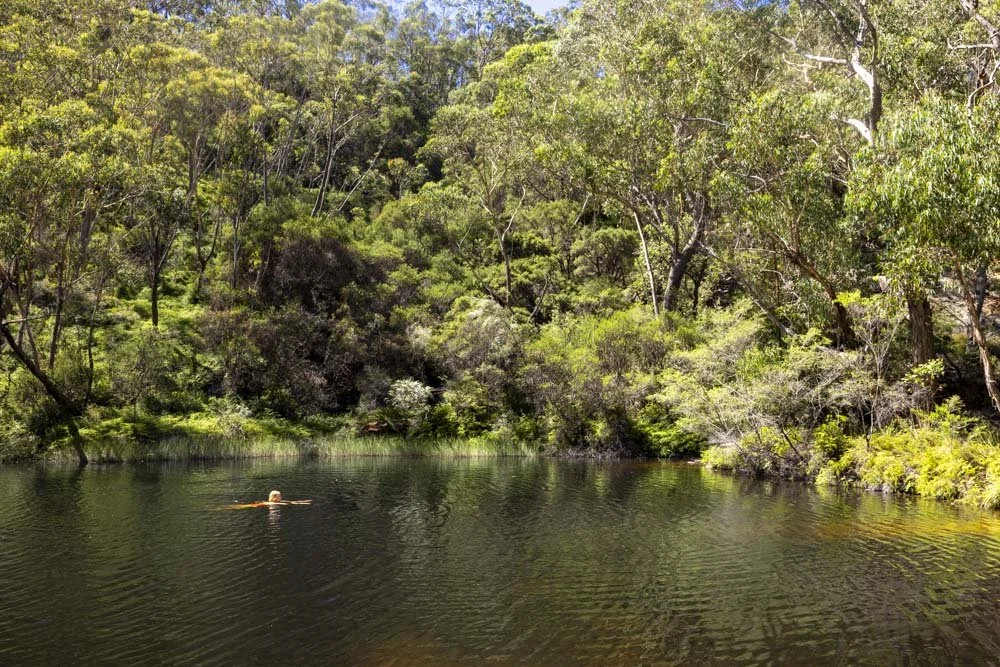
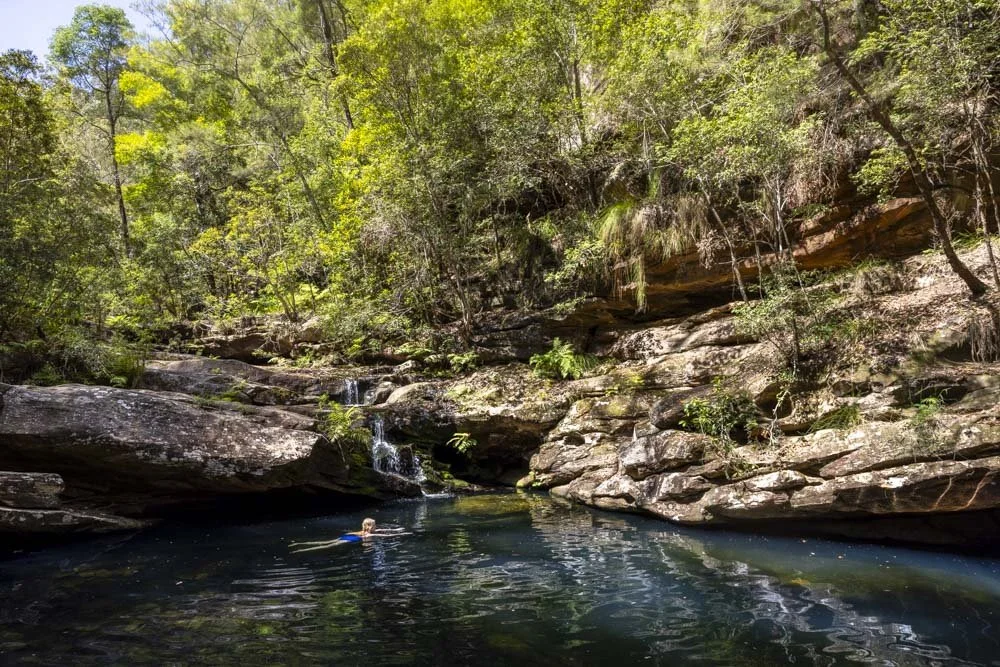
This is your perfect spot to laze, but not to swim. We did continue upriver for around 200m and found a small section of swimmable water.
Heading upstream is easy as you can just wade through shallow water (ankle to knee deep) with a sandy bottom.

This is the more scenic way of exploring the river, though you could also continue a little further upstream using the walking track behind the river (instead of turning down to the river on that 70m sandy track you would continue heading straight).

The current is fast, even with the lower water levels we had and we nicknamed this little bit of deep water 'the water slide’.
You basically get into it and within minutes you’re deposited back in the shallow sandy water before wading back up and doing it all again. And again.

It’s right beside the third beach you’ll come to and by a particularly attractive part of the riverbank.
Normally we would have continued further on to explore more of the river and try and find a proper swimming hole, but this time we were recovering from a nasty flu and in all honesty we loved the beaches and ‘water slide’ and decided that any further explorations would wait for another time!

I do know you can continue further up river and exit at a different track known as ‘Wire Trail’ but this is much steeper and more challenging than the Waterboard Fire Trail.
Assuming you want to exit the same way we did, the first half is quite steep, but made easier by good footing. The second half feels gentle and almost flat for the most part.
Keep them wild
Please remember to take all rubbish with you and keep these places wild and pristine - as with anywhere in the outdoors. It’s important to leave them exactly as you found them so they will remain beautiful for generations to come.
Litter tends to breed litter, so if you do spot any and are able to pick it up and dispose of it outside the national park, it will go a long way to keeping the area clean.
Parking for the Vale of Avoca Track (Waterboard Fire Trail)
The Vale of Avoca walk is located in the Grose Vale and there’s a dedicated car park for the track and room for a decent number of cars - and this is not a popular walk. The coordinates for the car park are -33.6099321, 150.6382206.
The last 800m of the road to the car park is unsealed, but it’s a well graded gravel road and suitable for any car at time of writing. The extra 600m up to the Vale of Avoca Lookout car park has a bit of a hill and is slightly less smooth, but it was still in good shape when we visited.
The trailhead is 26km and a 30 minute drive from Bilpin, 68km and a 1 hour 10 minute drive from Katoomba and 80km and a 1 hour 10 minute drive from Sydney.
This post may contain affiliate links, meaning at no additional cost to you, that we will earn a small commission if you click through and decide to make a purchase. This helps towards the costs of running our website. Thanks for your support.