Split Rock is a little taste of Utah hidden in the Blue Mountains. Just a short walk from Deep Pass campground you’ll find a very narrow slot between two huge cliff walls. Tall enough that even when we visited on the sunniest of days barely any light entered the chasm.
Walking through the slot is incredibly atmospheric, the stillness and silence gives it a unique feel and though it’s only a short adventure you can extend your time in the area by visiting the nearby Nayook Canyon.
Here’s how to find Split Rock and what to expect from the trail.

The walk to Split Rock
The stats
Distance: 2.6km return
Elevation gain: 165m
Difficulty: Moderate
Summary: Just over half the walk to Split Rock is on a rocky fire trail, but it’s easy to walk on. The rest of the walk is on a dirt path which has some very short loose or eroded sections, but when dry it’s not too slippery. To get into Split Rock requires a scramble but once inside, walking through the slot is easy.

Starting the trail: to Deep Pass Campground
There are two possible routes to Split Rock, with the quickest being from Deep Pass North car park, which is where we began the trail. Google maps tried to take us on a heavily eroded 4WD track to this car park, so please read the detailed directions on which roads to take at the end of this post to use the 2WD route.
From the car park the walk heads into the bush, passing the sign which mentions Deep Pass is only 500m away. It’s more like double this distance which was a bit of a surprise, but the trail is in good condition.


You’ll follow the wide rocky track downhill for 550m at which point the track narrows and you’ll reach a picturesque pagoda. It is steepish along this first stretch, but it’s a wide fire trail and easy to walk on.

The path curves right at the pagoda and the gradient slackens. You’ll now follow a sandy bush track which flattens around 250m later as you enter a beautiful ferny area.
At the 910m mark you’ll see a path branching off to the right, this leads to Nayook (Deep Pass) Canyon. The route to the campsite is directly ahead and it’s now only 90m away.

After making a tiny creek crossing (a couple of steps and shallow) you’ll arrive at what is one of the most inviting campsites I’ve seen in the mountains. There’s a huge amount of open green space surrounded by forested cliffs, pagodas and lots of trees for shade.
Even on a sunny Saturday in summer there was only one person camping there which seemed hard to believe!

To Split Rock
Though the trail to Split Rock is not signposted, there’s a worn path leaving from the eastern side of the campsite. You’re aiming for these coordinates: -33.3400512, 150.3099765
Head along the dirt trail and under a couple of fallen trees - you have to crouch very low under one of them, which is a bit awkward and will probably leave you with a fine dusting of charcoal on your back!
The dirt track is generally ok, but it is a bit loose and eroded in parts.


After 100m you’ll cross a creek which is very shallow. There’s a log to cross on, or you can just walk through the water and it’s only a few steps.
You then need to climb up a dirt path, which is a little steep for a brief period, and again quite eroded. This bit is only around 10m long though and not too slippery when dry.

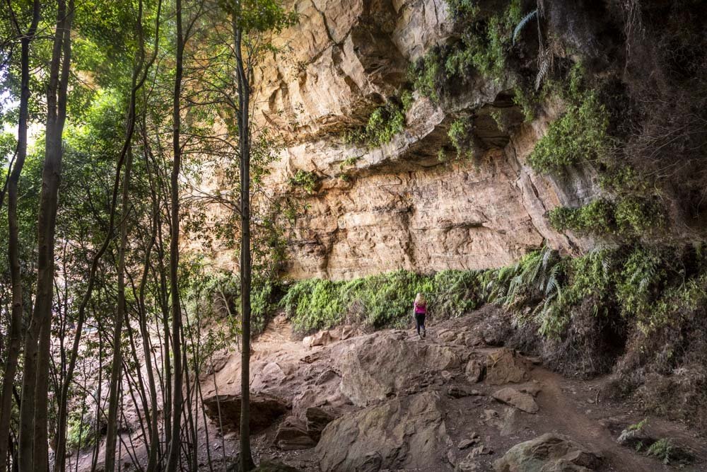
You’ll pass a large overhang, round the corner and then see a series of rocks leading uphill to Split Rock. You can use this route, but it’s a steep scramble with a tricky first step (involving a bit of a leg stretch).

The path on the left
However, there’s an easier route which is hiding behind the thick ferns to the right. Head right and you’ll see a much less steep path leading uphill.
It’s a bit rocky but still an easy path and leads you up to a small opening between some large boulders on the left.

The path on the right

The boulder gap you need to walk through
Again, you have two options here, with the easiest (for me anyway) being to pass through the boulder gap. This leads to a very tight squeeze under another boulder just before Split Rock.

If you’re anything other than very slender it is pretty tight, I couldn’t get both legs through at once and sort of had to slither along which was a bit uncomfortable as the rock is hard - however, I am really inept at these things, so others may get through more elegantly than me.
The other option is not to walk through the boulder gap and instead climb a little higher up the rocky track and cut left across the large rock and climb down to the start of Split Rock.
There are a couple of small footholds, so for confident scramblers this is probably a more comfortable route, but I went for the safe, albeit awkward option!

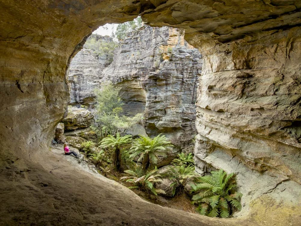
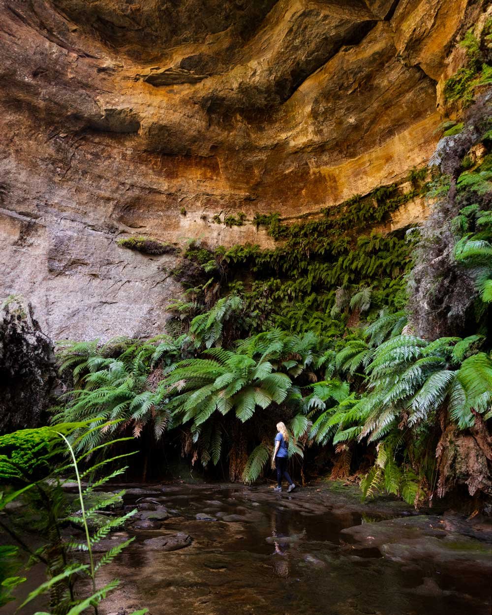
Exploring Split Rock
After dropping down one more rock (which is very easy) you’ll be standing in the narrow slot that is Split Rock. You can then walk for around 20m through the tight gap between the cliff walls. It’s very much like a slot canyon and a lot of fun to walk through.

It’s narrow but you can walk normally and I was amazed to see just how tall the cliff walls were. It was dark and mysterious even on a bright blue sky day and definitely took me back to exploring the slot canyons of Utah.
Once you reach the end of the slot you can walk a little further, both to the left and right.


We only went a little way in each direction, but it looked like you could have continued on. In fact we chatted to a guy at the campsite who had seen a large group go through Split Rock hours ago and hadn’t come back yet, so you definitely must be able to adventure further, though I have no idea what lies beyond.

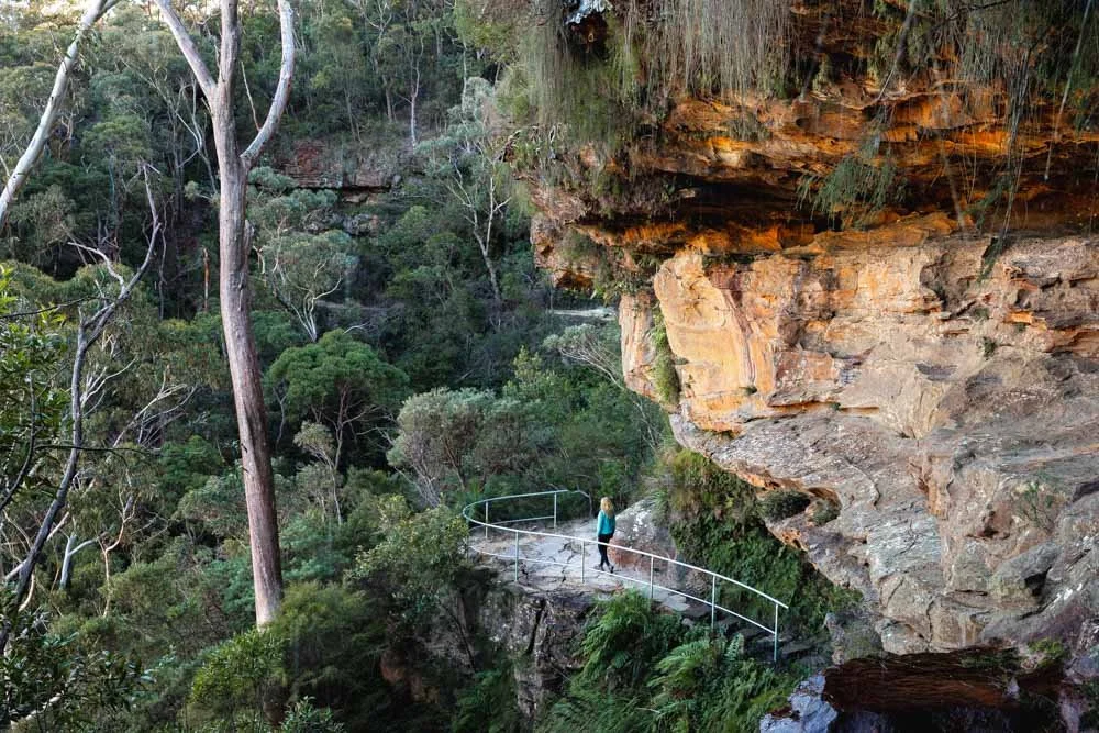
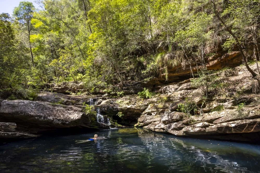
When you’ve finished exploring Split Rock you can head back to the campsite and then onto the track which leads to Deep Pass Canyon.
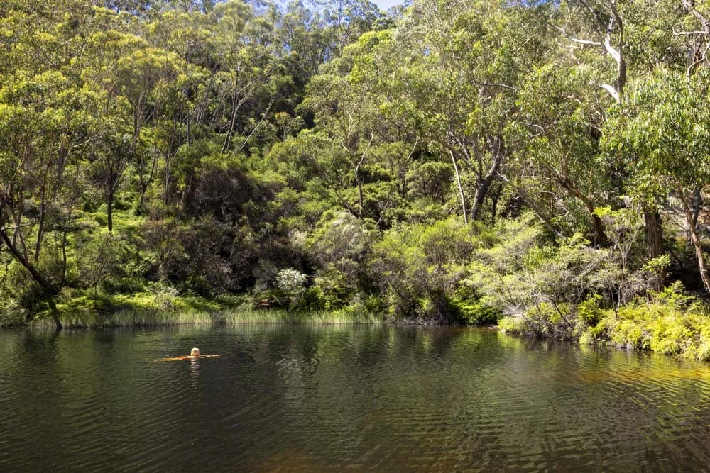
Completing the whole canyon requires navigating a few sections with fixed ropes, or you can stop at the first waterfall pool, which is only 650m from the campsite and doesn’t require negotiating any tricky terrain.

If you want to camp at the campground you can book through the national parks website here.
Getting to the Deep Pass north car park
Before you set off
You could walk to Split Rock from the Deep Pass North or South car parks in Wollemi National Park, but the quickest route as described above is from the north car park.
Before driving here, make sure you have downloaded an offline map for the Newnes/Garden of Stone area as there is rarely any phone signal. You can do this on Google Maps by clicking on your profile and selecting “Offline Maps” from the menu that appears (you can also follow these instructions).

At time of writing the route as described above is in excellent condition and though unsealed, is suitable for any car. It’s a gravel road which doesn’t have any steep sections and is currently very easy to drive.
Roads can deteriorate with time and rain, so if you are worried about visiting in a small car, please contact the national parks service for the current road conditions.
The route
The first thing to note is that there’s a specific route to take that will make things a lot easier. Don’t be tempted to drive along the Deep Pass Trail all the way to Deep Pass North, as going this route takes you along a very eroded road before a pretty steep hill that I wasn’t willing to try. If you follow our route, you won’t face anything but flat gravel roads the whole way.
The second thing to note is that Google Maps doesn’t work for the whole route. For some reason, Google hasn’t connected the Mount Cameron Trail to the section of the Deep Pass Trail you need to use. However, follow the directions below and you won’t have any trouble.
Put these co-ordinates into Google Maps: -33.352023, 150.261100
From the Bells Line of Road (B59), turn at Clarence onto the Old Bells Line of Road
Drive along the Old Bells Line of Road for 8.8km until you reach a T junction with Glow Worm Tunnel Road. Turn right here.
Continue along Glow Worm Tunnel road for 11.4km before you see a yellow sign on your left saying “Deep Pass Trail”. Take this right turn.
Drive 600m along the Deep Pass Trail before turning left onto the Mount Cameron Trail (unmarked)
Drive for 600m before stopping and putting in these co-ordinates: -33.340064, 150.291862 (your Google Maps should start up again)
Drive for 2.5km before taking a right onto an unmarked road.
Continue for another 1.1km before reaching “Deep Pass Walking Trail”. Turn down this road.
Drive a further 1.8km to the car park

Canyon safety (if you are planning to enter the canyon as well as Split Rock)
Canyons can be dangerous environments in the wrong conditions. Never enter a canyon if it’s raining or rain is predicted as flash flooding is a real risk and it can happen very quickly.
There is no phone signal around Deep Pass, so it’s advisable to carry a PLB incase of emergency. We carry a GME personal locator beacon, which has the added benefit of working globally. You can check this one and others on Amazon.
This post may contain affiliate links, meaning at no additional cost to you, that we will earn a small commission if you click through and decide to make a purchase. This helps towards the costs of running our website. Thanks for your support.